 view gallery view gallery S0 km S0 km
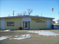
|   Havana, North Dakota 58043 Havana, North Dakota 58043
in U.S. Post Offices Small town post office near Interstate 94.
Elevation 1290 posted by:  NGComets NGComets location: North Dakota date approved: 02/21/2018 last visited: never |
 view gallery view galleryS0 km |  Havana, North Dakota Havana, North Dakota
in Small Town, Big Name A small town in North Dakota. Elevation 1288 posted by: NGComets location: North Dakota date approved: 03/13/2018 last visited: never |
 view gallery view gallery N17.4 km N17.4 km
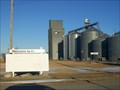
| Forman, North Dakota 58032 in U.S. Post Offices Forman was founded in 1883 by Cornelius Forman.
In 1886, the county seat was transferred to Forman from Milnor, North Dakota.
Elevation 1256 posted by: NGComets location: North Dakota date approved: 03/15/2018 last visited: never |
 view gallery view gallery SE19.6 km SE19.6 km
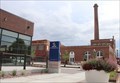
|  Schwenk Brewery --Yankton Commercial Historic District, Yankton SD Schwenk Brewery --Yankton Commercial Historic District, Yankton SD
in NRHP Historic Districts - Contributing Buildings The Schwenk Brewery is a contributed building to the Yankton Commercial Historic District, Yankton SD posted by: Benchmark Blasterz location: South Dakota date approved: 02/16/2023 last visited: 02/17/2023 |
 view gallery view gallery SW20.3 km SW20.3 km
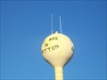
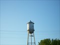
|  Water Tower, Britton, South Dakota Water Tower, Britton, South Dakota
in Water Towers Small town watertower. posted by: NGComets location: South Dakota date approved: 11/15/2010 last visited: 07/16/2019 |
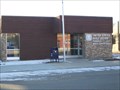
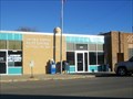 view gallery view gallerySW20.3 km | Britton, South Dakota 57430 in U.S. Post Offices Small town post office. posted by: NGComets location: South Dakota date approved: 11/15/2010 last visited: never |
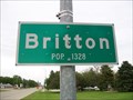 view gallery view gallerySW20.9 km |  Britton, South Dakota - Population 1328 Britton, South Dakota - Population 1328
in Population Signs County seat of Marshall County, South Dakota. posted by: NGComets location: South Dakota date approved: 08/13/2015 last visited: never |
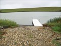 view gallery view galleryS34 km |  Hickman Lake Boat Ramp, Langford, South Dakota Hickman Lake Boat Ramp, Langford, South Dakota
in Boat Ramps Located about 6 miles northeast of Langford, South Dakota.
Elevation 1440 posted by: NGComets location: South Dakota date approved: 11/03/2017 last visited: never |
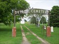 view gallery view gallerySW36.5 km |  Detroit Cemetery, Hecla, South Dakota Detroit Cemetery, Hecla, South Dakota
in Worldwide Cemeteries A small cemetery just west of Hecla, South Dakota. posted by: NGComets location: South Dakota date approved: 08/17/2015 last visited: never |
 view gallery view gallerySE40.2 km |  Eden Ball Park, Eden, South Dakota Eden Ball Park, Eden, South Dakota
in Amateur Baseball Fields Small baseball field on the northwest corner of the town. posted by: NGComets location: South Dakota date approved: 08/13/2015 last visited: never |
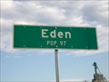 view gallery view gallerySE40.2 km | Eden, South Dakota - Population 97 in Population Signs A very small community in Marshall County, South Dakota. posted by: NGComets location: South Dakota date approved: 08/13/2015 last visited: never |
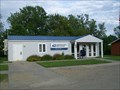 view gallery view gallerySE40.2 km | Eden, South Dakota 57232 in U.S. Post Offices Small town post office. posted by: NGComets location: South Dakota date approved: 07/19/2015 last visited: never |
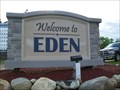 view gallery view gallerySE40.4 km |  Bible Name, Eden, South Dakota Bible Name, Eden, South Dakota
in Names From the Bible Small town on SD Highway 25. Elevation 1851. posted by: NGComets location: South Dakota date approved: 07/27/2015 last visited: never |
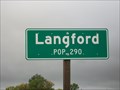 view gallery view galleryS41.7 km | Langford, South Dakota - Population 290 in Population Signs A small town in Marshall County, SD, along SD Hwy 17.
Elevation 1372 posted by: NGComets location: South Dakota date approved: 12/17/2017 last visited: never |
 view gallery view gallery W42 km W42 km
| Water Tower, Hecla, South Dakota in Water Towers Small town watertower. posted by: NGComets location: South Dakota date approved: 11/15/2010 last visited: never |
 view gallery view galleryW42 km | Hecla, South Dakota 57446 in U.S. Post Offices Small town post office. posted by: NGComets location: South Dakota date approved: 11/15/2010 last visited: never |
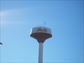
 view gallery view gallerySW42.2 km | Watertower, Langford, South Dakota in Water Towers Small town watertower. posted by: NGComets location: South Dakota date approved: 06/09/2010 last visited: never |
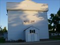 view gallery view gallerySW42.2 km |  "American Legion Post 141" Langford, South Dakota "American Legion Post 141" Langford, South Dakota
in Legion Posts and Branches Post named for Henry Osness, the son of Mr. and Mrs. John Osness, living at Langford and was killed in action in France during WW1. posted by: NGComets location: South Dakota date approved: 06/09/2010 last visited: never |
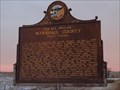
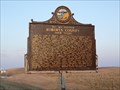 view gallery view gallerySE44.3 km |  Your Are Entering Roberts County South Dakota Your Are Entering Roberts County South Dakota
in South Dakota Historical Markers This is one of several similar markers placed on highways at the Roberts County Line. posted by:  NevaP NevaP location: South Dakota date approved: 05/05/2008 last visited: 07/16/2019 |
 view gallery view gallerySE44.3 km | You Are Entering Marshall County South Dakota in South Dakota Historical Markers This South Dakota Historical Marker is on Hwy 10 about 5 miles west of the Nicollet Tower. posted by: PeterNoG location: South Dakota date approved: 01/05/2012 last visited: 07/16/2019 |
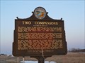 view gallery view gallerySE47 km | Two Companions in South Dakota Historical Markers This is one of three markers relating stories of winter hardships on the northern prairies. posted by: NevaP location: South Dakota date approved: 05/05/2008 last visited: 01/03/2012 |
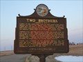 view gallery view gallerySE47 km | Two Brothers in South Dakota Historical Markers This is one of three markers relating stories of winter hardships on the northern prairies.
posted by: NevaP location: South Dakota date approved: 05/05/2008 last visited: 01/03/2012 |
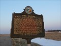 view gallery view gallerySE47 km | Two Sisters in South Dakota Historical Markers This is one of three markers relating stories of winter hardships on the northern prairies.
posted by: NevaP location: South Dakota date approved: 05/05/2008 last visited: 01/03/2012 |
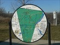 view gallery view gallerySE49.7 km | 35 Mile Radius of Sisseton Map in South Dakota Historical Markers Historic places map including 35 Mile Radius of Sisseton, SD posted by: plainsdrifter358 location: South Dakota date approved: 12/21/2006 last visited: 01/03/2012 |
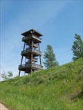 view gallery view gallerySE49.7 km |  Nicollet Tower Nicollet Tower
in Scenic Roadside Look-Outs The Joseph N. Nicollet Tower and Interpretive Center, located 3.5 miles west of Sisseton is a 75 foot observation tower with three floors that provides a breathtaking view of the great valley carved by the glacier some 40,000 years ago. posted by:  Milbank Milbank location: South Dakota date approved: 05/01/2006 last visited: 04/21/2012 |
|