 view gallery view gallery N18.8 km N18.8 km
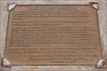
|   Four Counties: Perkins County, NE Four Counties: Perkins County, NE
in Nebraska Historical Markers Perkins County is located southeast of the corner of Colorado. posted by:  IJAdventures IJAdventures location: Nebraska date approved: 09/20/2013 last visited: 05/25/2022 |
 view gallery view galleryN18.8 km |  Four Counties: Sedgwick County, CO Four Counties: Sedgwick County, CO
in Colorado Historical Markers Sedgwick County is the northeasternmost county in Colorado bordering Nebraska on two sides. posted by: IJAdventures location: Colorado date approved: 09/21/2013 last visited: 05/25/2022 |
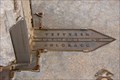
 view gallery view galleryN18.8 km |  Where Colorado Meets the Pan & Handle of Nebraska Where Colorado Meets the Pan & Handle of Nebraska
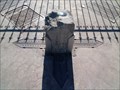
in U.S. Historic Survey Stones and Monuments The Waymark is at Benchmark MN0401, which is a horizontal control disk (brass) set in the top of a sculpted boulder, at the north-east corner of Colorado and the south-east corner of the Nebraska panhandle. posted by: DuneStalker location: Colorado date approved: 07/27/2010 last visited: 08/07/2023 |
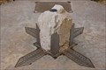 view gallery view galleryN18.8 km |  NORTHEAST CORNER COLORADO (MN0401) - Sedgwick County, CO NORTHEAST CORNER COLORADO (MN0401) - Sedgwick County, CO
in U.S. Benchmarks This horizontal control disk marks the northeast corner of Colorado and Nebraska. posted by: IJAdventures location: Colorado date approved: 09/13/2013 last visited: 05/25/2022 |
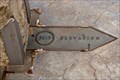 view gallery view galleryN18.8 km |  3613 Feet - Corner of Colorado & Nebraska 3613 Feet - Corner of Colorado & Nebraska
in Elevation Signs The elevation where the northeast corner of Colorado meets the panhandle of Nebraska. posted by: IJAdventures location: Nebraska date approved: 09/16/2013 last visited: 05/25/2022 |
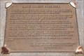
 view gallery view galleryN18.8 km |  N 41°00' W 102°03' - Corner of Colorado & Nebraska N 41°00' W 102°03' - Corner of Colorado & Nebraska
in Permanent Geographic Coordinates These coordinates are listed on a monument at the northeast corner of Colorado. posted by: IJAdventures location: Colorado date approved: 09/16/2013 last visited: 05/25/2022 |
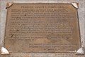
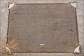
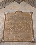 view gallery view galleryN18.8 km | Colorado's Northeast Corner - Sedgwick County, CO in Colorado Historical Markers This bronze plaque is located at the northeast corner of Colorado and Nebraska. posted by: IJAdventures location: Colorado date approved: 09/21/2013 last visited: 05/25/2022 |
 view gallery view galleryN18.8 km | Four Counties: Keith County, NE in Nebraska Historical Markers Keith County is located northeast of the corner of Colorado. posted by: IJAdventures location: Nebraska date approved: 09/20/2013 last visited: 05/25/2022 |
 view gallery view galleryN18.8 km | Four Counties: Deuel County, NE in Nebraska Historical Markers Deuel County is located northwest of the corner of Colorado. posted by: IJAdventures location: Nebraska date approved: 09/20/2013 last visited: 05/25/2022 |
 view gallery view gallery E21.9 km E21.9 km
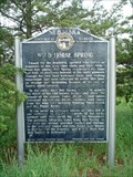
| Wild Horse Spring # 29 in Nebraska Historical Markers Road side marker posted by:  Biker Ozzy Biker Ozzy location: Nebraska date approved: 08/23/2008 last visited: never |
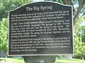 view gallery view galleryN25.6 km | The Big Spring in Nebraska Historical Markers Spring used by Plains Indians for centuries was disovered by Oregon Trail pioneers. posted by: plainsdrifter358 location: Nebraska date approved: 05/14/2008 last visited: 09/02/2007 |
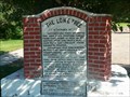 view gallery view galleryN25.6 km | The Lone Tree in Nebraska Historical Markers Largest tree from Omaha to Denver. posted by: plainsdrifter358 location: Nebraska date approved: 05/14/2008 last visited: 01/13/2013 |
 view gallery view galleryN25.6 km | SAM BASS AND THE BIG SPRINGS ROBBERY in Nebraska Historical Markers Sam Bass and his gang robbed the Union Pacific train of $60,000 on September 18, 1877. posted by: plainsdrifter358 location: Nebraska date approved: 05/14/2008 last visited: 01/12/2013 |
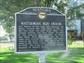 view gallery view galleryN25.6 km | Waterman Sod House in Nebraska Historical Markers Sod house built about 1886 and lived in until 1989! posted by: plainsdrifter358 location: Nebraska date approved: 05/14/2008 last visited: 01/12/2013 |
 view gallery view gallery NW26.7 km NW26.7 km
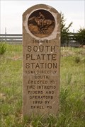
|  South Platte Station - Deuel County, NE South Platte Station - Deuel County, NE
in Pony Express Monuments The Frontz/South Platte station was one of only two Pony Express stations in Colorado. posted by: IJAdventures location: Nebraska date approved: 09/15/2013 last visited: never |
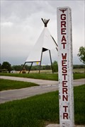 view gallery view galleryNW26.9 km |  Great Western Trail - Julesburg, CO Great Western Trail - Julesburg, CO
in Wagon Roads and Trails Great Western Trail marker located at the Colorado Welcome Center in Julesburg. posted by: IJAdventures location: Colorado date approved: 07/27/2013 last visited: 05/07/2021 |
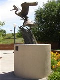 view gallery view galleryNW27 km |  "Swept Away" "Swept Away"
in Figurative Public Sculpture "Swept Away", a bronze sculpture of Great Blue Herons, is located in the plaza of the Julesburg, CO Welcome Center on I-76 posted by: beagle39z location: Colorado date approved: 07/05/2007 last visited: 07/12/2017 |
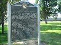
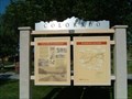 view gallery view galleryNW27 km | Welcome to Colorado -- Colorado Wildlife Story -- Last Days of the Buffalo in Colorado Historical Markers Four panel historical marker located at the Colorado Welcome Center near Julesburg, Colorado. posted by:  BruceS BruceS location: Colorado date approved: 08/18/2007 last visited: 02/01/2021 |
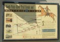 view gallery view galleryNW27 km | South Platte River Trail Scenic and Historic Byway in Colorado Historical Markers Historical marker commemorating the South Platte River Trail located at the Colorado Welcome Center near Julesburg. posted by: BruceS location: Colorado date approved: 08/18/2007 last visited: 05/07/2021 |
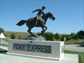 view gallery view galleryNW27 km | God Speed to the Boy and the Pony by Brenda J. Nilson Daniher - Julesburg, Colorado in Figurative Public Sculpture Pony Express sculpture located at Colorado Welcome Center near Julesburg on I-80. posted by: BruceS location: Colorado date approved: 08/19/2007 last visited: 05/07/2021 |
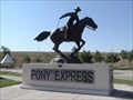 view gallery view galleryNW27 km | Colorado Pony Express Statue in Pony Express Monuments This one has a pretty large statue of a man riding. posted by: Dew Crew location: Colorado date approved: 07/08/2006 last visited: 05/07/2021 |
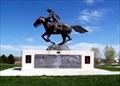 view gallery view galleryNW27 km |  God Speed to the Boy and the Pony God Speed to the Boy and the Pony
in Equestrian Statues This is a statue of a Pony Express rider. posted by: NevaP location: Colorado date approved: 06/03/2007 last visited: 05/07/2021 |
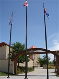 view gallery view galleryNW27 km |  Colorado Welcome Center - Julesburg Colorado Welcome Center - Julesburg
in Tourist Information Centers - Visitor Centers Located at the beginning of the South Platte River Trail, a Scenic and Historic Byway. Complimentary maps, coffee and friendly volunteers to help you with your travel plans. The Welcome Center is open daily 8am-5pm in the winter, and 8am-6pm in the summer. Picnic sites and walking paths surround the sunny, landscaped plaza. posted by: beagle39z location: Colorado date approved: 07/06/2007 last visited: 08/07/2023 |
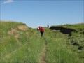 view gallery view galleryN27.5 km |  California Hill - Brule, Nebraska California Hill - Brule, Nebraska
in U.S. National Register of Historic Places California Hill was climbed by thousands of westward emigrants heading west during the covered wagon migrations from 1841-1860. posted by: Rose Red location: Nebraska date approved: 01/06/2010 last visited: never |
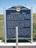 view gallery view galleryN27.5 km | California Hill # 313 in Nebraska Historical Markers Marker about a hill on the way to the North Platte River. posted by: Biker Ozzy location: Nebraska date approved: 09/16/2009 last visited: 06/18/2007 |
|