 view gallery view gallery NE13.2 km NE13.2 km
|   Juan Bautista de Anza NHT - Tumacacori NHP Juan Bautista de Anza NHT - Tumacacori NHP
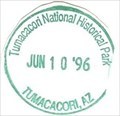
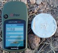
in NPS Passport Cancellation Stations A stop on the Juan Bautista de Anza NHT. This stop is also a National Historic Park. The stamp is in the visitor center. posted by:  npsVisitor npsVisitor location: Arizona date approved: 03/17/2019 last visited: 03/05/2023 |
 view gallery view galleryNE13.2 km | Tumacacori National Historic Park - Tumacacori, AZ in NPS Passport Cancellation Stations Tumacácori sits at a cultural crossroads in the Santa Cruz River valley. Here O’odham, Yaqui, and Apache people met and mingled with European Jesuit and Franciscan missionaries, settlers, and soldiers, sometimes in conflict and sometimes in cooperation. posted by: Don.Morfe location: Arizona date approved: 02/14/2020 last visited: 03/05/2023 |
 view gallery view galleryNE13.2 km |  Tumacácori National Historical Park - Tumacacori, AZ Tumacácori National Historical Park - Tumacacori, AZ
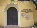
in Wikipedia Entries Tumacácori National Historical Park is located in the upper Santa Cruz River Valley in Santa Cruz County, southern Arizona. The park consists of 360 acres (1.5 km2) in three separate units. posted by: Don.Morfe location: Arizona date approved: 02/19/2022 last visited: 02/20/2022 |
 view gallery view galleryNE13.2 km |  Tumacácori National Historical Park - Tumacacori, AZ Tumacácori National Historical Park - Tumacacori, AZ
in U.S. National Register of Historic Places Tumacácori National Historical Park is located in the upper Santa Cruz River Valley in Santa Cruz County, southern Arizona. The park consists of 360 acres (1.5 km2) in three separate units. posted by: Don.Morfe location: Arizona date approved: 02/20/2022 last visited: 02/20/2022 |
 view gallery view galleryNE13.2 km |  Tumacácori National Historical Park - Tumacacori, AZ Tumacácori National Historical Park - Tumacacori, AZ
in National Parks of the World Tumacácori National Historical Park is located in the upper Santa Cruz River Valley in Santa Cruz County, southern Arizona. The park consists of 360 acres (1.5 km2) in three separate units. posted by: Don.Morfe location: Arizona date approved: 02/20/2022 last visited: 02/20/2022 |
 view gallery view galleryNE13.2 km |  Tumacácori National Historical Park - Tumacacori, AZ Tumacácori National Historical Park - Tumacacori, AZ
in Official Local Tourism Attractions Tumacácori National Historical Park is located in the upper Santa Cruz River Valley in Santa Cruz County, southern Arizona. The park consists of 360 acres (1.5 km2) in three separate units. posted by: Don.Morfe location: Arizona date approved: 02/19/2022 last visited: 02/20/2022 |
 view gallery view galleryNE13.2 km |  Tumacácori National Historical Park - Tumacacori, AZ Tumacácori National Historical Park - Tumacacori, AZ
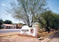
in Ranger Stations The Ranger Station is inside the Visitor Center. The Mission San José de Tumacácori complex is open to the public. Nearby are the park's visitor center and the Tumacácori Museum in a historic Mission Revival style building. posted by: Don.Morfe location: Arizona date approved: 03/06/2022 last visited: 02/20/2022 |
 view gallery view galleryNE13.2 km | ") Tumacácori National Historical Park Tumacácori National Historical Park
in National Parks (U.S.) Tumacácori NHP protects three Spanish colonial mission ruins in southern Arizona posted by: leadhiker location: Arizona date approved: 11/22/2009 last visited: 02/20/2022 |
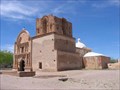 view gallery view galleryNE13.2 km |  Mission San José de Tumacácori (Franciscan) - Tumacácori, AZ Mission San José de Tumacácori (Franciscan) - Tumacácori, AZ
in Roman Catholic Churches Historic Mission ruins located approximately 40 miles south of Tucson on I-19. posted by:  HiFiLZ HiFiLZ location: Arizona date approved: 04/18/2008 last visited: 02/11/2012 |
 view gallery view galleryNE13.4 km | Mission San José de Tumacácori (Jesuit) - Tumacácori, AZ in Roman Catholic Churches Preserved rock foundation of the Jesuit church at Mission San José de Tumacácori. posted by: HiFiLZ location: Arizona date approved: 04/18/2008 last visited: 02/11/2012 |
 view gallery view galleryNE16.6 km |  Tubac Tubac
in Arizona Historical Markers The Art Colony of Tubac was established in 1752 as a Spanish presidio (fort). Working artists' studios now surround the grounds which once served as the home for a Spanish military garrison. posted by: leadhiker location: Arizona date approved: 05/03/2010 last visited: 09/30/2023 |
 view gallery view galleryNE16.9 km |  Wooden Cat, Tubac, AZ Wooden Cat, Tubac, AZ
in Outside Wooden Display Carvings A wooden cat on the sidewalk outside a shop in Tubac, Arizona. posted by: tugies location: Arizona date approved: 12/19/2013 last visited: 12/21/2013 |
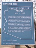 view gallery view galleryNE17.1 km | Charles Debrille Poston in Arizona Historical Markers Charles Debrille Poston was an American explorer, prospector, author, politician, and civil servant. He is referred to as the "Father of Arizona" due to his efforts lobbying for creation of the territory. posted by: leadhiker location: Arizona date approved: 05/06/2010 last visited: 09/30/2023 |
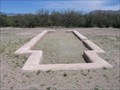
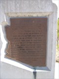
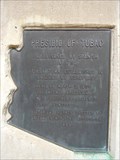 view gallery view galleryNE17.1 km | Presidio of Tubac in Arizona Historical Markers Tubac remembers its origins at the Tubac Presidio State Historic Park located in the village's Old Town, and no visit to Tubac is complete without a stop at Arizona's First State Park. posted by: leadhiker location: Arizona date approved: 05/03/2010 last visited: never |
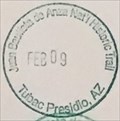 view gallery view galleryNE17.1 km | Juan Bautista de Anza NHT - Tubac Presidio in NPS Passport Cancellation Stations One of many places that has a passport stamp for the Juan Bautista de Anza NHT. This stamp is available behind the counter. I had to show the attendant a stamp for her to understand what I was asking for. posted by: npsVisitor location: Arizona date approved: 03/17/2019 last visited: never |
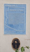 view gallery view galleryNE17.1 km |  Churches in Tubac, Arizona Churches in Tubac, Arizona
in Blue Plaques Tubac's most famous Spanish resident was Juan Bautista de Anza. While stationed at Tubac (1760-1776), de Anza built the chapel of Santa Gertrudis, the foundations of which lie beneath today's St. Ann's Church. posted by: grandmabetsy location: Arizona date approved: 12/10/2013 last visited: 09/30/2023 |
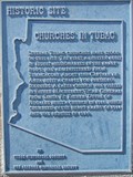 view gallery view galleryNE17.1 km | Churches in Tubac in Arizona Historical Markers Tubac's most famous Spanish resident was Juan Bautista de Anza. While stationed at Tubac (1760-1776), de Anza built the chapel of Santa Gertrudis, the foundations of which lie beneath today's St. Ann's Church. posted by: leadhiker location: Arizona date approved: 05/03/2010 last visited: 09/30/2023 |
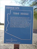 view gallery view galleryNE17.1 km | Tubac Schools in Arizona Historical Markers T. Lillie Mercer, Sabino Otero and others established the Tubac town site in 1882, built the Tubac School in 1885, and they organized the Tubac Scouts in 1866 to fight the Apaches. posted by: leadhiker location: Arizona date approved: 05/03/2010 last visited: 09/30/2023 |
 view gallery view gallery SE18.7 km SE18.7 km
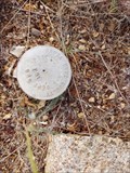
|  Santa Cruz County LIDAR #9 Santa Cruz County LIDAR #9
in U.S. Benchmarks Santa Cruz County Flood Control District flood map modernization project LIDAR Mapping Checkpoint #9. posted by: Arizona Ranger Team location: Arizona date approved: 03/22/2011 last visited: never |
 view gallery view gallery NW18.8 km NW18.8 km
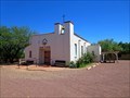
| St. Ferdinand Mission Church - Arivaca, AZ in Roman Catholic Churches Gated mission church located along Arivaca Road. posted by: HiFiLZ location: Arizona date approved: 04/23/2008 last visited: 04/22/2008 |
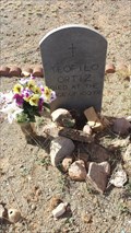 view gallery view galleryNW19.2 km |  102 - Teofilo Ortiz, - Arivaca, Arizona 102 - Teofilo Ortiz, - Arivaca, Arizona
in Headstones of Centenarians A centenarian buried in a historic cemetery and town near the Mexican border. posted by: tugies location: Arizona date approved: 02/23/2017 last visited: 02/23/2017 |
 view gallery view gallery E19.2 km E19.2 km
|  San Cayetano Top Hop San Cayetano Top Hop
in Summit Registers A summit Register for the second highest peak in the San Cayetano range. posted by: Phydux location: Arizona date approved: 06/14/2009 last visited: 05/10/2014 |
 view gallery view gallery N22.4 km N22.4 km
|  Santa Cruz County 107 - Amado, AZ Santa Cruz County 107 - Amado, AZ
in Public Land Survey Marks County marker at edge of dead end public road posted by: tnwave location: Arizona date approved: 09/09/2019 last visited: 09/09/2019 |
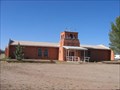
 view gallery view galleryN25.7 km |  The Universal Apostolic Church of Jesus Christ - Amado, AZ The Universal Apostolic Church of Jesus Christ - Amado, AZ
in Religious Buildings Multifarious This is one of two church buildings in the small community of Amado. posted by: rjmcdonough1 location: Arizona date approved: 06/26/2019 last visited: never |
 view gallery view galleryN25.7 km |  Bell Tower, Assumption of Mary - Amado, AZ Bell Tower, Assumption of Mary - Amado, AZ
in Bell Towers This tower supports a hand operated bell. posted by: rjmcdonough1 location: Arizona date approved: 06/24/2019 last visited: never |
|