 view gallery view gallery W13.2 km W13.2 km
|   Château-Le-duc Château-Le-duc
in Castles Ruine du Château-le-Duc posted by:  habot habot location: Belgium date approved: 08/16/2005 last visited: 07/25/2007 |
 view gallery view gallery E15.4 km E15.4 km
|   470 m - Marnau - Neufchâteau - Belgique 470 m - Marnau - Neufchâteau - Belgique
in Elevation Signs Signe d'altitude Marnau posted by:  franketmuriel franketmuriel location: Luxembourg, Belgium date approved: 04/23/2019 last visited: 03/13/2023 |
 view gallery view gallery SW15.4 km SW15.4 km
|   Bouillon Bouillon
in Castles Château de Godefroid de Bouillon. posted by:  habot habot location: Belgium date approved: 08/16/2005 last visited: 03/13/2023 |
 view gallery view gallery NW17.1 km NW17.1 km
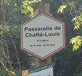
|   49° 59' 30,96" 05° 08' 39,89" - Passerelle de Chafté-Louis - Libin - Belgique 49° 59' 30,96" 05° 08' 39,89" - Passerelle de Chafté-Louis - Libin - Belgique
in Permanent Geographic Coordinates [FR] Coordonnées géographiques DMS se trouvant sur le panneau de randonnée. [EN] Geographical coordinates DMS located on the hiking sign. posted by:  PaulLassiter PaulLassiter location: Luxembourg, Belgium date approved: 07/16/2019 last visited: never |
 view gallery view gallery NW17.1 km NW17.1 km
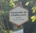
|   Passerelle de Chafté-Louis - Libin - Belgique, 260 m. Passerelle de Chafté-Louis - Libin - Belgique, 260 m.
in Elevation Signs [FR] Signal d'altitude près de la passerelle sur une des promenades entre les rivières Lesse et Lomme. [EN] Altitude signal near the bridge on one of the parkways between the Lesse and Lomme rivers. posted by:  PaulLassiter PaulLassiter location: Luxembourg, Belgium date approved: 07/16/2019 last visited: never |
 view gallery view gallery W18.8 km W18.8 km
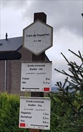
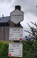
|   Croix de Poupehan - Corbion - Belgique, 356 m Croix de Poupehan - Corbion - Belgique, 356 m
in Elevation Signs [FR] Signal d'altitude situé près d'un croix chrétienne au début de la rue éponyme. [EN] 78 / 5000
Résultats de traduction
Altitude signal located near a Christian cross at the beginning of the eponymous street. posted by:  PaulLassiter PaulLassiter location: Luxembourg, Belgium date approved: 12/05/2020 last visited: never |
 view gallery view gallery W18.8 km W18.8 km
|   Lat 49° 48' 04" - Long 05° 00' 27" - Croix de Poupehan - Corbion, Belgique Lat 49° 48' 04" - Long 05° 00' 27" - Croix de Poupehan - Corbion, Belgique
in Permanent Geographic Coordinates FR] Coordonnées géographiques DMS se trouvant sur le panneau de randonnée. [EN] Geographical coordinates DMS located on the hiking sign. posted by:  PaulLassiter PaulLassiter location: Luxembourg, Belgium date approved: 12/18/2020 last visited: never |
 view gallery view gallery W19 km W19 km
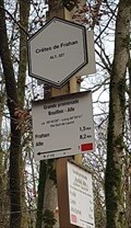
|   La 49° 49' 28" Long 04° 59' 41" - Crêtes de Frahan - Bouillon, Belgique La 49° 49' 28" Long 04° 59' 41" - Crêtes de Frahan - Bouillon, Belgique
in Permanent Geographic Coordinates [FR] Coordonnées géographiques DMS se trouvant sur le panneau de randonnée. [EN] Geographical coordinates DMS located on the hiking sign. posted by:  PaulLassiter PaulLassiter location: Luxembourg, Belgium date approved: 12/18/2020 last visited: never |
 view gallery view gallery W19 km W19 km
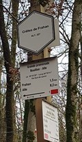
|   Crêtes de Frahan - Bouillon - Belgique, 227 m Crêtes de Frahan - Bouillon - Belgique, 227 m
in Elevation Signs [FR] Signal d'altitude au pied des crêtes de Frahan. [EN] Altitude signal at the foot of the crests of Frahan. posted by:  PaulLassiter PaulLassiter location: Luxembourg, Belgium date approved: 12/05/2020 last visited: never |
 view gallery view gallery W19.2 km W19.2 km
|   La Chaire à Prêcher - Bouillon - Belgique La Chaire à Prêcher - Bouillon - Belgique
in Urban Legends and Superstitions [FR] Piton rocheux dominant largement la vallée de la Semois et surplombant d'une hauteur de 100 m le village de Poupehan.[EN] A rocky peak largely dominating the valley of Semois River and overhanging the village of Poupehan from a height of 100m. posted by:  PaulLassiter PaulLassiter location: Luxembourg, Belgium date approved: 12/18/2020 last visited: never |
 view gallery view gallery NE20.6 km NE20.6 km
|   Aldi Store Saint-Hubert Belgium Aldi Store Saint-Hubert Belgium
in ALDI Stores Aldi Store Saint-Hubert Belgium posted by:  Alfredo4 Alfredo4 location: Luxembourg, Belgium date approved: 11/20/2011 last visited: never |
 view gallery view gallery NE20.8 km NE20.8 km
|   Basilique Saint-Hubert - Saint-Hubert - Belgique Basilique Saint-Hubert - Saint-Hubert - Belgique
in Philatelic Photographs [FR] Timbre représentant la basilique Saint-Hubert, Église abbatiale de l'abbaye de Saint-Pierre en Ardenne (687-1797). [EN] Stamp picturing Saint-Hubert basilica, abbey church of Saint-Pierre abbey in Ardenne (687-1797). posted by:  PaulLassiter PaulLassiter location: Luxembourg, Belgium date approved: 12/31/2020 last visited: never |
 view gallery view gallery NE20.8 km NE20.8 km
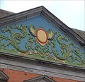
|   1729 - Abbaye de Saint-Hubert - Saint-Hubert, Belgique 1729 - Abbaye de Saint-Hubert - Saint-Hubert, Belgique
in Chronograms [FR] Chronogramme décoratif et coloré en haut du portail occidental du palais abbatial. [EN] Decorative and colourful chronogram at the top of the western portal of the abbot's palace. posted by:  PaulLassiter PaulLassiter location: Luxembourg, Belgium date approved: 01/05/2021 last visited: never |
 view gallery view gallery NE20.8 km NE20.8 km
|   Basilique Saint-Hubert - Saint-Hubert - Belgique Basilique Saint-Hubert - Saint-Hubert - Belgique
in Wikipedia Entries [FR] Ancienne église de l'abbaye bénédictine fondée au VIIe siècle, reconstruite en 1526.[EN] Former church of the Benedictine abbey founded in the 7th century, rebuilt in 1526. posted by:  PaulLassiter PaulLassiter location: Luxembourg, Belgium date approved: 12/30/2020 last visited: never |
 view gallery view gallery NE20.8 km NE20.8 km
|   Abbaye de Saint-Hubert - Saint-Hubert - Belgique Abbaye de Saint-Hubert - Saint-Hubert - Belgique
in Wikipedia Entries [FR] Ancienne abbaye fondée vers 687 et devenue bénédictine en 817. [EN] Former abbey founded around 687 and became Benedictine in 817. posted by:  PaulLassiter PaulLassiter location: Luxembourg, Belgium date approved: 01/01/2021 last visited: never |
 view gallery view gallery NE20.8 km NE20.8 km
|   1729 - Abbaye de Saint-Hubert - Saint-Hubert, Belgique 1729 - Abbaye de Saint-Hubert - Saint-Hubert, Belgique
in Chronograms [FR] Chronogramme décoratif et coloré en haut du portail oriental du palais abbatial. [EN] Decorative and colourful chronogram at the top of the eastern portal of the abbot's palace. posted by:  PaulLassiter PaulLassiter location: Luxembourg, Belgium date approved: 01/05/2021 last visited: never |
 view gallery view gallery NE20.8 km NE20.8 km
|   Abbaye de Saint-Hubert - Saint-Hubert - Belgique Abbaye de Saint-Hubert - Saint-Hubert - Belgique
in Abbeys, Convents and Monasteries [FR] Ancienne abbaye fondée vers 687 et devenue bénédictine en 817. [EN] Former abbey founded around 687 and became Benedictine in 817. posted by:  PaulLassiter PaulLassiter location: Luxembourg, Belgium date approved: 01/03/2021 last visited: never |
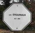 view gallery view gallery N23.8 km N23.8 km
|   Les Erguinaux. Wellin, Belgique. 260 m. Les Erguinaux. Wellin, Belgique. 260 m.
in Elevation Signs Signe d'altitude Les Erguinaux posted by:  franketmuriel franketmuriel location: Luxembourg, Belgium date approved: 04/01/2020 last visited: never |
 view gallery view gallery N24.3 km N24.3 km
|   Point de vue du Belvédère. Wellin, Belgique. 335 m. Point de vue du Belvédère. Wellin, Belgique. 335 m.
in Elevation Signs Signe d'altitude Point de vue du Belvédère. posted by:  franketmuriel franketmuriel location: Luxembourg, Belgium date approved: 04/01/2020 last visited: never |
 view gallery view gallery NW24.3 km NW24.3 km
|   N50 E005 - Haut-Fays, Belgium N50 E005 - Haut-Fays, Belgium
in Confluence Spots An easy accessible Confluence Point in a forest near Haut-Fays, Belgium. posted by:  Hibje Hibje location: Namur, Belgium date approved: 11/23/2009 last visited: 04/07/2022 |
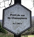 view gallery view gallery NW24.3 km NW24.3 km
|   Point de vue de Chassepierre. Wellin, Belgique. 360 m. Point de vue de Chassepierre. Wellin, Belgique. 360 m.
in Elevation Signs Signe d'altitude du Point de vue de Chassepierre. posted by:  franketmuriel franketmuriel location: Luxembourg, Belgium date approved: 04/01/2020 last visited: never |
 view gallery view gallery S24.9 km S24.9 km
|   L’abbaye Notre-Dame d'Orval, Luxembourg, Belgium L’abbaye Notre-Dame d'Orval, Luxembourg, Belgium
in Abbeys, Convents and Monasteries [EN] Notre-Dame d'Orval Abbey is a Cistercian-Trappist monastery located in Villers-devant-Orval. --- [FR] L'abbaye Notre-Dame d'Orval est un monastère cistercien-trappiste situé à Villers-devant-Orval. posted by:  Michaelfiles Michaelfiles location: Luxembourg, Belgium date approved: 08/23/2021 last visited: 03/13/2023 |
 view gallery view gallery S24.9 km S24.9 km
|   Les ruines de l’abbaye Notre-Dame d'Orval, Luxembourg, Wallonie Les ruines de l’abbaye Notre-Dame d'Orval, Luxembourg, Wallonie
in Belgium Monument Registers [EN] Notre-Dame d'Orval Abbey is a Cistercian-Trappist monastery located in Villers-devant-Orval, province Luxembourg. --- [FR] L'abbaye Notre-Dame d'Orval est un monastère cistercien-trappiste situé à Villers-devant-Orval, en province Luxembourg posted by:  Michaelfiles Michaelfiles location: Luxembourg, Belgium date approved: 08/22/2021 last visited: 11/12/2021 |
 view gallery view gallery S24.9 km S24.9 km
|   Abbaye Notre-Dame d'Orval, Belgium Abbaye Notre-Dame d'Orval, Belgium
in Wikipedia Entries [EN] Notre-Dame d'Orval Abbey is a Cistercian-Trappist monastery located in Villers-devant-Orval in the province of Luxembourg. --- [FR] L'abbaye Notre-Dame d'Orval est un monastère cistercien-trappiste situé à Villers-devant-Orval dans la province de Luxembourg. posted by:  Michaelfiles Michaelfiles location: Luxembourg, Belgium date approved: 08/23/2021 last visited: 11/12/2021 |
 view gallery view gallery S25.1 km S25.1 km
|   Trappist Orval, L’abbaye Notre-Dame d'Orval, Belgium Trappist Orval, L’abbaye Notre-Dame d'Orval, Belgium
in Breweries [EN] The Notre-Dame d'Orval abbey where the Orval trappist beer is brewed. --- [FR] L’abbaye Notre-Dame d'Orval où est brassé la trappiste Orval posted by:  Michaelfiles Michaelfiles location: Luxembourg, Belgium date approved: 08/24/2021 last visited: 11/12/2021 |
|