 view gallery view gallery NE8.9 km NE8.9 km
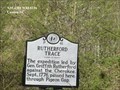
|   Rutherford Trace (P-41) Rutherford Trace (P-41)
in North Carolina Historical Markers The expedition led by Gen. Griffith Rutherford against the Cherokee, Sept. 1776, passed here, through Pigeon Gap. posted by:  Don.Morfe Don.Morfe location: North Carolina date approved: 04/02/2020 last visited: 10/23/2021 |
 view gallery view gallery SW9.5 km SW9.5 km
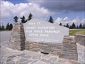
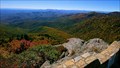
|  Blue Ridge Parkway - Highest Point - North Carolina, USA. Blue Ridge Parkway - Highest Point - North Carolina, USA.
in National Scenic Byways Richland Balsam Overlook. Altitude 6,053 feet, the highest point on the Blue Ridge Parkway motor road. Four States can be viewed from this location. Located at Milepost 431.4, North Carolina. posted by:  veritas vita veritas vita location: North Carolina date approved: 05/02/2015 last visited: 05/27/2017 |
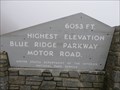
 view gallery view gallerySW9.5 km |  Highest Elevation - BlueRidge Parkway Highest Elevation - BlueRidge Parkway
in Elevation Signs The highest point of the BlueRidge Parkway is found at this overlook (Milepost 431.0). posted by: TheGeoGnomes location: North Carolina date approved: 08/12/2011 last visited: 05/27/2017 |
 view gallery view gallery SE10.6 km SE10.6 km
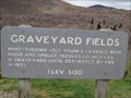
| Graveyard Fields - Brevard, North Carolina - 5,120 feet. in Elevation Signs Graveyard Fields, at an elevation of 5,120 feet - Named for the tree stumps left after a storm or fire. Listed as one of the most popular hiking areas in the Blue Ridge Mountains. Located at Mile Post 418, Brevard, North Carolina. posted by: veritas vita location: North Carolina date approved: 05/17/2015 last visited: 10/12/2019 |
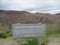 view gallery view gallerySE10.6 km | Blue Ridge Parkway - Graveyard Fields - Mile Post 418, North Carolina, USA. in National Scenic Byways Graveyard Fields - Named for the tree stumps left after a storm or fire, that left the area looking like a graveyard. Listed as one of the most popular hiking areas on the Blue Ridge Parkway. Located at Mile Post 418, Brevard, North Carolina. posted by: veritas vita location: North Carolina date approved: 05/17/2015 last visited: 10/12/2019 |
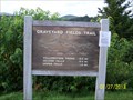 view gallery view gallerySE10.6 km |  Graveyard Fields Trailhead - Brevard, NC Graveyard Fields Trailhead - Brevard, NC
in Hiking and walking trailheads The Graveyard Fields Trailhead and parking area is located at Blue Ridge Parkway milepost 418.8. posted by: hummerstation location: North Carolina date approved: 07/29/2013 last visited: 10/12/2019 |
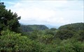 view gallery view gallerySE10.6 km |  Graveyard Fields Overlook - Brevard, NC Graveyard Fields Overlook - Brevard, NC
in Scenic Roadside Look-Outs The Graveyard Fields Overlook and parking area is located at Blue Ridge Parkway milepost 418.8. posted by: hummerstation location: North Carolina date approved: 09/08/2013 last visited: 10/12/2019 |
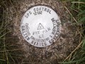
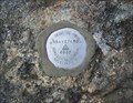 view gallery view gallerySE10.6 km |  Graveyard Horizontal Control - Brevard, NC Graveyard Horizontal Control - Brevard, NC
in U.S. Benchmarks Horizontal Control disk at the Graveyard Overlook at Blue Ridge Parkway milepost 418.8. posted by: hummerstation location: North Carolina date approved: 07/28/2013 last visited: never |
 view gallery view gallery E11.3 km E11.3 km
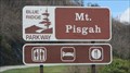
| Blue Ridge Parkway - Mount Pisgah - Asheville, North Carolina, USA. in National Scenic Byways Mount Pisgah in the Blue Ridge Mountains. The Birthplace of Forest Conservation in America. Located at Milepost 408, Blue Ridge Parkway, near Asheville, North Carolina. posted by: veritas vita location: North Carolina date approved: 05/05/2015 last visited: 06/27/2018 |
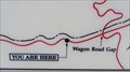 view gallery view galleryE11.3 km |  You Are Here - Cradle of Forestry - Blue Ridge Mountains, North Carolina, USA. You Are Here - Cradle of Forestry - Blue Ridge Mountains, North Carolina, USA.
in 'You Are Here' Maps Mount Pisgah in the Blue Ridge Mountains. The Birthplace of Forest Conservation in America. Located at Milepost 408, Blue Ridge Parkway, near Asheville, North Carolina. posted by: veritas vita location: North Carolina date approved: 05/05/2015 last visited: 05/05/2015 |
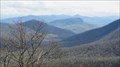 view gallery view galleryE11.3 km | Cradle of Forestry Overlook - Blue Ridge Mountains, North Carolina, USA in Scenic Roadside Look-Outs The cradle of forestry overlook, offers spectacular views of Mount Pisgah & the Blue Ridge Mountains. The Birthplace of forest conservation in America. Located at Milepost 408, Blue Ridge Parkway, near Asheville, North Carolina. posted by: veritas vita location: North Carolina date approved: 05/05/2015 last visited: 06/27/2018 |
 view gallery view gallery S11.4 km S11.4 km
| Devil's Courthouse, Blue Ridge Parkway, milemarker 422 in Elevation Signs Elevation is posted on horizon viewer information plaque. posted by: NCDaywalker location: North Carolina date approved: 07/17/2014 last visited: 05/27/2017 |
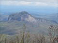
 view gallery view galleryS11.4 km |  Devil's Courthouse, Blue Ridge Parkway, milemarker 422 Devil's Courthouse, Blue Ridge Parkway, milemarker 422
in Scenic Overlooks The reward for a half mile long and arduous climb to the top of The Devil's Courthouse is a spectacular view of the surrounding mountains, posted by: NCDaywalker location: North Carolina date approved: 07/17/2014 last visited: 05/27/2017 |
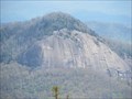 view gallery view gallerySE11.4 km | Blue Ridge Parkway - Looking Glass Rock - Mile Post 417 - North Carolina, USA. in National Scenic Byways Looking Glass Rock. So named because it reflects light brilliantly when water and ice are on the rock’s granite face. Located at Mile post 417 on the Blue Ridge Parkway, North Carolina. posted by: veritas vita location: North Carolina date approved: 04/29/2015 last visited: 06/10/2018 |
 view gallery view gallerySE11.4 km | Looking Glass Rock - Blue Ridge Parkway - Mile Post 417 - North Carolina, USA. in Scenic Roadside Look-Outs Looking Glass Rock - So named because it reflects light brilliantly when water & ice are on the rock’s massive granite face. Located at Mile post 417 on the Blue Ridge Scenic Parkway, North Carolina. posted by: veritas vita location: North Carolina date approved: 04/29/2015 last visited: 06/10/2018 |
 view gallery view gallerySE11.4 km |  Looking Glass Rock - Blue Ridge Parkway - North Carolina, USA. Looking Glass Rock - Blue Ridge Parkway - North Carolina, USA.
in Wikipedia Entries Looking Glass Rock - So named because it reflects light brilliantly when water & ice are on the rock’s massive granite face. Located at Mile post 417 on the Blue Ridge Scenic Parkway, North Carolina. posted by: veritas vita location: North Carolina date approved: 04/29/2015 last visited: 06/10/2018 |
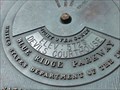
 view gallery view galleryE11.6 km | FRY PAN AZ MK in U.S. Benchmarks Located at the Pink Beds scenic overlook on the Blue Ridge Parkway. About center of the area, 20 feet off the pavement. posted by: jhuoni location: North Carolina date approved: 03/13/2014 last visited: never |
 view gallery view gallery NW11.7 km NW11.7 km
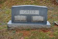
|  William Robert Greer William Robert Greer
in Grave of a Famous Person Will Greer was a Special Agent with the United States Secret Service who was the driver of President Kennedy’s Limousine in Dallas on November 23, 1963. posted by: Sneakin Deacon location: North Carolina date approved: 12/19/2011 last visited: 08/17/2012 |
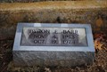 view gallery view galleryNW11.9 km | Byron Elsworth Barr in Grave of a Famous Person Byron Barr is better as Academy Award winning actor "Gig Young" posted by: Sneakin Deacon location: North Carolina date approved: 04/11/2012 last visited: 08/17/2012 |
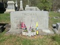
 view gallery view galleryNW11.9 km |  Greenhill Cemetery - Waynesville NC Greenhill Cemetery - Waynesville NC
in Worldwide Cemeteries Col. William Holland Thomas (February 5, 1805-May 10, 1893) is among the Confederate officers and soldiers buried here in Greenhill Cemetery. His grave is located about thirty yards in front of you on the right. posted by: Don.Morfe location: North Carolina date approved: 05/07/2023 last visited: 05/07/2023 |
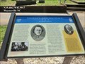 view gallery view galleryNW11.9 km |  FINAL - Engagement of the war in North Carolina-Thomas's Resting Place -Waynesville NC FINAL - Engagement of the war in North Carolina-Thomas's Resting Place -Waynesville NC
in Superlatives Part of the Legion served in the final engagement of the war in North Carolina at Waynesville on May 6-7. Thomas surrendered the Legion to Union Col. William C. Bartlett on May 9. posted by: Don.Morfe location: North Carolina date approved: 05/09/2023 last visited: 05/09/2023 |
 view gallery view galleryNW11.9 km | William Holland Thomas-Greenhill Cemetery - Waynesville NC in Grave of a Famous Person Col. William Holland Thomas (February 5, 1805-May 10, 1893) is among the Confederate officers and soldiers buried here in Greenhill Cemetery. His grave is located about thirty yards in front of you on the right. posted by: Don.Morfe location: North Carolina date approved: 04/29/2023 last visited: 04/29/2023 |
 view gallery view galleryNW11.9 km |  Thomas's Resting Place-Greenhill Cemetery - Waynesville NC Thomas's Resting Place-Greenhill Cemetery - Waynesville NC
in Civil War Discovery Trail Sites Col. William Holland Thomas (February 5, 1805-May 10, 1893) is among the Confederate officers and soldiers buried here in Greenhill Cemetery. His grave is located about thirty yards in front of you on the right. posted by: Don.Morfe location: North Carolina date approved: 05/08/2020 last visited: 08/30/2022 |
 view gallery view galleryNW11.9 km | Thomas's Resting Place-Greenhill Cemetery - Waynesville NC in U.S. Civil War Sites Thomas’s unit was known as the “Highland Rangers.” Thomas eventually recruited more than 2,000 officers and men, including two companies composed of 400 Cherokee. The unit fought in Tennessee, Kentucky, and Virginia. posted by: Don.Morfe location: North Carolina date approved: 04/28/2023 last visited: 04/29/2023 |
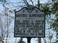 view gallery view galleryNW12.1 km | LAST - Surrender Confederate Force-Martin's Surrender - Waynesville NC in Superlatives Marker is on Main Street (U.S. 23) near Gruder Street, Main Street posted by: Don.Morfe location: North Carolina date approved: 05/09/2023 last visited: 05/09/2023 |
|