 view gallery view gallery N3.4 km N3.4 km
|   La Victoria Cemetery - La Victoria TX La Victoria Cemetery - La Victoria TX
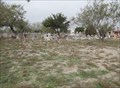
in Worldwide Cemeteries This Cemetery is 800 feet east of FM 2360 on the north side of the community of La Victoria in Starr County, Texas. posted by:  PeterNoG PeterNoG location: Texas date approved: 02/22/2014 last visited: 01/12/2014 |
 view gallery view galleryN3.5 km | Saenz Cemetery - La Victoria TX in Worldwide Cemeteries This Cemetery is 400 feet south of Olmito Road, about 1200 feet east of FM 2360 just north of the community of La Victoria in Starr County, Texas. posted by: PeterNoG location: Texas date approved: 02/22/2014 last visited: 01/12/2014 |
 view gallery view gallery W10 km W10 km
|  Union Water Supply Corp Water Tower - La Puerta TX Union Water Supply Corp Water Tower - La Puerta TX
in Water Towers This Water Tower is on the south side of US Hwy 83 just west of Bionas Street in La Puerta, Texas. posted by: PeterNoG location: Texas date approved: 04/10/2014 last visited: 12/24/2013 |
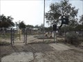
 view gallery view galleryW11.4 km | La Puerta Cemetery - La Puerta TX in Worldwide Cemeteries This Cemetery is the south side of US Hwy 83 about 800 feet east of FM 103 in La Puerta, Texas. posted by: PeterNoG location: Texas date approved: 02/22/2014 last visited: 01/12/2014 |
 view gallery view gallery SE11.4 km SE11.4 km
|  ONLY -- Hand Pulled International Ferry in US -- Los Ebanos TX-Cd. Diaz Ordaz MX ONLY -- Hand Pulled International Ferry in US -- Los Ebanos TX-Cd. Diaz Ordaz MX
in Superlatives The international ferry between Los Ebanos TX and Cd. Diaz Ordaz MX is the only hand-pulled ferry of its kind in the United States posted by: Benchmark Blasterz location: Texas date approved: 08/20/2015 last visited: 07/18/2015 |
 view gallery view gallerySE11.4 km |  Los Ebanos TX - Ciudad Gustavo Diaz Ordaz, Tamps., MX Los Ebanos TX - Ciudad Gustavo Diaz Ordaz, Tamps., MX
in Border Crossings The border crossing between Los Ebanos and Cd. Ordaz is made by means of a hand-pulled ferry posted by: Benchmark Blasterz location: Texas date approved: 08/19/2015 last visited: 08/20/2015 |
 view gallery view gallerySE11.4 km |  Los Ebanos Ferry -- Los Ebanos TX - Ciudad Gustavo Diaz Ordaz, Tamps., MX Los Ebanos Ferry -- Los Ebanos TX - Ciudad Gustavo Diaz Ordaz, Tamps., MX
in Ferries and Ferry Landings The border crossing between Los Ebanos and Cd. Ordaz is made by means of a hand-pulled ferry posted by: Benchmark Blasterz location: Texas date approved: 08/20/2015 last visited: 07/18/2015 |
 view gallery view gallerySE11.4 km |  LAST -- Hand Pulled International Ferry in US -- Los Ebanos TX-Cd. Diaz Ordaz MX LAST -- Hand Pulled International Ferry in US -- Los Ebanos TX-Cd. Diaz Ordaz MX
in Last of its Kind The international ferry between Los Ebanos TX and Cd. Diaz Ordaz MX is the last (and only) hand-pulled ferry of its kind in the United States posted by: Benchmark Blasterz location: Texas date approved: 08/19/2015 last visited: 07/18/2015 |
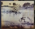 view gallery view gallerySE11.4 km |  1950 & 2015 -- Los Ebanos Ferry, Los Ebanos TX - Ciudad Gustavo Diaz Ordaz, Tamps., MX 1950 & 2015 -- Los Ebanos Ferry, Los Ebanos TX - Ciudad Gustavo Diaz Ordaz, Tamps., MX
in Photos Then and Now The natural ford over the Rio Grande here has been used for centuries. A hand-pulled ferry began operation in 1950, and is still carrying cars and passengers today (2015) posted by: Benchmark Blasterz location: Texas date approved: 08/20/2015 last visited: 07/18/2015 |
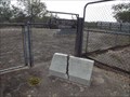
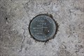 view gallery view gallerySE11.4 km |  IBWC-CIDLA benchmark disk -- Los Ebanos TX IBWC-CIDLA benchmark disk -- Los Ebanos TX
in U.S. Benchmarks A joint US International Boundary and Water Commission - MX Comision Internacional des Limites Y Aguas benchmark disk on a concrete pad with a historic marker near the Los Ebanos ferry crossing to Mexico posted by: Benchmark Blasterz location: Texas date approved: 08/19/2015 last visited: 08/20/2015 |
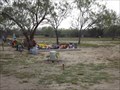
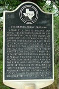 view gallery view gallerySE11.4 km |  Los Ebanos Ferry Crossing Los Ebanos Ferry Crossing
in Texas Historical Markers This ferry crossing has been used to ford the Rio Grande since ancient times. Today you can take the hand-pulled ferry across the river. posted by:  JimmyEv JimmyEv location: Texas date approved: 11/29/2007 last visited: 07/18/2015 |
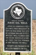 view gallery view gallerySE13 km | Hidalgo County's First Oil Well in Texas Historical Markers Near this site was Hidalgo County's first oil well. posted by: JimmyEv location: Texas date approved: 11/30/2007 last visited: 07/18/2015 |
 view gallery view galleryW14.3 km | Jose Maria Lopez Cemetery - Rio Grande City TX in Worldwide Cemeteries This Cemetery is on the north side of Sauz Street, 500 feet west of Embassy Street in the eastern portion of Rio Grande City, Texas, posted by: PeterNoG location: Texas date approved: 04/04/2014 last visited: 01/12/2014 |
 view gallery view galleryW15.1 km | Olmos Cemetery - Las Lomas TX in Worldwide Cemeteries This Cemetery is just west of North Bianca Road almost 1/2 mile north of US Hwy 83 just west of Las Lomas in Starr County, Texas. posted by: PeterNoG location: Texas date approved: 04/04/2014 last visited: 01/12/2014 |
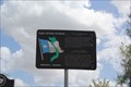
 view gallery view gallerySE15.3 km | Havana Cemetery - Havana TX in Worldwide Cemeteries This Cemetery is on the south side of US Hwy 83, 550 feet east of Patricia Perez Road in the community of Havana in Hidalgo County, Texas. posted by: PeterNoG location: Texas date approved: 02/22/2014 last visited: 07/18/2015 |
 view gallery view gallerySE15.3 km |  Vietnam War Memorial -- US 83 at Havana Cemetery, Havana TX USA Vietnam War Memorial -- US 83 at Havana Cemetery, Havana TX USA
in Vietnam War Memorials One of many markers of this type along US 83, which has been designated the Texas Vietnam War Memorial Highway. posted by: Benchmark Blasterz location: Texas date approved: 08/19/2015 last visited: 08/20/2015 |
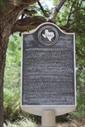
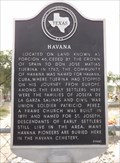 view gallery view gallerySE15.3 km | Havana in Texas Historical Markers This Texas Historical Marker is at the Havana Cemetery on Hwy 83, 550 feet east of Patricio Perez Road in the community of Havana, Texas. posted by: PeterNoG location: Texas date approved: 03/04/2014 last visited: 07/18/2015 |
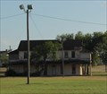
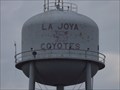 view gallery view gallerySE17.4 km | Coyotes Water Tower - La Joya TX in Water Towers This Water Tower is 400 feet north of US Hwy 83 Expressway just west of the Nellie Schunior Elementary School in La Joya, Texas. posted by: PeterNoG location: Texas date approved: 05/06/2014 last visited: 07/18/2015 |
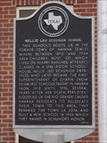
 view gallery view gallerySE17.5 km |  FIRST -- Superintendent of Chapin Schools, La Joya TX FIRST -- Superintendent of Chapin Schools, La Joya TX
in First of its Kind Nellie L. Schunior was named the first superintendent of Chapin school. Chapin was later renamed Edinburg. posted by: Benchmark Blasterz location: Texas date approved: 08/19/2015 last visited: 07/18/2015 |
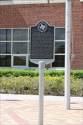
 view gallery view gallerySE17.5 km | Nellie Leo Schunior School in Texas Historical Markers This Texas Historical Marker is in front of the Nellie Leo Schunior School (now La Joya Independent School District offices) on US 83 Expressway just west of FM 2521 (Leo Avenue) in La Joya, Texas. posted by: PeterNoG location: Texas date approved: 03/04/2014 last visited: 07/18/2015 |
 view gallery view gallerySE17.7 km | Lakeview Cemetery - La Joya TX in Worldwide Cemeteries This Cemetery is on West 6th Street, 400 feet west of King Street in La Joya, Texas. posted by: PeterNoG location: Texas date approved: 04/04/2014 last visited: 01/12/2014 |
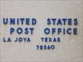 view gallery view gallerySE17.7 km |  La Joya TX 78560 La Joya TX 78560
in U.S. Post Offices This Post Office is on FM 3521, 300 feet north of US Hwy 83 in La Joya, Texas. posted by: PeterNoG location: Texas date approved: 05/04/2014 last visited: 01/12/2014 |
 view gallery view galleryW17.9 km |  Ordinance Storehouse -- Fort Ringgold Historic District, Rio Grande City TX Ordinance Storehouse -- Fort Ringgold Historic District, Rio Grande City TX
in NRHP Historic Districts - Contributing Buildings A ordinance storehouse near the Lee House is a contributing building to the US National Register Fort Ringgold Historic District. posted by: Benchmark Blasterz location: Texas date approved: 08/26/2015 last visited: 07/19/2015 |
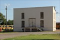
 view gallery view galleryW17.9 km | Parade Ground -- Fort Ringgold Historic District, Rio Grande City TX in NRHP Historic Districts - Contributing Buildings The parade ground at old Fort Ringgold in Rio Grande City was designated contributing structure to the Fort Ringgold US National Register Historic District in 1993. posted by: Benchmark Blasterz location: Texas date approved: 08/26/2015 last visited: 07/19/2015 |
 view gallery view galleryW17.9 km | Officer's Quarters 1,2 -- Fort Ringgold Historic District -- Rio Grande City TX in NRHP Historic Districts - Contributing Buildings The easternmost pair of Officer's Quarters buildings on the south side of the parade ground are on the US National Register of Historic Places as contributing buildings in the Fort Ringgold Historic District, in Rio Grande City TX posted by: Benchmark Blasterz location: Texas date approved: 08/26/2015 last visited: 07/19/2015 |
|