 view gallery view gallery S22.4 km S22.4 km
|   Chateau de Foix, France Chateau de Foix, France
in Castles Chateau de Foix, the castle of the Counts de Foix was a key center of resistance by the Counts de Foix and the Cathars against the Albigensian Crusade. The three towers are distinctive landmarks. posted by:  arby101ca arby101ca location: France date approved: 05/03/2010 last visited: 01/08/2020 |
 view gallery view gallery S22.4 km S22.4 km
|   Benchmarck de l'agence de Foix Benchmarck de l'agence de Foix
in French Benchmarks Repère de nivellement de l'Ariège posted by:  yohaeva yohaeva location: Occitanie, France date approved: 08/28/2014 last visited: 01/08/2020 |
 view gallery view gallery E24.5 km E24.5 km
|   Fêtes historiques : Les Médiévales de Mirepoix - Ariège, Occitanie, France Fêtes historiques : Les Médiévales de Mirepoix - Ariège, Occitanie, France
in Renaissance Fairs [FR] Les Médiévales de Mirepoix se déroulent chaque année le 3ème week-end de juillet.
[EN] The Medieval of Mirepoix take place every year on the 3rd weekend of July. posted by:  Waldog Waldog location: Occitanie, France date approved: 11/15/2018 last visited: 02/29/2020 |
 view gallery view gallery NE27.4 km NE27.4 km
|   Seuil de Naurouze, Montferrand, France Seuil de Naurouze, Montferrand, France
in Watershed Markers and Monuments [FR] Le seuil de Naurouze, à Montferrand marque le partage des eaux des bassins méditerranéen et atlantique
[EN] The threshold of Naurouze, in Montferrand marks the watershed of the Mediterranean and Atlantic basins posted by:  junkys junkys location: Occitanie, France date approved: 12/29/2017 last visited: never |
 view gallery view gallery NE27.4 km NE27.4 km
|   NGF, Naurouze, Z'.E.Q3 - 17 (Canal du Midi - Partage des eaux) NGF, Naurouze, Z'.E.Q3 - 17 (Canal du Midi - Partage des eaux)
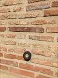
in French Benchmarks [FR] Paul Riquet fut le premier à découvrir ce site sur le seuil de partage des eaux. [EN] The Seuil de Naurouze is the watershed point identified by Pierre-Paul Riquet when he designed and built the Canal du Midi. posted by:  RakeInTheCache RakeInTheCache location: Occitanie, France date approved: 05/05/2012 last visited: 03/22/2018 |
 view gallery view gallery NE27.7 km NE27.7 km
|   L'écluse de l'Océan (Le Canal du Midi) - France L'écluse de l'Océan (Le Canal du Midi) - France
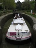
in Waterway Locks, Planes and Lifts [FR] L'écluse de l'Océan est une écluse à chambre unique sur le canal du Midi. [EN] Océan Lock is a single chamber lock on the Canal du Midi. posted by:  RakeInTheCache RakeInTheCache location: Occitanie, France date approved: 05/19/2012 last visited: never |
 view gallery view gallery NE27.7 km NE27.7 km
|   Canal du Midi (Ecluse de l'Océan), France Canal du Midi (Ecluse de l'Océan), France
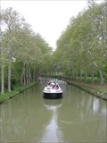
in World Heritage Sites [FR] Le canal du Midi est un canal français qui relie la Garonne à la mer Méditerranée. [EN] The Canal du Midi is a 240 km (150 mi) long canal in Southern France. posted by:  RakeInTheCache RakeInTheCache location: Occitanie, France date approved: 05/16/2012 last visited: never |
 view gallery view gallery NE27.8 km NE27.8 km
|   Ecluse de l'Océan (Canal du Midi) - France Ecluse de l'Océan (Canal du Midi) - France
in Elevation Signs [FR] Le seuil de Naurouze est un seuil géographique (ou col) de 189 mètres d’altitude. [EN] The Seuil de Naurouze, aka Col de Naurouze, is a mountain pass in southern France. posted by:  RakeInTheCache RakeInTheCache location: Occitanie, France date approved: 05/16/2012 last visited: never |
 view gallery view gallery NW27.8 km NW27.8 km
|   Le moulin de pesquies Le moulin de pesquies
in Windmills Le moulin à vent de Pesquies.
Restauré en 1991, il ne fonctionne plus. posted by:  niko_kristyn niko_kristyn location: Occitanie, France date approved: 07/31/2017 last visited: never |
 view gallery view gallery NE28 km NE28 km
|   L'obélisque de Riquet (Midi-Pyrénées) - France L'obélisque de Riquet (Midi-Pyrénées) - France
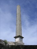
in Obelisks [FR] En 1825, les héritiers de Riquet font ériger un obélisque au seuil de Naurouze pour marquer la symbolique du lieu. [EN] The Riquet Obelisk is dedicated to the creater of the Canal du Midi, Pierre-Paul Riquet. posted by:  RakeInTheCache RakeInTheCache location: Occitanie, France date approved: 05/16/2012 last visited: 03/22/2018 |
 view gallery view gallery N30.4 km N30.4 km
|   Repère de nivellement - Eglise Saint-Sernin - Villenouvelle, France Repère de nivellement - Eglise Saint-Sernin - Villenouvelle, France
in French Benchmarks Repère de nivellement sur l'église . Mur de facade posted by:  lynx36 lynx36 location: Occitanie, France date approved: 04/27/2020 last visited: 02/19/2019 |
 view gallery view gallery S32.8 km S32.8 km
|   La grotte de Bédeilhac (Ariège) - France La grotte de Bédeilhac (Ariège) - France
in Cave Entrances (Natural) [FR] La grotte de Bédeilhac est une vaste grotte ornée située sur la commune de Bédeilhac-et-Aynat en Ariège. [EN] The caves of the Ariège have some of the finest examples of paleolithic paintings and artifacts anywhere in the world. posted by:  RakeInTheCache RakeInTheCache location: Occitanie, France date approved: 05/26/2012 last visited: 02/06/2020 |
 view gallery view gallery N34 km N34 km
|   Au Gré du Temps - Donneville, France Au Gré du Temps - Donneville, France
in Bed and Breakfast [FR] Blottie au coeur du village de Donneville, à 15 mn au sud-est de Toulouse, à 10 mn du métro-parking et à deux pas du canal du midi. [EN] Located in the heart of the village of Donneville, 15 minutes south-west of Toulouse. posted by:  RakeInTheCache RakeInTheCache location: Occitanie, France date approved: 05/07/2012 last visited: never |
 view gallery view gallery S34.9 km S34.9 km
|   Domaine Fournié - Tarascon-sur-Ariège, France Domaine Fournié - Tarascon-sur-Ariège, France
in Bed and Breakfast [FR] La famille Marie vous ouvre les portes de sa propriété du 17e siecle, au parc centenaire et bois classé. [EN] The Marie family welcomes you to their 17th century property, where you can unwind in the shade of the hundred year old trees. posted by:  RakeInTheCache RakeInTheCache location: Occitanie, France date approved: 05/20/2012 last visited: 02/06/2020 |
 view gallery view gallery SE37.8 km SE37.8 km
|   Montségur, France Montségur, France
in Castles The Montségur fortress was the last holdout of the Cathars. It fell in 1244 and the remaining Cathars were burned, martyred for their faith. posted by:  arby101ca arby101ca location: France date approved: 05/03/2010 last visited: 01/27/2020 |
 view gallery view gallery S38.6 km S38.6 km
|   La grotte de Niaux (Ariège) - France La grotte de Niaux (Ariège) - France
in Cave Entrances (Natural) [FR] La grotte de Niaux est une grotte ornée du Paléolithique supérieur ayant livré de nombreuses figurations pariétales magdaléniennes. [EN] Like Lascaux, La grotte de Niaux, contains many prehistoric paintings of superior quality. posted by:  RakeInTheCache RakeInTheCache location: Occitanie, France date approved: 05/26/2012 last visited: 02/06/2020 |
 view gallery view gallery SW41.2 km SW41.2 km
|   Benchmark E.C.O3P3 - 9 - Eycheil Benchmark E.C.O3P3 - 9 - Eycheil
in French Benchmarks Localisation : AU NO 16, ROUTE DES PYRENEES
Partie support : MUR DE FACADE SUD-OUEST DE LA PARTIE CENTRALE, FACE ROUTE
Altitude : 408,025 m posted by:  eolas eolas location: Occitanie, France date approved: 02/21/2013 last visited: never |
 view gallery view gallery SW41.4 km SW41.4 km
|   Cathédrale Saint-Lizier - Saint-Lizier Cathédrale Saint-Lizier - Saint-Lizier
in Cathedrals Première cathédrale du village de Saint-Lizier avec son cloître roman, rare en Occitanie et le seul en Ariège. posted by:  09Naturel 09Naturel location: Occitanie, France date approved: 06/28/2018 last visited: 02/24/2020 |
 view gallery view gallery SW41.4 km SW41.4 km
|   Cathédrale Saint-Lizier - Saint-Lizier Cathédrale Saint-Lizier - Saint-Lizier
in Monuments Historiques Français Première cathédrale du village de Saint-Lizier avec son cloître roman, rare en Occitanie et le seul en Ariège. posted by:  09Naturel 09Naturel location: Occitanie, France date approved: 06/28/2018 last visited: 02/24/2020 |
 view gallery view gallery SW41.4 km SW41.4 km
|   Cathédrale Saint-Lizier - Saint-Lizier Cathédrale Saint-Lizier - Saint-Lizier
in World Heritage Sites Première cathédrale du village de Saint-Lizier avec son cloître roman, rare en Occitanie et le seul en Ariège. posted by:  09Naturel 09Naturel location: Occitanie, France date approved: 06/28/2018 last visited: 02/24/2020 |
 view gallery view gallery SW41.4 km SW41.4 km
|   Benchmark - ANCIEN COLLEGE D'ENSEIGNEMENT TECHNIQUE Benchmark - ANCIEN COLLEGE D'ENSEIGNEMENT TECHNIQUE
in French Benchmarks Localisation : A SAINT-GIRONS, AU NO 28 DE L'AVENUE RENE PLAISANT
Support : MAISON (ANCIEN COLLEGE D'ENSEIGNEMENT TECHNIQUE)
Altitude : 390,435 m posted by:  eolas eolas location: Occitanie, France date approved: 02/21/2013 last visited: never |
 view gallery view gallery SW41.4 km SW41.4 km
|   Borne de recharge - Vigne de l'évêché, Saint-Lizier Borne de recharge - Vigne de l'évêché, Saint-Lizier
in Electric Car Charging Stations 2 points de charge disponibles, place Vigne de L'Eveche, d'une puissance de 22kW max chacun. posted by:  09Naturel 09Naturel location: Occitanie, France date approved: 06/27/2018 last visited: 02/24/2020 |
 view gallery view gallery SW41.5 km SW41.5 km
|   Benchmark E.C.O3P3 - 7 - Saint-Girons Benchmark E.C.O3P3 - 7 - Saint-Girons
in French Benchmarks Localisation : A LA PLAINE D'EYCHEIL, AU NO 72, AVENUE DE LA RESISTANCE
Altitude : 405,245 m posted by:  eolas eolas location: Occitanie, France date approved: 02/21/2013 last visited: never |
 view gallery view gallery SW41.5 km SW41.5 km
|   Benchmark E.C.O3P3 - 6 - D.618 - Saint-Girons Benchmark E.C.O3P3 - 6 - D.618 - Saint-Girons
in French Benchmarks Type : Repère cylindrique
Localisation : Plaine d'Eycheil, 61 Avenue de la Résitance
Partie support : Soubassement du mur pignon sud-ouest, face route
Altitude : 403.25 posted by:  eolas eolas location: Occitanie, France date approved: 02/20/2013 last visited: never |
 view gallery view gallery SW41.7 km SW41.7 km
|   Benchmark - EE' - 43 BIS - Saint-Lizier Benchmark - EE' - 43 BIS - Saint-Lizier
in French Benchmarks Localisation : AU NORD-OUEST DU CARREFOUR GIRATOIRE AVEC LA D.33A
Support : MUR DE CLOTURE
*** Ce repère n'a pas été observé par l' I.G.N.
Altitude : 386,417 m posted by:  eolas eolas location: Occitanie, France date approved: 02/21/2013 last visited: never |
|