 view gallery view gallery SW7.6 km SW7.6 km
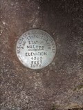
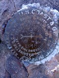
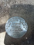
|   NY0551 - USC&GS&SS 'L 277' BM - Klamath County, OR NY0551 - USC&GS&SS 'L 277' BM - Klamath County, OR
in U.S. Benchmarks This NGS benchmark is located along Williamson River Road. posted by:  NW_history_buff NW_history_buff location: Oregon date approved: 06/17/2016 last visited: never |
 view gallery view gallery S7.7 km S7.7 km
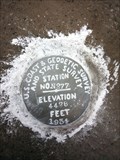
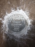
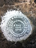
| NY0552 - USC&GS 'E 352' BM - Klamath County, OR in U.S. Benchmarks This NGS benchmark is located along Williamson River Road. posted by: NW_history_buff location: Oregon date approved: 06/17/2016 last visited: never |
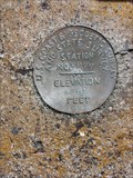
 view gallery view galleryS9.2 km | NY0554 - USC&GS&SS 'N 277' BM - Klamath County, OR in U.S. Benchmarks This NGS benchmark is located along Lone Pine Road. posted by: NW_history_buff location: Oregon date approved: 06/17/2016 last visited: never |
 view gallery view gallery SE9.3 km SE9.3 km
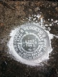
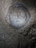
| 9Y0955 & 9Y0954 - USCGS 'CALIMUS RM 2' - Klamath County, OR in U.S. Benchmarks This NGS reference mark & station mark is located on the summit of Calimus Butte in Klamath County, OR. posted by: NW_history_buff location: Oregon date approved: 09/09/2013 last visited: never |
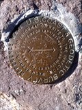
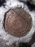
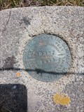
 view gallery view gallerySE9.3 km | CD7043 - USCGS 'CALIMUS' Reference Mark 1 - Klamath County, OR in U.S. Benchmarks This NGS reference mark is located at the summit of Calimus Butte in Klamath County, OR. posted by: NW_history_buff location: Oregon date approved: 09/09/2013 last visited: never |
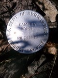 view gallery view gallerySE9.3 km | USDA Camera Point No. 200082 - Calimus Butte, OR in U.S. Benchmarks This USDA Forest Service disk is located at the summit of Calimus Butte in Klamath County, OR. posted by: NW_history_buff location: Oregon date approved: 09/09/2013 last visited: never |
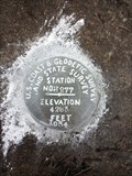
 view gallery view gallerySE9.3 km | 9Y0954 - USCGS 'CALIMUS' Triangulation Station - Klamath County, OR in U.S. Benchmarks This NGS triangulation station is located at the summit of Calimus Butte in Klamath County, OR. posted by: NW_history_buff location: Oregon date approved: 09/09/2013 last visited: never |
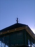 view gallery view gallerySE9.3 km | NY0956 - 'CALIMUS BUTTE LOOKOUT HOUSE' - Klamath County, OR in U.S. Benchmarks This NGS lookout house is located at the summit of Calimus Butte in Klamath County, OR. posted by: NW_history_buff location: Oregon date approved: 09/09/2013 last visited: never |
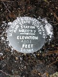
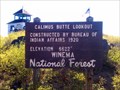 view gallery view gallerySE9.3 km |  Calimus Butte Lookout - Elevation 6622' - Klamath County, OR Calimus Butte Lookout - Elevation 6622' - Klamath County, OR
in Elevation Signs This elevation sign is located at the summit of Calimus Butte in Klamath County, OR. posted by: NW_history_buff location: Oregon date approved: 09/09/2013 last visited: never |
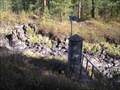
 view gallery view gallerySW10.8 km | USDA FS 'T34S R8E S14, S15, S22, S23 290' Section Corner - Klamath County, OR in U.S. Benchmarks This section corner resides south of Williamson River Rd. posted by: NW_history_buff location: Oregon date approved: 06/18/2016 last visited: never |
 view gallery view gallerySW10.8 km |  USDA FS 'T34S R8E S14, S15, S22, S23 290' Section Corner - Klamath County, OR USDA FS 'T34S R8E S14, S15, S22, S23 290' Section Corner - Klamath County, OR
in Public Land Survey Marks This section corner resides south of Williamson River Rd. posted by: NW_history_buff location: Oregon date approved: 06/18/2016 last visited: never |
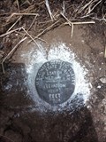
 view gallery view gallerySW10.9 km | NY0548 - USC&GS&SS 'H 277' BM - Klamath County, OR in U.S. Benchmarks This NGS benchmark is located along Williamson River Road. posted by: NW_history_buff location: Oregon date approved: 06/18/2016 last visited: never |
 view gallery view gallerySW11.7 km | NY0547 - USC&GS 'D 352' BM - Klamath County, OR in U.S. Benchmarks This NGS benchmark is located along Williamson River Road. posted by: NW_history_buff location: Oregon date approved: 06/18/2016 last visited: never |
 view gallery view gallerySW13 km | NY0546 - USC&GS&SS 'G 277' BM - Klamath County, OR in U.S. Benchmarks This NGS benchmark is located along Williamson River Road. posted by: NW_history_buff location: Oregon date approved: 06/19/2016 last visited: never |
 view gallery view galleryS13.7 km | NY0557 - USC&GS&SS 'S 277' BM - Klamath County, OR in U.S. Benchmarks This NGS benchmark is located along Lone Pine Road. posted by: NW_history_buff location: Oregon date approved: 06/17/2016 last visited: never |
 view gallery view gallerySW14.6 km | NY0545 - USC&GS&SS 'F 277' BM - Klamath County, OR in U.S. Benchmarks This NGS benchmark is located along the former Sprague River Road now known as Forest Service Rd 4502. posted by: NW_history_buff location: Oregon date approved: 06/18/2016 last visited: never |
 view gallery view galleryS15.1 km | NY0558 - USC&GS&SS 'T 277' BM - Klamath County, OR in U.S. Benchmarks This NGS benchmark is located along Sprague River Road. posted by: NW_history_buff location: Oregon date approved: 06/17/2016 last visited: never |
 view gallery view gallerySW15.6 km | NY0544 - USC&GS&SS 'E 277' BM - Klamath County, OR in U.S. Benchmarks This NGS benchmark is located along Sprague River Road. posted by: NW_history_buff location: Oregon date approved: 06/19/2016 last visited: never |
 view gallery view gallerySW15.9 km |  Braymill Mercantile Store - Braymill, OR Braymill Mercantile Store - Braymill, OR
in Ghost Signs Two ghost signs hang in front of an old mercantile store, long closed to the public, and one of the few remnants of the logging community of Braymill's glory days. posted by: NW_history_buff location: Oregon date approved: 06/20/2016 last visited: never |
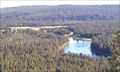
 view gallery view gallery W16.6 km W16.6 km
|  Williamson River above Buckeroo Spring, OR Williamson River above Buckeroo Spring, OR
in River Gauges USGS River Gauge on Williamson River above Buckeroo Spring. posted by: Volcanoguy location: Oregon date approved: 11/13/2007 last visited: 11/14/2007 |
 view gallery view gallerySW17.2 km | NY0543 - USC&GS&SS 'D 277' BM - Klamath County, OR in U.S. Benchmarks This NGS benchmark is located along Sprague River Road. posted by: NW_history_buff location: Oregon date approved: 06/19/2016 last visited: never |
 view gallery view galleryS18.3 km | NY0560 - USC&GS 'G 352' BM - Klamath County, OR in U.S. Benchmarks This NGS benchmark is located along Sprague River Road. posted by: NW_history_buff location: Oregon date approved: 06/17/2016 last visited: never |
 view gallery view gallerySW18.5 km | NY0542 - USC&GS 'A 352' BM - Klamath County, OR in U.S. Benchmarks This NGS benchmark is located along Sprague River Road. posted by: NW_history_buff location: Oregon date approved: 06/19/2016 last visited: never |
 view gallery view galleryW18.8 km |  Oux-kanee Skyline Viewpoint - Klamath County, OR Oux-kanee Skyline Viewpoint - Klamath County, OR
in Scenic Roadside Look-Outs This spectacular viewpoint is located in the Winema National Forest and a couple of miles west of Hwy 97, in Klamath County, OR. posted by: NW_history_buff location: Oregon date approved: 07/03/2012 last visited: 05/06/2023 |
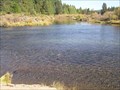 view gallery view galleryW19.5 km |  CONFLUENCE - Spring Creek - Williamson River CONFLUENCE - Spring Creek - Williamson River
in River Origins, Destinations and Confluences Spring Creek joins the Williamson River at Collier State Park, Oregon. posted by: Volcanoguy location: Oregon date approved: 11/14/2007 last visited: 11/14/2007 |
|