|
 Yucca Point Trail, Kings Canyon, CA
N 36° 49.821 W 118° 52.623
11S E 332608 N 4077696
A steep trail from Kings Canyon Road down to Kings River
Waymark Code: WM3NGJ
Location: California, United States
Date Posted: 04/24/2008
Views: 82
 Click on any picture for larger images and click the blue links for other nearby waymarks.
|
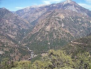
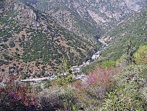
Our journey down to the Kings River started about half a mile before the trailhead. We stopped at Junction View (picture location 1) and looked down 2,100 feet to the junction of the middle and south forks of the Kings River. (The North Fork joins the river a little bit later and out of view). The river seemed far, but we could hear it roar!
From here, we also took a first look at the trail (right) |
|
 Kings River's South and Middle Forks Kings River's South and Middle Forks |
 Top part of Yucca Point Trail Top part of Yucca Point Trail
|
|
We copied a Google Earth satellite image of the trail. (The original is much larger than the thumbnail to the right). Click here for the unobstructed picture and here for an image with descriptions. |
|
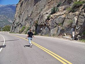
We took our trip one week too early (mid April) and the lower part of the road was still closed. So we had to hike along the road to get to the trailhead (main coordinates) but it was beautiful, as the pictures below testify.
Judy, skipping along on an empty road |
|
|
|
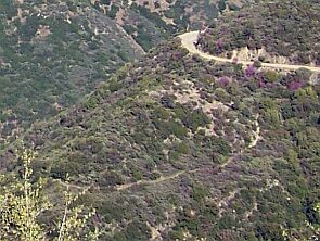
The first part to Yucca Point (pictures above) was easy, but then it got interesting. The trail is only two miles long, but it descents 1,200 feet, making it a steep 10% downhill grade winding along through different habitats. Enjoy the pictures we took along the way.
|
|
After about half a mile, we enjoyed a great view at Tenmile Creek. There is a short trail leading to the creek (picture location 2), but after hiking down and back up we realized that the best place to see the creek is right on the main trail.
|
|
Judy at the trail head to Tenmile Creek
|
|
Fun along the way: we didn't even have to carve a heart into a tree, it was already there. And Bernd das Brot enjoyed it too.
|
|
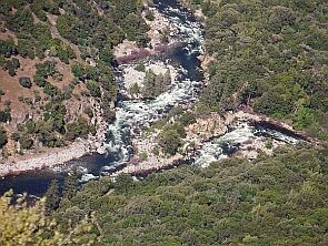
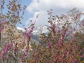
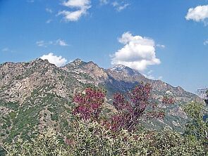
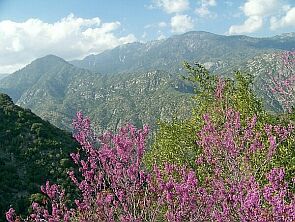
Shortly after Ten-Mile Creek, the trail reached the steep slopes of Kings Canyon. Hiking became harder but the rewards were breathtaking. Great views at the mountains (above) and at the two forks of the Kings River (below).
|
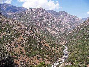 Kings River, Middle Fork Kings River, Middle Fork |
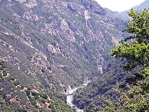 Kings River, South Fork
 |
|
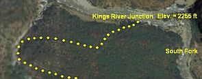
After about one hour, we reached our final destination, the junction of the Kings River Forks (picture location 3).
For more pictures of the river and the junction, check out our Kings River waymark. The hike back up took about two hours, and the panorama was just amazing! |
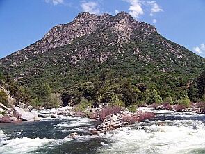 Kings River Junction in front of Wren Peak
|
 Junction from 1,000 ft above Junction from 1,000 ft above |
 Mount Gardiner Mount Gardiner
|
 Wren Peak & Hogback Peak Wren Peak & Hogback Peak |
 Kings Canyon Kings Canyon
|
|
We recommend to do this hike in spring when it is not too hot and the entire canyon looks like a giant rock garden:
|
Picture location 1: N 36° 49.891 W 118° 53.396

Picture Location 2: N 36° 49.821 W 118° 52.623
Picture Location 3: N 36° 50.276 W 118° 52.513
|
Visit Instructions:
To log a waymark you must post at least one original picture (preferably with yourself in it) showing the main feature or attraction of this walk/hike.
No picture means no proof which means No Post!
Recent Visits/Logs:
| There are no logs for this waymark yet. |
|
|
|
|