
Camas Prairie Railroad Bridge and Tunnel - Idaho
Posted by:  Volcanoguy
N 46° 17.979 W 116° 35.560
11T E 531370 N 5127422
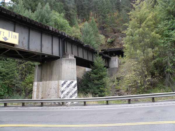
Railroad bridge over Lapwai Creek and US Hwy 95.
Waymark Code: WMAHXX
Location: Idaho, United States
Date Posted: 01/18/2011
Views: 4
Camas Prairie Railroad Bridge and Tunnel (
WMP5E)
The railroad came up Lapwai Creek to this area on a three percent grade crossing several wooden trestles, including the one at Rock Creek (
WMAHWG). Eight tenths of a mile north of here the railroad also crosses over the highway on a trestle and deck girder bridge (
WMAHXE).
Emerging from the tunnel the railroad continues to climb the canyon wall crossing several more wooden trestles and another tunnel before crossing the curved “Halfmoon” trestle (
WMAHWG) (685-foot long, 141-foot high).
Railroad info comes from:
www.wwvrailway.com