 view gallery view gallery NW8.5 km NW8.5 km
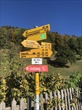
|   Bicycle Network Distance Arrows - Heididorf, Switzerland Bicycle Network Distance Arrows - Heididorf, Switzerland
in Direction and Distance Arrows Bicycle Network Distance Arrows - Heididorf posted by:  Max93600 Max93600 location: Graubünden, Switzerland date approved: 11/01/2018 last visited: 10/27/2018 |
 view gallery view gallery NW8.5 km NW8.5 km
|   Brunnen im Heididorf - Maienfeld, GR, Switzerland Brunnen im Heididorf - Maienfeld, GR, Switzerland
in Fountains Brunnen im Heididorf - Maienfeld, GR, Schweiz
Fountain in Heididorf - Maienfeld, GR, Switzerland posted by:  jotheonly jotheonly location: Graubünden, Switzerland date approved: 11/05/2017 last visited: 11/05/2017 |
 view gallery view gallery NW10 km NW10 km
|   Heidibrunnen - Maienfeld Heidiland (CH) Heidibrunnen - Maienfeld Heidiland (CH)
in Fountains one of the beautifull places in the "Heidiland" near Maienfeld posted by:  speedwalkers speedwalkers location: Graubünden, Switzerland date approved: 09/30/2008 last visited: 11/20/2016 |
 view gallery view gallery W10.8 km W10.8 km
|   Burger King - Autobahnraststatte Heidiland - Maienfeld, Switzerland Burger King - Autobahnraststatte Heidiland - Maienfeld, Switzerland
in Burger King Restaurants Burger King Restaurant in Maienfeld posted by:  Max93600 Max93600 location: Graubünden, Switzerland date approved: 01/15/2021 last visited: 01/15/2021 |
 view gallery view gallery N10.9 km N10.9 km
|   View on pfalzerhutte, Liechtenstein. View on pfalzerhutte, Liechtenstein.
in Web Cameras This webcam picture is directed to the refuge "pfalzerhutte" located at 2108 m. posted by:  franketmuriel franketmuriel location: Liechtenstein date approved: 10/08/2020 last visited: never |
 view gallery view gallery SW11.1 km SW11.1 km
|   Rathausbrunnen - Trimmis, GR, Switzerland Rathausbrunnen - Trimmis, GR, Switzerland
in Fountains Brunnen auf dem Rathausplatz posted by:  jotheonly jotheonly location: Graubünden, Switzerland date approved: 11/21/2016 last visited: 12/13/2016 |
 view gallery view gallery W11.3 km W11.3 km
|   Dancing Fountain - Bad Ragaz, Switzerland Dancing Fountain - Bad Ragaz, Switzerland
in Fountains Dancing Fountain in Bad Ragaz, Switzerland. posted by:  GCEdo GCEdo location: St. Gallen, Switzerland date approved: 11/15/2016 last visited: never |
 view gallery view gallery W11.3 km W11.3 km
|   Bench holders Bad Ragaz (CH) Bench holders Bad Ragaz (CH)
in Artistic Seating Helpfull support posted by:  speedwalkers speedwalkers location: St. Gallen, Switzerland date approved: 10/01/2008 last visited: 07/07/2012 |
 view gallery view gallery W11.4 km W11.4 km
|   Bench in Bad Ragaz Bench in Bad Ragaz
in Sit-by-me Statues Bench in front of bank office in Bad Ragaz posted by:  Oleg Oleg location: St. Gallen, Switzerland date approved: 12/15/2008 last visited: 07/07/2012 |
 view gallery view gallery W11.4 km W11.4 km
|   Tamina Gorge - Bad Ragaz, Switzerland Tamina Gorge - Bad Ragaz, Switzerland
in Places of Geologic Significance Beautiful gorge of the Tamina River near Bad Ragaz in Switzerland. posted by:  GCEdo GCEdo location: St. Gallen, Switzerland date approved: 10/19/2016 last visited: 07/29/2021 |
 view gallery view gallery N11.7 km N11.7 km
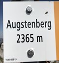
|   Augstenberg, Liechtenstein. 2365 m Augstenberg, Liechtenstein. 2365 m
in Elevation Signs Augstenberg is a mountain in Liechtenstein with a height of 2,359 metres (7,740 ft) posted by:  franketmuriel franketmuriel location: Liechtenstein date approved: 10/07/2020 last visited: never |
 view gallery view gallery N11.7 km N11.7 km
|   Augstenberg, Liechtenstein Augstenberg, Liechtenstein
in Mountain Summits Augstenberg is a mountain in Liechtenstein in the Rätikon posted by:  franketmuriel franketmuriel location: Liechtenstein date approved: 10/06/2020 last visited: never |
 view gallery view gallery N12.9 km N12.9 km
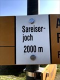
|   Sareiserjoch, Triesenberg - Liechtenstein. 2000 m Sareiserjoch, Triesenberg - Liechtenstein. 2000 m
in Elevation Signs The Sareiserjoch leads from Malbun to Austria into the Gamperdona Valley. posted by:  franketmuriel franketmuriel location: Liechtenstein date approved: 10/07/2020 last visited: never |
 view gallery view gallery NW13.4 km NW13.4 km
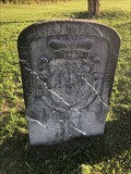
|   Border Crossing Switzerland/Liechtenstein - Fläsch Border Crossing Switzerland/Liechtenstein - Fläsch
in Border Crossings An old milestone from 1735 that borders Switzerland and Liechtenstein. posted by:  Max93600 Max93600 location: Liechtenstein date approved: 10/28/2018 last visited: 10/17/2018 |
 view gallery view gallery N13.8 km N13.8 km
|   Sareis chairlift - Malbun, Liechtenstein Sareis chairlift - Malbun, Liechtenstein
in Aerial Lifts The Sareis chairlift in Malbun posted by:  puczmeloun puczmeloun location: Liechtenstein date approved: 10/22/2013 last visited: never |
 view gallery view gallery N13.8 km N13.8 km
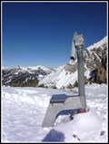
|   Coin-Op Binocular (Sareisjoch) - Malbun, Liechtenstein Coin-Op Binocular (Sareisjoch) - Malbun, Liechtenstein
in Coin-Op Binoculars Coin-Op Binocular at Sareisjoch mountain ridge posted by:  puczmeloun puczmeloun location: Liechtenstein date approved: 10/22/2013 last visited: never |
 view gallery view gallery N14 km N14 km
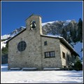
|   Chapel of Peace - Malbun, Liechtenstein Chapel of Peace - Malbun, Liechtenstein
in Waychapels Chapel of Peace in Malbun posted by:  puczmeloun puczmeloun location: Liechtenstein date approved: 10/23/2013 last visited: never |
 view gallery view gallery N14 km N14 km
|   Vögeli Alpenhotel Malbun - Malbun, Liechtenstein Vögeli Alpenhotel Malbun - Malbun, Liechtenstein
in Ski Lodges This ski lodge is a romantic wooden building offering a glimpse of old times in the mountain. posted by:  Torgut Torgut location: Liechtenstein date approved: 11/01/2021 last visited: never |
 view gallery view gallery N14 km N14 km
|   Malbun - Liechtenstein Malbun - Liechtenstein
in Winter Sports Locations Malbun is the only ski resort of the small Liechtenstein posted by:  Torgut Torgut location: Liechtenstein date approved: 11/01/2021 last visited: never |
 view gallery view gallery N14 km N14 km
|   Webcam Malbun (Principality of Liechtenstein) Webcam Malbun (Principality of Liechtenstein)
in Web Cameras Liechtenstein liegt östlich der Schweiz.
The Principality of Liechtenstein is to the east of Switzerland. posted by:  PeterWehrli PeterWehrli location: Liechtenstein date approved: 12/03/2005 last visited: 08/14/2022 |
 view gallery view gallery NW14.5 km NW14.5 km
|   Kirchturm St. Nikolaus - Balzers, Unterland, Liechtenstein Kirchturm St. Nikolaus - Balzers, Unterland, Liechtenstein
in Wikipedia Entries Kirchturm der alten Pfarrkirche St. Nikolaus in Balzers
Church tower of the old parish church of St. Nicholas in Balzers posted by:  jotheonly jotheonly location: Liechtenstein date approved: 02/07/2018 last visited: 11/01/2018 |
 view gallery view gallery NW14.5 km NW14.5 km
|   Kirchturm St. Nikolaus - Balzers, Unterland, Liechtenstein Kirchturm St. Nikolaus - Balzers, Unterland, Liechtenstein
in Bell Towers Kirchturm der alten Pfarrkirche St. Nikolaus in Balzers posted by:  jotheonly jotheonly location: Liechtenstein date approved: 02/07/2018 last visited: 11/01/2018 |
 view gallery view gallery NW14.6 km NW14.6 km
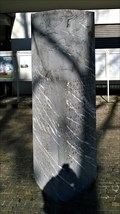
|   Chronologie der Gemeinde Balzers - 4000v.Chr to Current - Balzers, Liechtenstein Chronologie der Gemeinde Balzers - 4000v.Chr to Current - Balzers, Liechtenstein
in Etched in Stone Chronologie der Gemeinde Balzers ---
Chronology of the community Balzers posted by:  jotheonly jotheonly location: Liechtenstein date approved: 01/25/2018 last visited: 06/04/2019 |
 view gallery view gallery NW14.6 km NW14.6 km
|   Gemeindeverwaltung Balzers - Balzers, Liechtenstein Gemeindeverwaltung Balzers - Balzers, Liechtenstein
in City and Town Halls Gemeindeverwaltung Balzers in Liechtenstein posted by:  jotheonly jotheonly location: Liechtenstein date approved: 01/25/2018 last visited: 06/06/2019 |
 view gallery view gallery NW14.6 km NW14.6 km
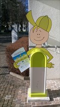
|   E-Bike Ladestation - Balzers, Liechtenstein E-Bike Ladestation - Balzers, Liechtenstein
in Electric Bike Charging Stations E-Bike Ladestation in Balzers/Liechtenstein ---
E-bike charging station in Balzers / Liechtenstein posted by:  jotheonly jotheonly location: Liechtenstein date approved: 01/24/2018 last visited: 06/04/2019 |
|