 view gallery view gallery S4.5 km S4.5 km
|   Roslyn, South Dakota 57261 Roslyn, South Dakota 57261
in U.S. Post Offices Small town post office. posted by:  NGComets NGComets location: South Dakota date approved: 11/15/2010 last visited: 03/17/2011 |
 view gallery view gallery S4.5 km S4.5 km
|   Water Tower, Roslyn, South Dakota Water Tower, Roslyn, South Dakota
in Water Towers Small town watertower. posted by:  NGComets NGComets location: South Dakota date approved: 11/15/2010 last visited: 03/17/2011 |
 view gallery view gallery S9 km S9 km
|   Pioneering in Dakota - Prairie Fires Pioneering in Dakota - Prairie Fires
in South Dakota Historical Markers Site of first recorded death by prairie fire in the Dakotas. posted by:  plainsdrifter358 plainsdrifter358 location: South Dakota date approved: 12/21/2006 last visited: 11/05/2011 |
 view gallery view gallery NE10.5 km NE10.5 km
|   Eden, South Dakota 57232 Eden, South Dakota 57232
in U.S. Post Offices Small town post office. posted by:  NGComets NGComets location: South Dakota date approved: 07/19/2015 last visited: never |
 view gallery view gallery NE10.5 km NE10.5 km
|   Eden Ball Park, Eden, South Dakota Eden Ball Park, Eden, South Dakota
in Amateur Baseball Fields Small baseball field on the northwest corner of the town. posted by:  NGComets NGComets location: South Dakota date approved: 08/13/2015 last visited: never |
 view gallery view gallery NE10.6 km NE10.6 km
|   Bible Name, Eden, South Dakota Bible Name, Eden, South Dakota
in Names From the Bible Small town on SD Highway 25. Elevation 1851. posted by:  NGComets NGComets location: South Dakota date approved: 07/27/2015 last visited: never |
 view gallery view gallery NE10.8 km NE10.8 km
|   Eden, South Dakota - Population 97 Eden, South Dakota - Population 97
in Population Signs A very small community in Marshall County, South Dakota. posted by:  NGComets NGComets location: South Dakota date approved: 08/13/2015 last visited: never |
 view gallery view gallery E19.6 km E19.6 km
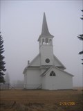
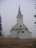
|   Zoar Lutheran Church - SD Zoar Lutheran Church - SD
in Country Churches A small church in rural northeastern SD. posted by:  MNSearchers MNSearchers location: South Dakota date approved: 01/13/2007 last visited: 12/28/2006 |
 view gallery view gallery E19.6 km E19.6 km
|   Zoar Norwegian Lutheran Church Zoar Norwegian Lutheran Church
in U.S. National Register of Historic Places Small old country church located in Kosciusko Township in Day County SD. posted by:  MNSearchers MNSearchers location: South Dakota date approved: 01/13/2007 last visited: 12/28/2006 |
 view gallery view gallery SW20.4 km SW20.4 km
|   Bergen Lutheran Church - SD Bergen Lutheran Church - SD
in Country Churches In Brown County near Bristol SD. posted by:  MNSearchers MNSearchers location: South Dakota date approved: 03/19/2007 last visited: 03/20/2007 |
 view gallery view gallery S21.4 km S21.4 km
|   Webster Population Webster Population
in Population Signs Small community located in Day County at the junction of US Highway 12 and SD Highway 25. posted by:  NGComets NGComets location: South Dakota date approved: 08/13/2015 last visited: never |
 view gallery view gallery S21.9 km S21.9 km
|   The Fight At Webster The Fight At Webster
in South Dakota Historical Markers Rebel band of Indians guilty of murder in the aftermath of the Minnesota Massacre of 1862 are killed in a gun fight near Webster, SD. posted by:  plainsdrifter358 plainsdrifter358 location: South Dakota date approved: 12/20/2006 last visited: 11/05/2011 |
 view gallery view gallery S21.9 km S21.9 km
|   WWII Plane Crash Holds Memories WWII Plane Crash Holds Memories
in South Dakota Historical Markers One 25 October 1944 a A26-B two engine medium bomber from Watertown Army airbase crashed 2mi S and 1mi E of this site. posted by:  plainsdrifter358 plainsdrifter358 location: South Dakota date approved: 12/20/2006 last visited: 11/05/2011 |
 view gallery view gallery S21.9 km S21.9 km
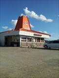
|   A&W - Webster, South Dakota A&W - Webster, South Dakota
in A + W Restaurants This A&W has a dirt/gravel lot. posted by:  SageInThyme82 SageInThyme82 location: South Dakota date approved: 08/14/2015 last visited: 06/09/2007 |
 view gallery view gallery S21.9 km S21.9 km
|   Sigurd Andersen Sigurd Andersen
in South Dakota Historical Markers Sigurd Andersen, 19th Governor of SD 1951-1955 posted by:  plainsdrifter358 plainsdrifter358 location: South Dakota date approved: 12/20/2006 last visited: 11/05/2011 |
 view gallery view gallery S21.9 km S21.9 km
|   Webster - County Seat of Day County Webster - County Seat of Day County
in South Dakota Historical Markers Webster, founded in 1881, is County Seat of Day County. posted by:  plainsdrifter358 plainsdrifter358 location: South Dakota date approved: 12/20/2006 last visited: 11/05/2011 |
 view gallery view gallery S22 km S22 km
|   U.S. Highway 12, Webster, SD U.S. Highway 12, Webster, SD
in Blue Star Memorial Highway Markers Located along Highway 12 in Webster SD. Day County. posted by:  MNSearchers MNSearchers location: South Dakota date approved: 02/20/2007 last visited: 11/05/2011 |
 view gallery view gallery S22.9 km S22.9 km
|   Town Clock in Webster, SD Town Clock in Webster, SD
in Town Clocks Town Clock, mural and mini-park on Main Street in Webster, SD posted by:  plainsdrifter358 plainsdrifter358 location: South Dakota date approved: 08/10/2007 last visited: 11/05/2011 |
 view gallery view gallery S23 km S23 km
|   Dakotah Bank, Webster, South Dakota Dakotah Bank, Webster, South Dakota
in Time and Temperature Signs On the corner of 6th and Main. Elevation 1897 posted by:  NGComets NGComets location: South Dakota date approved: 06/18/2013 last visited: never |
 view gallery view gallery NW24 km NW24 km
|   Hickman Lake Boat Ramp, Langford, South Dakota Hickman Lake Boat Ramp, Langford, South Dakota
in Boat Ramps Located about 6 miles northeast of Langford, South Dakota.
Elevation 1440 posted by:  NGComets NGComets location: South Dakota date approved: 11/03/2017 last visited: never |
 view gallery view gallery NE24.5 km NE24.5 km
|   Your Are Entering Roberts County South Dakota Your Are Entering Roberts County South Dakota
in South Dakota Historical Markers This is one of several similar markers placed on highways at the Roberts County Line. posted by:  NevaP NevaP location: South Dakota date approved: 05/05/2008 last visited: 07/16/2019 |
 view gallery view gallery NE24.5 km NE24.5 km
|   You Are Entering Marshall County South Dakota You Are Entering Marshall County South Dakota
in South Dakota Historical Markers This South Dakota Historical Marker is on Hwy 10 about 5 miles west of the Nicollet Tower. posted by:  PeterNoG PeterNoG location: South Dakota date approved: 01/05/2012 last visited: 07/16/2019 |
 view gallery view gallery SE25.9 km SE25.9 km
|   Waubay Population Waubay Population
in Population Signs A small city in Day County, South Dakota. posted by:  NGComets NGComets location: South Dakota date approved: 08/13/2015 last visited: never |
 view gallery view gallery W26.7 km W26.7 km
|   Langford, South Dakota - Population 290 Langford, South Dakota - Population 290
in Population Signs A small town in Marshall County, SD, along SD Hwy 17.
Elevation 1372 posted by:  NGComets NGComets location: South Dakota date approved: 12/17/2017 last visited: never |
 view gallery view gallery SE26.7 km SE26.7 km
|   Watertower, Waubay, South Dakota Watertower, Waubay, South Dakota
in Water Towers Small town watertower. posted by:  NGComets NGComets location: South Dakota date approved: 03/16/2010 last visited: never |
|