 view gallery view gallery E15.3 km E15.3 km
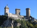
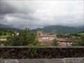
|   Chateau de Foix, France Chateau de Foix, France
in Castles Chateau de Foix, the castle of the Counts de Foix was a key center of resistance by the Counts de Foix and the Cathars against the Albigensian Crusade. The three towers are distinctive landmarks. posted by:  arby101ca arby101ca location: France date approved: 05/03/2010 last visited: 01/08/2020 |
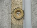
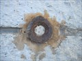
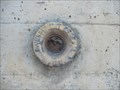
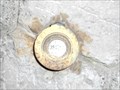
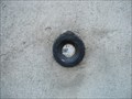
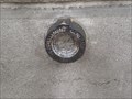 view gallery view galleryE15.4 km |  Benchmarck de l'agence de Foix Benchmarck de l'agence de Foix
in French Benchmarks Repère de nivellement de l'Ariège posted by:  yohaeva yohaeva location: Occitanie, France date approved: 08/28/2014 last visited: 01/08/2020 |
 view gallery view gallery SE19.5 km SE19.5 km
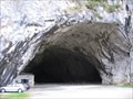
| ") La grotte de Bédeilhac (Ariège) - France La grotte de Bédeilhac (Ariège) - France
in Cave Entrances (Natural) [FR] La grotte de Bédeilhac est une vaste grotte ornée située sur la commune de Bédeilhac-et-Aynat en Ariège. [EN] The caves of the Ariège have some of the finest examples of paleolithic paintings and artifacts anywhere in the world. posted by: RakeInTheCache location: Occitanie, France date approved: 05/26/2012 last visited: 02/06/2020 |
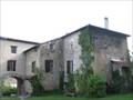 view gallery view gallerySE21.7 km |  Domaine Fournié - Tarascon-sur-Ariège, France Domaine Fournié - Tarascon-sur-Ariège, France
in Bed and Breakfast [FR] La famille Marie vous ouvre les portes de sa propriété du 17e siecle, au parc centenaire et bois classé. [EN] The Marie family welcomes you to their 17th century property, where you can unwind in the shade of the hundred year old trees. posted by: RakeInTheCache location: Occitanie, France date approved: 05/20/2012 last visited: 02/06/2020 |
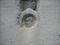
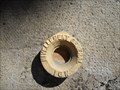
 view gallery view gallery W22 km W22 km
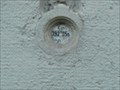
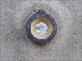
| Benchmark E.C.O3P3 - 9 - Eycheil in French Benchmarks Localisation : AU NO 16, ROUTE DES PYRENEES
Partie support : MUR DE FACADE SUD-OUEST DE LA PARTIE CENTRALE, FACE ROUTE
Altitude : 408,025 m posted by: eolas location: Occitanie, France date approved: 02/21/2013 last visited: never |
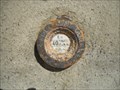
 view gallery view galleryW22.4 km | Benchmark E.C.O3P3 - 7 - Saint-Girons in French Benchmarks Localisation : A LA PLAINE D'EYCHEIL, AU NO 72, AVENUE DE LA RESISTANCE
Altitude : 405,245 m posted by: eolas location: Occitanie, France date approved: 02/21/2013 last visited: never |
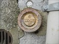
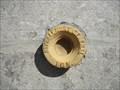
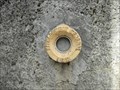
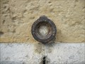
 view gallery view galleryW22.5 km | Benchmark E.C.O3P3 - 6 - D.618 - Saint-Girons in French Benchmarks Type : Repère cylindrique
Localisation : Plaine d'Eycheil, 61 Avenue de la Résitance
Partie support : Soubassement du mur pignon sud-ouest, face route
Altitude : 403.25 posted by: eolas location: Occitanie, France date approved: 02/20/2013 last visited: never |
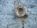
 view gallery view galleryW23 km | Benchmark - ANCIEN COLLEGE D'ENSEIGNEMENT TECHNIQUE in French Benchmarks Localisation : A SAINT-GIRONS, AU NO 28 DE L'AVENUE RENE PLAISANT
Support : MAISON (ANCIEN COLLEGE D'ENSEIGNEMENT TECHNIQUE)
Altitude : 390,435 m posted by: eolas location: Occitanie, France date approved: 02/21/2013 last visited: never |
 view gallery view galleryW23.2 km | Benchmark E.C.P3 - 3 - D.117 - Saint-Girons in French Benchmarks Type : repère cylindrique nivellement
Localisation : pont D117
Altitude : 391.45 posted by: eolas location: Occitanie, France date approved: 02/20/2013 last visited: never |
 view gallery view galleryW23.2 km | Benchmark E.C.O3P3 - 2 - Saint-Girons in French Benchmarks Localisation : AU CARREFOUR AVEC LE BOULEVARD PEYREVIDOL
Partie support : MUR DE FACADE SUD-OUEST, FACE RUE DESBIAUX
Altitude : 392,194 m posted by: eolas location: Occitanie, France date approved: 02/20/2013 last visited: never |
 view gallery view galleryW23.2 km | Benchmark E.C.O3P3 - 1 - Saint-Girons in French Benchmarks Support : ECOLE PAUL SAINT-ALARY
Partie support : SOUBASSEMENT DU MUR DE FACADE SUD-OUEST, FACE PLACE
Altitude : 391,825 m posted by: eolas location: Occitanie, France date approved: 02/20/2013 last visited: never |
 view gallery view galleryW23.3 km | Benchmark L'église de Saint-Girons in French Benchmarks Localisation : A 190 M AU SUD DU CARREFOUR DE LA D.117 ET DE LA RUE DU MARCHE, PLACE DE VERDUN
Partie support : ABOUT DU 2EME CONTREFORT DU TRANSEPT GAUCHE A PARTIR DU CHOEUR, FACE A LA
PLACE, FACE NORD-OUEST
Altitude: 390.818 m. posted by: eolas location: Occitanie, France date approved: 02/20/2013 last visited: never |
 view gallery view galleryW23.3 km | Benchmark E.C.O3P3 - 4 - D.618 - Saint-Girons in French Benchmarks Type : Repère cylindrique de nivellement
Localisation : à 15 mètres au sud-est du carrefour avec la rue Morinière
Altitude : 398.94 posted by: eolas location: Occitanie, France date approved: 02/20/2013 last visited: never |
 view gallery view galleryW23.5 km | Benchmark E.C.O3P3 - 3 - Saint-Girons in French Benchmarks Voie suivie : AVENUE GALLIENI (D.618) - 24
Partie support : SOUBASSEMENT DU MUR DE FACADE EST, FACE AVENUE
Altitude : 392.34 posted by: eolas location: Occitanie, France date approved: 02/20/2013 last visited: never |
 view gallery view galleryW23.5 km | Benchmark Pont neuf - Saint-Girons in French Benchmarks Localisation : A L'ANGLE SUD-OUEST DU SQUARE BALAGUE
Support : PONT SUR LE SALAT
Altitude : 390,329 m posted by: eolas location: Occitanie, France date approved: 02/21/2013 last visited: never |
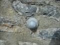
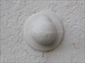 view gallery view galleryW23.7 km | Benchmark - L'ancienne gare - Saint-Girons in French Benchmarks Type : REPERE BOULE
Localisation : A 50 M A L'OUEST DE LA D.117
Support : GARE DE SAINT-GIRONS
Partie support : MUR DE FACADE DE L'AILE NORD, FACE VOIE FERREE
*** Ce repère n'a pas été observé par l' I.G.N.
Altitude : 391,720 m posted by: eolas location: Occitanie, France date approved: 02/20/2013 last visited: never |
 view gallery view galleryW23.7 km |  Cathédrale Saint-Lizier - Saint-Lizier Cathédrale Saint-Lizier - Saint-Lizier
in Cathedrals Première cathédrale du village de Saint-Lizier avec son cloître roman, rare en Occitanie et le seul en Ariège. posted by: 09Naturel location: Occitanie, France date approved: 06/28/2018 last visited: 02/24/2020 |
 view gallery view galleryW23.7 km |  Cathédrale Saint-Lizier - Saint-Lizier Cathédrale Saint-Lizier - Saint-Lizier
in Monuments Historiques Français Première cathédrale du village de Saint-Lizier avec son cloître roman, rare en Occitanie et le seul en Ariège. posted by: 09Naturel location: Occitanie, France date approved: 06/28/2018 last visited: 02/24/2020 |
 view gallery view galleryW23.7 km |  Cathédrale Saint-Lizier - Saint-Lizier Cathédrale Saint-Lizier - Saint-Lizier
in World Heritage Sites Première cathédrale du village de Saint-Lizier avec son cloître roman, rare en Occitanie et le seul en Ariège. posted by: 09Naturel location: Occitanie, France date approved: 06/28/2018 last visited: 02/24/2020 |
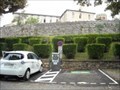 view gallery view galleryW23.7 km |  Borne de recharge - Vigne de l'évêché, Saint-Lizier Borne de recharge - Vigne de l'évêché, Saint-Lizier
in Electric Car Charging Stations 2 points de charge disponibles, place Vigne de L'Eveche, d'une puissance de 22kW max chacun. posted by: 09Naturel location: Occitanie, France date approved: 06/27/2018 last visited: 02/24/2020 |
 view gallery view galleryW24 km | Benchmark - E.C.N3O3 - 37 - Saint-Girons in French Benchmarks Localisation : AU QUARTIER DE LEDAR, AU NO 19, AVENUE DU MARECHAL FOCH
Partie support : SOUBASSEMENT DU MUR PIGNON NORD-OUEST, FACE ROUTE
Altitude : 394,549 m posted by: eolas location: Occitanie, France date approved: 02/20/2013 last visited: never |
 view gallery view galleryW24.1 km | Benchmark - EE' - 43 BIS - Saint-Lizier in French Benchmarks Localisation : AU NORD-OUEST DU CARREFOUR GIRATOIRE AVEC LA D.33A
Support : MUR DE CLOTURE
*** Ce repère n'a pas été observé par l' I.G.N.
Altitude : 386,417 m posted by: eolas location: Occitanie, France date approved: 02/21/2013 last visited: never |
 view gallery view galleryW24.3 km | Benchmark - E.C.N3O3 - 36 - Saint-Girons in French Benchmarks Localisation : AVENUE DU MARECHAL FOCH (D.618)
AU QUARTIER LEDAR, AU NO 43, AVENUE DU MARECHAL FOCH
Altitude : 397,006 m posted by: eolas location: Occitanie, France date approved: 02/20/2013 last visited: never |
 view gallery view galleryW24.5 km | Benchmark - Eglise de Lédar in French Benchmarks Localisation : EGLISE
Partie support : MUR DE FACADE SUD-EST DE LA NEF, FACE ROUTE
Altitude : 400,198 m posted by: eolas location: Occitanie, France date approved: 02/20/2013 last visited: never |
 view gallery view galleryW25.1 km | Benchmark - EGLISE DE LORP in French Benchmarks Partie support : ABOUT DU TROISIEME CONTREFORT A COMPTER DE LA ROUTE, DANS LE MUR DE FACADE
ANTERIEUR
Altitude : 377,995 m posted by: eolas location: Occitanie, France date approved: 02/21/2013 last visited: never |
|