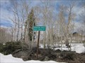
 view gallery view gallery SE1.1 km SE1.1 km
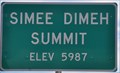
|   Simee Dimeh Summit ~ Elevation 5987 Feet Simee Dimeh Summit ~ Elevation 5987 Feet
in Elevation Signs This Elevation Sign sits atop Simee Dimeh Summit on US Highway 395 between Gardnerville and the Nevada/California Border. posted by:  brwhiz brwhiz location: Nevada date approved: 09/19/2012 last visited: never |
 view gallery view gallery NW10.9 km NW10.9 km
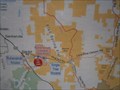
|  Pinenut Nut Mountains - Gardnerville Nevada Pinenut Nut Mountains - Gardnerville Nevada
in Public Access Lands This land is managed by the Bureau of Land Management. posted by: Geojeepsters location: Nevada date approved: 07/30/2012 last visited: never |
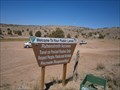
 view gallery view galleryNW10.9 km |  You are Here - Pinenut Mountains Nevada You are Here - Pinenut Mountains Nevada
in 'You Are Here' Maps You are here map on the Pinenut Mountain Public land. posted by: Geojeepsters location: Nevada date approved: 07/30/2012 last visited: never |
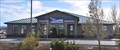
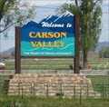 view gallery view galleryNW11.6 km |  Carson Valley, NV - "The heart of Douglas County" Carson Valley, NV - "The heart of Douglas County"
in Welcome Signs A sign just outside of Gardnerville welcoming visitors to the Carson Valley. posted by: saopaulo1 location: Nevada date approved: 05/29/2011 last visited: never |
 view gallery view galleryNW12.2 km |  Dresslerville - Dresslerville, NV Dresslerville - Dresslerville, NV
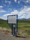
in Nevada Historical Markers A plaque for the community of Dresslerville. posted by: saopaulo1 location: Nevada date approved: 05/21/2011 last visited: 10/16/2010 |
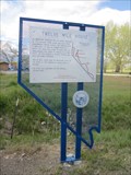 view gallery view galleryNW12.2 km | Twelve Mile House - Gardnerville, NV in Nevada Historical Markers A plaque about the Twelve Mile House. This plaque is located along Hway 395. posted by: saopaulo1 location: Nevada date approved: 05/21/2011 last visited: 10/16/2010 |
 view gallery view galleryNW12.2 km |  Washoe Tribe Police Department - Gardnerville, NV Washoe Tribe Police Department - Gardnerville, NV
in Police Stations The Police department for the Washoe Tribe of Nevada and California. The building is located outside of Gardnerville, NV. posted by: saopaulo1 location: Nevada date approved: 05/17/2011 last visited: never |
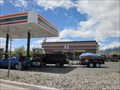 view gallery view galleryNW13.7 km |  7-Eleven - Hway 395 - Gardnerville, NV 7-Eleven - Hway 395 - Gardnerville, NV
in 7-Eleven Stores A 7-Eleven on Hway 395 in Gardnerville, NV. posted by: saopaulo1 location: Nevada date approved: 05/16/2011 last visited: 08/30/2016 |
 view gallery view galleryNW13.8 km |  Gardnerville, Nevada 89460 ~ Ranchos Station Gardnerville, Nevada 89460 ~ Ranchos Station
in U.S. Post Offices This Post Office is located at 1271 Kimmerling Road in Gardnerville, Nevada. posted by: brwhiz location: Nevada date approved: 01/16/2012 last visited: never |
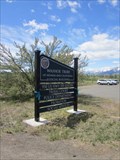
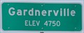 view gallery view galleryNW14 km | Gardnerville, Nevada ~ Elevation 4750 in Elevation Signs This Elevation Sign is at the southern city limits of Gardnerville, Nevada on US Highway 395. posted by: brwhiz location: Nevada date approved: 09/07/2012 last visited: never |
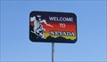
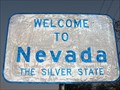 view gallery view gallery W14.3 km W14.3 km
| The Silver State - Nevada, USA in Welcome Signs This is the welcome sign at the border of California and Nevada, on Highway 88, in the United States. posted by:  Chasing Blue Sky Chasing Blue Sky location: Nevada date approved: 03/07/2012 last visited: 10/09/2016 |
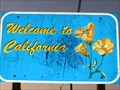 view gallery view galleryW14.3 km |  CA / NV on Highway 88 - south of Carson City, NV CA / NV on Highway 88 - south of Carson City, NV
in Border Crossings This is the border crossing on Highway 88 between California and Nevada in the United States. posted by: Chasing Blue Sky location: California date approved: 03/08/2012 last visited: 10/09/2016 |
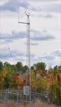 view gallery view galleryNW14.5 km |  Gardnerville Remote Weather Station Gardnerville Remote Weather Station
in Weather Stations This remote-reporting weather station is located at the very southeastern tip of Gardnerville. posted by: brwhiz location: Nevada date approved: 09/22/2013 last visited: never |
 view gallery view galleryNW15.4 km | Gardnerville, NV - 89410 in U.S. Post Offices The main post office in Gardnerville, NV. posted by: saopaulo1 location: Nevada date approved: 05/16/2011 last visited: 11/23/2011 |
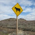 view gallery view gallery S15.6 km S15.6 km
|  Cow Crossing - Mono County, CA Cow Crossing - Mono County, CA
in Uncommon Crossing Signs This cow crossing is on Hway 89 in Mono County, CA. It's at the Mono/Alpine county borders. posted by: saopaulo1 location: California date approved: 05/23/2011 last visited: never |
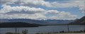 view gallery view gallerySE15.6 km |  Topaz Lake Topaz Lake
in Wikipedia Entries Topaz Lake is a resevoir that straddles the states of California and Nevada. posted by: saopaulo1 location: Nevada date approved: 06/09/2011 last visited: 09/24/2011 |
 view gallery view galleryS15.8 km | CA/NV 395 North in Border Crossings Welcome to Nevada. When heading north on 395 in California, you cross the border near Topaz Lake. posted by: Free2bme29 location: Nevada date approved: 07/15/2009 last visited: 07/12/2012 |
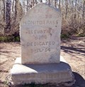
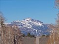
 view gallery view galleryS15.9 km |  Monitor Pass, California Monitor Pass, California
in Named Mountain Gaps Monitor pass is the Sierra Nevada mountains. posted by: Geojeepsters location: California date approved: 08/05/2024 last visited: never |
 view gallery view galleryS15.9 km | Monitor Pass, CA - 8,314 ft in Elevation Signs One of the highest passes across the Sierra Nevada posted by: Bernd das Brot Team location: California date approved: 05/31/2008 last visited: 07/28/2024 |
 view gallery view galleryS15.9 km |  Ebbetts Pass Scenic Byway - Monitor Pass Ebbetts Pass Scenic Byway - Monitor Pass
in National Scenic Byways The eastern entrance to Ebbetts Pass Scenic Byway posted by: Bernd das Brot Team location: California date approved: 05/31/2008 last visited: 07/28/2024 |
 view gallery view galleryS16.1 km | Monitor Pass in Wikipedia Entries Monitor Pass is one of the highest points in the Sierras. posted by: saopaulo1 location: California date approved: 05/17/2011 last visited: 07/28/2024 |
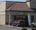 view gallery view galleryNW16.6 km |  Subway - Hway 395 - Gardnerville, NV Subway - Hway 395 - Gardnerville, NV
in Subway Restaurants A Subway on Hway 395 in Gardnerville, NV. posted by: saopaulo1 location: Nevada date approved: 05/16/2011 last visited: 05/27/2011 |
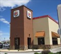 view gallery view galleryNW16.6 km |  Burger King - Hway 395 - Gardnerville, NV Burger King - Hway 395 - Gardnerville, NV
in Burger King Restaurants A Burger King on Hway 395 in Gardnerville, NV. posted by: saopaulo1 location: Nevada date approved: 05/16/2011 last visited: 06/19/2013 |
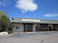
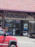 view gallery view galleryNW16.6 km |  Radio Shack - Hway 395 - Gardnerville, NV Radio Shack - Hway 395 - Gardnerville, NV
in Radio Shack Stores A Radio Shack in Gardenrville, NV. This Radio Shack is in a shopping center. posted by: saopaulo1 location: Nevada date approved: 05/16/2011 last visited: 05/27/2011 |
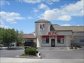 view gallery view galleryNW16.6 km |  KFC - Hway 395 - Gardnerville, NV KFC - Hway 395 - Gardnerville, NV
in Kentucky Fried Chicken/KFC Restaurants A KFC on Hway 395 in Gardnerville, NV. posted by: saopaulo1 location: Nevada date approved: 05/16/2011 last visited: 05/27/2011 |
|