 view gallery view gallery SW5.3 km SW5.3 km
|   The American Bottom The American Bottom
in Illinois Historical Markers Historical marker describing the rich soil and history of the area.
posted by:  paulspaper paulspaper location: Illinois date approved: 08/27/2007 last visited: 03/28/2014 |
 view gallery view gallery E8.2 km E8.2 km
|   Charter Oak School Charter Oak School
in Illinois Historical Markers Octagonal brick schoolhouse built in 1873. posted by:  paulspaper paulspaper location: Illinois date approved: 05/04/2008 last visited: never |
 view gallery view gallery E8.2 km E8.2 km
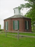
|   Charter Oak Schoolhouse Charter Oak Schoolhouse
in U.S. National Register of Historic Places Octagonal brick schoolhouse built in 1873. Located between Schuline and Walsh in a nice shaded area. posted by:  paulspaper paulspaper location: Illinois date approved: 05/04/2008 last visited: 03/24/2014 |
 view gallery view gallery E8.2 km E8.2 km
|   Charter Oak School Charter Oak School
in Octagon Buildings Octagonal brick schoolhouse built in 1873. posted by:  paulspaper paulspaper location: Illinois date approved: 05/04/2008 last visited: 03/24/2014 |
 view gallery view gallery E8.2 km E8.2 km
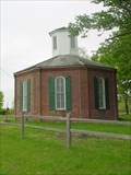
|   Charter Oak "8-Sided" School - Schuline, Illinois Charter Oak "8-Sided" School - Schuline, Illinois
in Official Local Tourism Attractions This building is a study in physics as well as history as it was designed to withstand strong winds and capture light throughout the day. posted by:  paulspaper paulspaper location: Illinois date approved: 05/04/2008 last visited: 03/24/2014 |
 view gallery view gallery E8.2 km E8.2 km
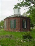
|   Charter Oak School Charter Oak School
in Former Schools Octagonal brick schoolhouse built in 1873. Located between Walsh and Schuline, Illinois. posted by:  paulspaper paulspaper location: Illinois date approved: 05/04/2008 last visited: 03/24/2014 |
 view gallery view gallery E9.2 km E9.2 km
|   Charter Oak "8-Sided" School - Schuline, Illinois Charter Oak "8-Sided" School - Schuline, Illinois
in One-Room Schoolhouses Octagonal brick schoolhouse built in 1873. Very charming building in a nice rural location. posted by:  paulspaper paulspaper location: Illinois date approved: 02/03/2022 last visited: never |
 view gallery view gallery E9.2 km E9.2 km
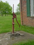
|   Charter Oak School Water Pump - Schuline, IL Charter Oak School Water Pump - Schuline, IL
in Hand Operated Water Pumps Old water pump at the Charter Oak School in Schuline, Illinois. posted by:  paulspaper paulspaper location: Illinois date approved: 02/20/2022 last visited: never |
 view gallery view gallery N10.9 km N10.9 km
|   Trinity Lutheran Church and Cemetery - Redbud (Prairie), Illinois Trinity Lutheran Church and Cemetery - Redbud (Prairie), Illinois
in Churchyard Cemeteries Historic country Lutheran Church and cemetery near Redbud, Illinois. posted by:  BruceS BruceS location: Illinois date approved: 05/04/2009 last visited: 02/13/2014 |
 view gallery view gallery N10.9 km N10.9 km
|   Trinity Lutheran Cemetery - Redbud (Prairie), Illinois Trinity Lutheran Cemetery - Redbud (Prairie), Illinois
in Worldwide Cemeteries Cemetery adjacent to country Lutheran church near Redbud, Illinois. posted by:  BruceS BruceS location: Illinois date approved: 05/02/2009 last visited: 02/13/2014 |
 view gallery view gallery N10.9 km N10.9 km
|   Trinity Lutheran Church - Redbud (Prairie), Illinois Trinity Lutheran Church - Redbud (Prairie), Illinois
in This Old Church Historic country Lutheran Church near Redbud, Illinois. posted by:  BruceS BruceS location: Illinois date approved: 05/02/2009 last visited: 02/13/2014 |
 view gallery view gallery N10.9 km N10.9 km
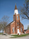
|   Trinity Lutheran Church - Redbud (Prairie), Illinois Trinity Lutheran Church - Redbud (Prairie), Illinois
in Country Churches Historic country Lutheran Church near Redbud, Illinois. posted by:  BruceS BruceS location: Illinois date approved: 05/05/2009 last visited: never |
 view gallery view gallery N10.9 km N10.9 km
|   Trinity Lutheran Church - Redbud (Prairie), Illinois Trinity Lutheran Church - Redbud (Prairie), Illinois
in Lutheran Churches Historic country Lutheran Church near Redbud, Illinois. posted by:  BruceS BruceS location: Illinois date approved: 05/02/2009 last visited: 02/13/2014 |
 view gallery view gallery N10.9 km N10.9 km
|   1868 - Trinity Lutheran Church - Redbud (Prairie), Illinois 1868 - Trinity Lutheran Church - Redbud (Prairie), Illinois
in Dated Buildings and Cornerstones Historic country Lutheran Church near Redbud, Illinois. posted by:  BruceS BruceS location: Illinois date approved: 05/04/2009 last visited: never |
 view gallery view gallery S12.9 km S12.9 km
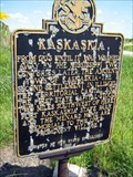
|   Kaskaskia - Ellis Grove, IL Kaskaskia - Ellis Grove, IL
in Illinois Historical Markers Second settlement in Illinois, The Territorial Capital and First State Capital posted by:  kodiak_62 kodiak_62 location: Illinois date approved: 08/21/2008 last visited: 08/23/2008 |
 view gallery view gallery S13.4 km S13.4 km
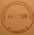
|   Lewis & Clark National Historic Trail - Ft. Kaskaskia, IL Lewis & Clark National Historic Trail - Ft. Kaskaskia, IL
in NPS Passport Cancellation Stations Between May 1804 and September 1806, 31 men, one woman, and a baby traveled from the plains of the Midwest to the shores of the Pacific Ocean. They called themselves the Corps of Discovery. In their search for a water route to the Pacific Ocean, they opened a window onto the west for the young United States. posted by:  nomadwillie nomadwillie location: Illinois date approved: 10/30/2008 last visited: 08/19/2005 |
 view gallery view gallery SW13.5 km SW13.5 km
|   N 38 W 90 - Near Flinton, IL N 38 W 90 - Near Flinton, IL
in Confluence Spots This confluence point lies in the Mississippi River floodplain of Southern Illinois. Near Chester, IL and Sainte Genevieve, MO posted by:  Cap'n YB Cap'n YB location: Illinois date approved: 12/22/2007 last visited: 12/19/2007 |
 view gallery view gallery S13.7 km S13.7 km
|   Lewis and Clark NHT - Fort Kaskaskia, IL Lewis and Clark NHT - Fort Kaskaskia, IL
in National Parks (U.S.) Between May 1804 and September 1806, 31 men, one woman, and a baby traveled from the plains of the Midwest to the shores of the Pacific Ocean posted by:  nomadwillie nomadwillie location: Illinois date approved: 02/10/2009 last visited: 09/17/2011 |
 view gallery view gallery S13.7 km S13.7 km
|   A Vanished Capital - near Chester IL A Vanished Capital - near Chester IL
in Scenic Roadside Look-Outs A Vanished Capital, view of the location of Illinois 1st State Capital, Kaskakia. posted by:  kJfishman kJfishman location: Illinois date approved: 10/03/2011 last visited: 10/01/2011 |
 view gallery view gallery S13.7 km S13.7 km
|   Lewis and Clark in Illinois - Fort Kaskaskia, Illinois Lewis and Clark in Illinois - Fort Kaskaskia, Illinois
in Lewis and Clark Trail Lewis and Clark visited here during preparations before departing west. posted by:  paulspaper paulspaper location: Illinois date approved: 08/28/2007 last visited: 05/20/2011 |
 view gallery view gallery S13.7 km S13.7 km
|   Lewis and Clark in Illinois - Ellis Grove, IL Lewis and Clark in Illinois - Ellis Grove, IL
in Illinois Historical Markers Located at Fort Kaskaskia right outside the pavillion overlooking the Mississippi River posted by:  nomadwillie nomadwillie location: Illinois date approved: 02/24/2013 last visited: never |
  S13.7 km S13.7 km
|   To a Sunken City To a Sunken City
in Weird Story Locations A city sunken, and a state divided by a possible indian curse... posted by:  rockey_f_squirrell rockey_f_squirrell location: Illinois date approved: 08/18/2005 last visited: 06/18/2011 |
 view gallery view gallery S14 km S14 km
|   Pierre Menard Home Spring House Pierre Menard Home Spring House
in Spring Houses Nice spring house made of stone. posted by:  paulspaper paulspaper location: Illinois date approved: 08/20/2007 last visited: 09/05/2010 |
 view gallery view gallery S14.2 km S14.2 km
|   Fort Kaskaskia near Chester IL Fort Kaskaskia near Chester IL
in Military Installations Fort Kaskaskia construction began in 1759 due to the fear of British invasion into what was French territory at the time. posted by:  kJfishman kJfishman location: Illinois date approved: 10/03/2011 last visited: 10/01/2011 |
 view gallery view gallery S14.2 km S14.2 km
|   Menard, Pierre, House - Ellis Grove, Illinois Menard, Pierre, House - Ellis Grove, Illinois
in U.S. National Register of Historic Places This French Creole style house was the home of Illinois' First Lt Governor, Pierre Menard. posted by:  paulspaper paulspaper location: Illinois date approved: 05/04/2008 last visited: never |
|