 view gallery view gallery SW3.5 km SW3.5 km
|   Las Yescas Cemetery - Rio Hondo TX Las Yescas Cemetery - Rio Hondo TX
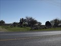
in Worldwide Cemeteries This Cemetery is on Olmito North Road (FM 803) just south of General Brant Road (FM 106) about 5 miles east of Rio Hondo in Cameron County, Texas. posted by:  PeterNoG PeterNoG location: Texas date approved: 04/07/2014 last visited: 01/15/2014 |
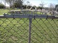 view gallery view gallerySW4.5 km | San Vicente Cemetery - Rio Hondo TX in Worldwide Cemeteries This Cemetery is on the south side of General Brant Road about 0.9 miles west of Olmito North Road (FM 803) near Rio Hondo in Cameron County, Texas. posted by: PeterNoG location: Texas date approved: 04/07/2014 last visited: 01/15/2014 |
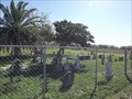 view gallery view gallerySW5 km | Old San Vicente Cemetery - Rio Hondo TX in Worldwide Cemeteries This Cemetery is on a dirt road beside a canal, 550 feet south of General Brant Road about 1.2 miles west of Olmito North Road (FM 803) near Rio Hondo in Cameron County, Texas. posted by: PeterNoG location: Texas date approved: 04/07/2014 last visited: 01/15/2014 |
 view gallery view gallery W9 km W9 km
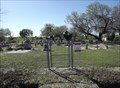
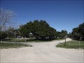
| Rio Hondo Community Cemetery - Rio Hondo TX in Worldwide Cemeteries This Cemetery is on Madero Avenue 1000 feet west of North Sam Houston Boulevard on the east side of Rio Hondo, Texas. posted by: PeterNoG location: Texas date approved: 04/07/2014 last visited: 01/15/2014 |
 view gallery view galleryW9.7 km |  Water Tower - Rio Hondo TX Water Tower - Rio Hondo TX
in Water Towers This Water Tower is on Robertson Road at Madera Drive in Rio Hondo, Texas. posted by: PeterNoG location: Texas date approved: 01/16/2014 last visited: 01/16/2014 |
 view gallery view galleryW10.3 km |  Rio Hondo Fire Dept. Rio Hondo Fire Dept.
in Firehouses This Firehouse is on North Aroyo Boulevard just north of FM 106 (Colorado Avenue) in Rio Hondo, Texas. posted by: PeterNoG location: Texas date approved: 04/13/2014 last visited: 12/15/2013 |
 view gallery view galleryW10.6 km | Rio Hondo City Cemetery - Rio Hondo TX in Worldwide Cemeteries This Cemetery is on South Arroyo Boulevard at Parkway Avenue in Rio Hondo, Texas, posted by: PeterNoG location: Texas date approved: 04/07/2014 last visited: 01/15/2014 |
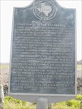 view gallery view galleryW11.7 km |  Stagecoach to the Rio Grande, C.S.A. Stagecoach to the Rio Grande, C.S.A.
in Texas Historical Markers Story of stagecoach travel during the Confederacy posted by: 8Nuts MotherGoose location: Texas date approved: 04/28/2007 last visited: 12/15/2013 |
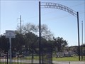
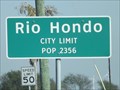 view gallery view galleryW11.7 km |  Rio Hondo TX - Pop. 2,356 Rio Hondo TX - Pop. 2,356
in Population Signs This Population Sign is on Combes Rio Hondo Road at West Colorado Avenue on the west side of Rio Hondo, Texas. posted by: PeterNoG location: Texas date approved: 03/05/2014 last visited: 12/15/2013 |
 view gallery view galleryW12.9 km | Water Tower - Port of Harlingen TX in Water Towers This Water Tower is on Port Road about 1/3 mile north of FM 574 (Cemetery Road) at the Port of Harlingen, Texas. posted by: PeterNoG location: Texas date approved: 04/06/2014 last visited: 12/15/2013 |
 view gallery view gallerySW12.9 km | Mont Meta Memorial Park - San Benito TX in Worldwide Cemeteries This Cemetery is on North Sam Houston Boulevard (Hwy 345) just south of Coston Road about 2 miles north of San Benito in Cameron County, Texas. posted by: PeterNoG location: Texas date approved: 01/20/2014 last visited: 01/20/2014 |
 view gallery view gallery NE13 km NE13 km
|  Adolph Thomae Jr. Park, Port Isabel, Texas Adolph Thomae Jr. Park, Port Isabel, Texas
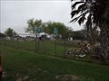
in Municipal Parks and Plazas This is probably the best spot for RVs in the Valley, with spaces right on the banks of the palm-fringed Arroyo Colorado. Other amenities include three fishing piers, a hiking trail, boat ramps, and picnic tables with grills. posted by:  JimmyEv JimmyEv location: Texas date approved: 12/03/2007 last visited: never |
 view gallery view gallery E13.4 km E13.4 km
|  Laguna Atascosa National Wildlife Refuge - Texas Laguna Atascosa National Wildlife Refuge - Texas
in National Wildlife Refuges Along the shores of the hypersaline Laguna Madre is this spectacular 45,000-acre wildlife refuge, filled with birds, butterflies, rare cats, excellent views, and 15 miles of hiking and biking trails. posted by: JimmyEv location: Texas date approved: 04/01/2008 last visited: 10/28/2023 |
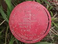
 view gallery view galleryE13.5 km |  JBL13, Laguna Atascosa NWR, TX JBL13, Laguna Atascosa NWR, TX
in U.S. Benchmarks Find this benchmark while visiting Laguna Atascosa National Wildlife Refuge. posted by: 8Nuts MotherGoose location: Texas date approved: 07/27/2010 last visited: never |
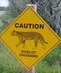 view gallery view galleryE15.4 km |  Ocelot Crossing Ocelot Crossing
in Uncommon Crossing Signs Located in a National Wildlife Refuge. posted by: 8Nuts MotherGoose location: Texas date approved: 09/02/2007 last visited: never |
 view gallery view gallery NW16.6 km NW16.6 km
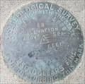
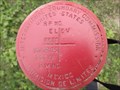
| International Boundary Commission (west) - Santa Monica TX in U.S. Benchmarks This U.S. Benchmark is one of two in the Tanquisitos Cemetery which is just south of the South Levee Road, 0.9 miles west of FM 1420, 0.57 miles south of FM 1018 near Santa Monica, Texas. posted by: PeterNoG location: Texas date approved: 05/16/2014 last visited: 02/03/2014 |
 view gallery view galleryNW16.6 km | International Boundary Commission #1 - Santa Monica TX in U.S. Benchmarks This U.S. Benchmark is one of two in the Tanquisitos Cemetery which is just south of the South Levee Road, 0.9 miles west of FM 1420, 0.57 miles south of FM 1018 near Santa Monica, Texas. posted by: PeterNoG location: Texas date approved: 05/16/2014 last visited: 02/03/2014 |
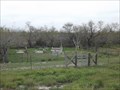 view gallery view galleryNW16.6 km | Tanquisitos Cemetery - Santa Monica TX in Worldwide Cemeteries The Cemetery is just south of the South Levee Road, 0.9 miles west of FM 1420, 0.57 miles south of FM 1018 near Santa Monica, Texas. posted by: PeterNoG location: Texas date approved: 02/22/2014 last visited: 02/03/2014 |
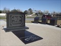 view gallery view gallerySW16.9 km |  Freddy Fender Grave and Memorial - San Benito TX Freddy Fender Grave and Memorial - San Benito TX
in Roadside Attractions This Roadside Attraction is the Grave & Memorial for Freddy Fender. It's in San Benito Memorial Park in San Benito, Texas. posted by: PeterNoG location: Texas date approved: 01/26/2014 last visited: 01/01/2014 |
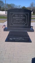 view gallery view gallerySW16.9 km |  Grave of Freddy Fender - San Benito TX Grave of Freddy Fender - San Benito TX
in Grave of a Famous Person This Grave of a Famous Person for Baldemar Huerta aka Freddy Fender is in San Benito Memorial Park in San Benito, Texas. posted by: PeterNoG location: Texas date approved: 01/28/2014 last visited: 01/01/2014 |
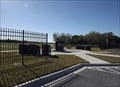 view gallery view gallerySW16.9 km | San Benito Memorial Park - San Benito TX in Worldwide Cemeteries This Cemetery is on North Sam Houston Boulevard (Hwy 345), 0.33 miles south of FM 3462 on the north side of San Benito, Texas. posted by: PeterNoG location: Texas date approved: 02/22/2014 last visited: 01/15/2014 |
 view gallery view gallerySW17.1 km | San Benito Cemetery - San Benito TX in Worldwide Cemeteries This Cemetery is on North Sam Houston Boulevard (Hwy 345), 0.45 miles south of FM 3462 on the north side of San Benito, Texas. posted by: PeterNoG location: Texas date approved: 01/20/2014 last visited: 01/20/2014 |
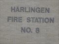 view gallery view galleryW18.2 km | Harlingen Fire Station No. 8 in Firehouses This Firehouse is on Grimes Avenue, 0.3 miles east of Loop Hwy 499 (North Ed Carey Drive) in Harlingen, Texas. posted by: PeterNoG location: Texas date approved: 05/17/2014 last visited: 02/19/2014 |
 view gallery view gallery S18.7 km S18.7 km
| Los Cuates Cemetery - Los Cuates TX in Worldwide Cemeteries This Cemetery is on FM 1575 just north of the Resaca de Los Cuates in Los Cuates, Texas. posted by: PeterNoG location: Texas date approved: 04/07/2014 last visited: 02/23/2014 |
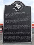 view gallery view gallerySW18.7 km | Spiderweb Railroad in Texas Historical Markers This Texas Historical Marker is on US Business 77 just west of North Sam Houston Boulevard (Hwy 345) in San Benito, Texas. posted by: PeterNoG location: Texas date approved: 01/19/2014 last visited: 01/19/2014 |
|