 view gallery view gallery N4.2 km N4.2 km
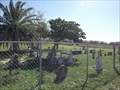
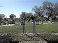
|   Old San Vicente Cemetery - Rio Hondo TX Old San Vicente Cemetery - Rio Hondo TX
in Worldwide Cemeteries This Cemetery is on a dirt road beside a canal, 550 feet south of General Brant Road about 1.2 miles west of Olmito North Road (FM 803) near Rio Hondo in Cameron County, Texas. posted by:  PeterNoG PeterNoG location: Texas date approved: 04/07/2014 last visited: 01/15/2014 |
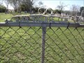 view gallery view gallery NE4.5 km NE4.5 km
| San Vicente Cemetery - Rio Hondo TX in Worldwide Cemeteries This Cemetery is on the south side of General Brant Road about 0.9 miles west of Olmito North Road (FM 803) near Rio Hondo in Cameron County, Texas. posted by: PeterNoG location: Texas date approved: 04/07/2014 last visited: 01/15/2014 |
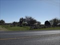
 view gallery view gallery W4.8 km W4.8 km
| Mont Meta Memorial Park - San Benito TX in Worldwide Cemeteries This Cemetery is on North Sam Houston Boulevard (Hwy 345) just south of Coston Road about 2 miles north of San Benito in Cameron County, Texas. posted by: PeterNoG location: Texas date approved: 01/20/2014 last visited: 01/20/2014 |
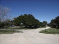
 view gallery view galleryNE5 km | Las Yescas Cemetery - Rio Hondo TX in Worldwide Cemeteries This Cemetery is on Olmito North Road (FM 803) just south of General Brant Road (FM 106) about 5 miles east of Rio Hondo in Cameron County, Texas. posted by: PeterNoG location: Texas date approved: 04/07/2014 last visited: 01/15/2014 |
 view gallery view gallery NW6 km NW6 km
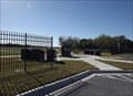
| Rio Hondo City Cemetery - Rio Hondo TX in Worldwide Cemeteries This Cemetery is on South Arroyo Boulevard at Parkway Avenue in Rio Hondo, Texas, posted by: PeterNoG location: Texas date approved: 04/07/2014 last visited: 01/15/2014 |
 view gallery view galleryW6 km |  Water Tower - Port of Harlingen TX Water Tower - Port of Harlingen TX
in Water Towers This Water Tower is on Port Road about 1/3 mile north of FM 574 (Cemetery Road) at the Port of Harlingen, Texas. posted by: PeterNoG location: Texas date approved: 04/06/2014 last visited: 12/15/2013 |
 view gallery view galleryNW6.1 km | Rio Hondo Community Cemetery - Rio Hondo TX in Worldwide Cemeteries This Cemetery is on Madero Avenue 1000 feet west of North Sam Houston Boulevard on the east side of Rio Hondo, Texas. posted by: PeterNoG location: Texas date approved: 04/07/2014 last visited: 01/15/2014 |
 view gallery view galleryNW6.6 km | Water Tower - Rio Hondo TX in Water Towers This Water Tower is on Robertson Road at Madera Drive in Rio Hondo, Texas. posted by: PeterNoG location: Texas date approved: 01/16/2014 last visited: 01/16/2014 |
 view gallery view galleryNW6.8 km |  Rio Hondo Fire Dept. Rio Hondo Fire Dept.
in Firehouses This Firehouse is on North Aroyo Boulevard just north of FM 106 (Colorado Avenue) in Rio Hondo, Texas. posted by: PeterNoG location: Texas date approved: 04/13/2014 last visited: 12/15/2013 |
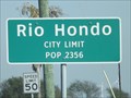 view gallery view galleryNW7.4 km |  Rio Hondo TX - Pop. 2,356 Rio Hondo TX - Pop. 2,356
in Population Signs This Population Sign is on Combes Rio Hondo Road at West Colorado Avenue on the west side of Rio Hondo, Texas. posted by: PeterNoG location: Texas date approved: 03/05/2014 last visited: 12/15/2013 |
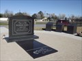 view gallery view gallery SW8.4 km SW8.4 km
|  Freddy Fender Grave and Memorial - San Benito TX Freddy Fender Grave and Memorial - San Benito TX
in Roadside Attractions This Roadside Attraction is the Grave & Memorial for Freddy Fender. It's in San Benito Memorial Park in San Benito, Texas. posted by: PeterNoG location: Texas date approved: 01/26/2014 last visited: 01/01/2014 |
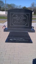 view gallery view gallerySW8.4 km |  Grave of Freddy Fender - San Benito TX Grave of Freddy Fender - San Benito TX
in Grave of a Famous Person This Grave of a Famous Person for Baldemar Huerta aka Freddy Fender is in San Benito Memorial Park in San Benito, Texas. posted by: PeterNoG location: Texas date approved: 01/28/2014 last visited: 01/01/2014 |
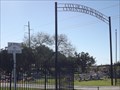
 view gallery view gallerySW8.4 km | San Benito Memorial Park - San Benito TX in Worldwide Cemeteries This Cemetery is on North Sam Houston Boulevard (Hwy 345), 0.33 miles south of FM 3462 on the north side of San Benito, Texas. posted by: PeterNoG location: Texas date approved: 02/22/2014 last visited: 01/15/2014 |
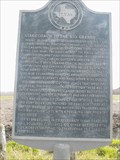 view gallery view galleryNW8.5 km |  Stagecoach to the Rio Grande, C.S.A. Stagecoach to the Rio Grande, C.S.A.
in Texas Historical Markers Story of stagecoach travel during the Confederacy posted by: 8Nuts MotherGoose location: Texas date approved: 04/28/2007 last visited: 12/15/2013 |
 view gallery view gallerySW8.7 km | San Benito Cemetery - San Benito TX in Worldwide Cemeteries This Cemetery is on North Sam Houston Boulevard (Hwy 345), 0.45 miles south of FM 3462 on the north side of San Benito, Texas. posted by: PeterNoG location: Texas date approved: 01/20/2014 last visited: 01/20/2014 |
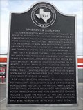 view gallery view gallerySW10.1 km | Spiderweb Railroad in Texas Historical Markers This Texas Historical Marker is on US Business 77 just west of North Sam Houston Boulevard (Hwy 345) in San Benito, Texas. posted by: PeterNoG location: Texas date approved: 01/19/2014 last visited: 01/19/2014 |
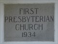 view gallery view gallerySW10.5 km |  1934 First Presbyterian Church - San Benito TX 1934 First Presbyterian Church - San Benito TX
in Dated Buildings and Cornerstones This Cornerstone building is the First Presbyterian Church on North Reagan Street at East Francis Street in San Benito, Texas. posted by: PeterNoG location: Texas date approved: 04/07/2014 last visited: 12/15/2013 |
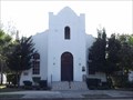 view gallery view gallerySW10.5 km |  First Presbyterian Church - San Benito TX First Presbyterian Church - San Benito TX
in Presbyterian Churches This Presbyterian Church is on North Reagan Street at East Francis Street in San Benito, Texas. posted by: PeterNoG location: Texas date approved: 04/06/2014 last visited: 01/18/2014 |
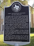
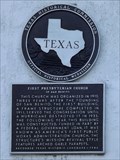 view gallery view gallerySW10.5 km | First Presbyterian Church of San Benito in Texas Historical Markers This Texas Historical Marker is on the First Presbyterian Church on North Reagan Street at East Francis Street in San Benito, Texas. posted by: PeterNoG location: Texas date approved: 01/17/2014 last visited: 01/18/2014 |
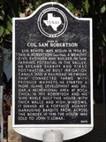 view gallery view gallerySW10.6 km | Home of Col. Sam Robertson in Texas Historical Markers This Texas Historical Marker is in front of the house on North Sam Houston Boulevard (FM 345) at West Adele Street in San Benito, Texas. posted by: PeterNoG location: Texas date approved: 01/06/2014 last visited: 01/13/2014 |
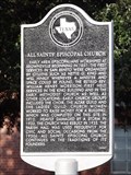 view gallery view gallerySW10.6 km | All Saints' Episcopal Church in Texas Historical Markers This Texas Historical Marker is in front of the All Saints' Episcopal Church on North Reagan Street at West Adele Street in San Benito, Texas, posted by: PeterNoG location: Texas date approved: 01/17/2014 last visited: 01/18/2014 |
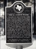 view gallery view gallerySW10.6 km | The A.C. Purvis House in Texas Historical Markers This Texas Historical Marker is in front of the Purvis House at 441 North Reagan Street in San Benito, Texas. posted by: PeterNoG location: Texas date approved: 01/17/2014 last visited: 01/18/2014 |
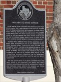 view gallery view gallerySW10.8 km | San Benito Post Office in Texas Historical Markers This Texas Historical Marker is in front of the former San Benito Post Office on South Sam Houston Boulevard (FM 345) at West Hicks Street in San Benito, Texas. posted by: PeterNoG location: Texas date approved: 01/06/2014 last visited: 01/13/2014 |
 view gallery view gallerySW10.8 km | First Methodist Church of San Benito in Texas Historical Markers This Texas Historical Marker is in front of the First Methodist Church of San Benito on South Sam Houston Boulevard (FM 345) at West Hicks Street in San Benito, Texas. posted by: PeterNoG location: Texas date approved: 01/06/2014 last visited: 01/13/2014 |
 view gallery view gallerySW11.1 km | City of San Benito in Texas Historical Markers This Texas Historical Marker is in front of the San Benito Veteran's War Memorial, east side of South Sam Houston Boulevard at the railroad crossing in San Benito, Texas. posted by: PeterNoG location: Texas date approved: 01/18/2014 last visited: 01/18/2014 |
|