 view gallery view gallery NW0.6 km NW0.6 km
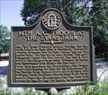
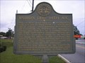
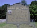
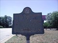
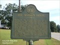
|   14th A.C. Troops at the Evans Farm - GHM 031-29 - Clayton Co., GA 14th A.C. Troops at the Evans Farm - GHM 031-29 - Clayton Co., GA
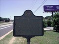
in Georgia Historical Markers 14th A.C. Troops at the Evans Farm state historic marker located on Old Fayetteville Rd at Church St, Riverdale, GA. posted by:  Lat34North Lat34North location: Georgia date approved: 06/19/2008 last visited: 06/18/2008 |
 view gallery view gallery S1.6 km S1.6 km
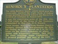
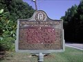
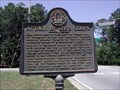
| RENFROE'S PLANTATION- GHM 031-16 in Georgia Historical Markers Located corner of Hwy 138 and Ga 85 in Clayton County in the parking lot of the Chruch's Chicken posted by: Sprinterman location: Georgia date approved: 10/21/2007 last visited: 09/10/2000 |
 view gallery view gallery N1.8 km N1.8 km
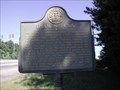
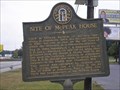
| Site of Couch House - GHM 031-17 - Clayton Co., GA in Georgia Historical Markers Site of Couch House state historic marker located on GA 139 (Church St) between King and Adams, Sts, Riverdale, GA. posted by: Lat34North location: Georgia date approved: 04/30/2009 last visited: 03/18/2017 |
 view gallery view gallery E3.9 km E3.9 km
| Hardee's Detour - GHM 031-10 - Clayton Co., GA in Georgia Historical Markers Hardee's Detour state historic marker located on US 41 at Battle Creek Rd north of Jonesboro, GA.
posted by: Lat34North location: Georgia date approved: 06/19/2008 last visited: 09/10/2000 |
 view gallery view galleryNW3.9 km |  ALDI - College Park, GA ALDI - College Park, GA
in ALDI Stores ALDI located on Riverdale Road at Garden Walk Blvd in College Park, GA. posted by: Lat34North location: Georgia date approved: 07/06/2011 last visited: 07/06/2011 |
 view gallery view galleryNW4.5 km | Baird's Div., 14th A.C. GHM 031-30, Clayton Co. in Georgia Historical Markers Baird's Div., 14th A.C. GHM 031-30 Ga 139 and Flat Shoals Rd, 2 miles north of Riverdale posted by: GA Cacher location: Georgia date approved: 10/15/2007 last visited: 09/10/2000 |
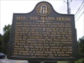 view gallery view galleryNW4.5 km | Site: The Mann House 031-33 in Georgia Historical Markers Site: The Mann House State Historical Marker
Located on Flat Shoals Rd., east of Ga. 139.
posted by: GA Cacher location: Georgia date approved: 10/15/2007 last visited: 09/10/2000 |
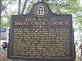
 view gallery view galleryNW4.5 km | Site: Shoal Cr. Church GHM 031-34, Clayton County in Georgia Historical Markers Site: Shoal Cr. Church State Historical Marker
Located northeast of intersection of Flat Shoals Rd. and Fayetteville Rd.
posted by: GA Cacher location: Georgia date approved: 10/10/2007 last visited: 06/18/2008 |
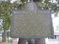
 view gallery view galleryNW4.5 km | 14TH A. C. AT SHOAL CREEK CHURCH - 031-35 Clayton CO. in Georgia Historical Markers 14th A. C. at Shoal Creek Church State Historical Marker
Located NE of intersection of Flat Shoals Rd. and Fayetteville Rd.
posted by: GA Cacher location: Georgia date approved: 10/10/2007 last visited: 06/18/2008 |
 view gallery view gallery W4.5 km W4.5 km
| Bethsaida Baptist Church and Cemetery - Fulton Co., GA in Georgia Historical Markers Bethsaida Baptist Church and Cemetery historic marker located on Bethsaida Rd E of Old National Hwy near Fulton-Clayton line at the cemetery. posted by: Lat34North location: Georgia date approved: 06/19/2008 last visited: 06/18/2008 |
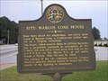 view gallery view galleryNW4.5 km | Site: Marcus Long House 031-32 Clayton Co. in Georgia Historical Markers Site: Marcus Long House State Historical Marker
Located at intersection of Ga. 139 & Flat Shoals Rd., 2 mi. N of Riverdale
posted by: GA Cacher location: Georgia date approved: 10/15/2007 last visited: 09/10/2000 |
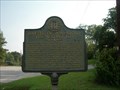
 view gallery view galleryW4.7 km | Howard's March to Jonesboro - GHM 060-170 - Fulton Co., GA in Georgia Historical Markers Howard's March to Jonesboro state historic marker located on Bethsaida Rd E of Old National Hwy near Fulton-Clayton line. posted by: Lat34North location: Georgia date approved: 06/19/2008 last visited: 06/18/2008 |
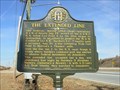 view gallery view galleryN4.8 km | The Extended Line-GHM 031-7B-Clayton Co in Georgia Historical Markers Ga 85 SB .4 miles S of Atlanta South Pkwy 1/4 mile N of Lees Mill Rd. posted by: Sprinterman location: Georgia date approved: 02/21/2010 last visited: 02/01/2001 |
 view gallery view gallery SE5.1 km SE5.1 km
|  McDonalds, Tara Blvd, Jonesboro, GA. McDonalds, Tara Blvd, Jonesboro, GA.
in McDonald's Restaurants McDonald's # 1620 located on Tara Blvd in Jonesboro, GA. posted by: Lat34North location: Georgia date approved: 06/29/2008 last visited: 03/01/2011 |
 view gallery view gallerySE5.5 km | Battle of Jonesboro: The First Day - GHM 031-26 - Clayton Co., GA in Georgia Historical Markers Battle of Jonesboro: The First Day state historic marker located on North Avenue just west of US 41, west of Jonesboro, GA. posted by: Lat34North location: Georgia date approved: 06/20/2008 last visited: 03/18/2017 |
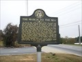 view gallery view gallerySE5.6 km | The March to the Sea-GHM 031-21-Clayton Co in Georgia Historical Markers Tara Blvd at North Avenue, Jonesboro posted by: Sprinterman location: Georgia date approved: 12/08/2010 last visited: 09/10/2000 |
 view gallery view galleryN5.6 km | Thames House - GHM 031-18 - Clayton Co., GA in Georgia Historical Markers Thames House state historic marker located on Clark Howell Rd, west of Ga 85. posted by: Lat34North location: Georgia date approved: 06/18/2008 last visited: 04/08/2009 |
 view gallery view gallerySE6 km | Attack by Lee's Corps - GHM 031-15 - Clayton Co., GA in Georgia Historical Markers Attack by Lee's Corps state historic marker located on Fayetteville Road at North Avenue, Jonesboro, GA. posted by: Lat34North location: Georgia date approved: 06/20/2008 last visited: 02/25/2017 |
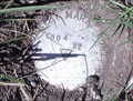 view gallery view galleryE6 km |  MARTA C004 AZ - Clayton, Co., GA MARTA C004 AZ - Clayton, Co., GA
in Azimuth Benchmarks MARTA C004 AZ located on the west side of Jonesboro Rd (GA 54), south of Battlecreek Road in Clayton County, GA. posted by: Lat34North location: Georgia date approved: 07/01/2008 last visited: 08/02/2012 |
 view gallery view galleryE6 km | Site of McPeak House GHM 031-23, Clayton Co. in Georgia Historical Markers Site of McPeak House State Historic.al Marker
Located on Ga. 54, 1/4 mile south of Battle Creek Rd, northeast of Jonesboro
posted by: GA Cacher location: Georgia date approved: 10/19/2007 last visited: 09/10/2000 |
 view gallery view gallerySE6.1 km | Battlefield Landmark - GHM 031-27 - Clayton Co., GA in Georgia Historical Markers Battlefield Landmark state historic marker located on the west side of US 41 between Robert E Lee Parkway & Dixon Rd. posted by: Lat34North location: Georgia date approved: 06/20/2008 last visited: 03/01/2011 |
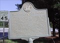
 view gallery view gallerySE6.3 km | 031-24, Battle of Jonesboro, The Second Day in Georgia Historical Markers On September 1, 1864, this area saw the last pitched battle of the Atlanta Campaign that began May 7, 1864. Marker is on SR54 at entry to Jonesboro. posted by:  Harelips Harelips location: Georgia date approved: 08/29/2006 last visited: 09/16/2022 |
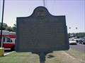
 view gallery view gallerySE6.4 km |  Battle of Jonesborough - Jonesboro GA Battle of Jonesborough - Jonesboro GA
in Wikipedia Entries The Battle of Jonesborough (August 31–September 1, 1864) was fought between Union Army forces led by William Tecumseh Sherman and Confederate forces under William J. Hardee during the Atlanta Campaign in the American Civil War. posted by: Don.Morfe location: Georgia date approved: 09/15/2022 last visited: 06/11/2023 |
 view gallery view gallerySE6.4 km |  Battle of Jonesborough - Jonesboro GA Battle of Jonesborough - Jonesboro GA
in U.S. Civil War Sites The Battle of Jonesborough (August 31–September 1, 1864) was fought between Union Army forces led by William Tecumseh Sherman and Confederate forces under William J. Hardee during the Atlanta Campaign in the American Civil War. posted by: Don.Morfe location: Georgia date approved: 09/17/2022 last visited: 06/11/2023 |
 view gallery view gallerySE6.4 km |  Battle of Jonesboro - Jonesboro GA Battle of Jonesboro - Jonesboro GA
in Battlefields The Battle of Jonesborough (modern name Jonesboro) was fought August 31–September 1, 1864, during the Atlanta Campaign in the American Civil War. Maj. Gen. William T. Sherman maneuvered to draw the Army of Tennessee (led by John Bell Hood). posted by: Don.Morfe location: Georgia date approved: 11/08/2020 last visited: 10/17/2021 |
|