On a vertical hardwood post is a blue-coated metal sign inset to the post with the following printed text:
"The Parramatta Fishways Project aims to unlock native fish migration routes that have long been blocked by Parramatta's weir network.
"Improved fish migration will restore natural breeding cycles, increase native fish populations and biodiversity, and ultimately assist in the rehabilitation of the Parramatta River for the benefit of future generations." [some 'wag' had scratched into the metal plate - LIES]
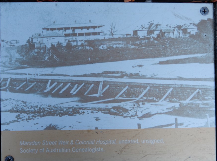
Marsden Street Weir & Colonial Hospital
On a large horizontal hardwood post is a series of metal signs and printed historical photos of the area. One has the following text:
Marsden Street Weir Fish Ladder
"Marsden Street Weir fish ladder is a vertical fish-lock fishway which enables fish to climb or descend a rise or fall of approximately 3 metres.
"The vertical fish-lock comprises a chamber at the weir face with gates at its top and bottom that connect the lock to the upper headwater and the lower tailwater levels of the river. The lower gate periodically opens allowing fish to enter or exit at the tailwater level. When the lower gate closes the upper gate opens which fills the lock with water, allowing fish to ascend to the headwater level or to descend downstream to the tailwater below."

Plaque for the Fish Ladder
Other printed metal plates are also inset to the hardwood post, with: a reproduction of a painting of part of Parramatta c~1809; a photo of Marsden Street Weir & Colonial Hospital; a photo of Lennox Bridge [stone]; and a photo of King's School; with a final elongated rectangular plaque, with the following text:
crossing
"Commissioned by Governor Macquarie in 1818, Marsden Street Weir was originally a crude earth and timber structure that served as both causeway and 30 million gallon (136 million litre) freshwater dam. Damaged by severe floods in 1864, the 1870s and again in 1888, it was progressively rebuilt, then totally encased in concrete c1920 when the channel and water cushion were constructed. A footway and floodgates were added during the late 1950s before the Marsden Street Bridge opened in the mid 1960s.
"One of Parramatta's earliest bridges was a rickety timber structure that spanned the river at Church Street from 1795. It was replaced in 1802 then superseded by the Lennox Bridge, designed by David Lennox in 1833, and constructed by convict labour 1836-39. Lennox Bridge was strengthened to carry trams in 1901-02, a new footway was added in 1912, and was further widened and strengthened during 1934-35.
"A thatch-roofed hospital occupied the southern riverbank from 1789, which made way for John Watts' elegant two storey Colonial Hospital in 1818. Accommodating some 100 patients both convict and free, the Colonial Hospital closed its doors in 1848 following the end of convict transportation to NSW. King's School occupied its Marsden Street premises in 1836. The school relocated to North Parramatta in the 1960s, but its grand old buildings still overlook the river."
Some of the fish that use the Fish Ladder here have their names carved into the hardwood post: Common Jollytail - Galaxias maculatus; Australian Bass - Macquaria novemaculeata; Striped Gudgeon - Gobiomorphus australis; Sea Mullet - Mugil cephalus; and, Long-finned Eel - Anguilla reinhardtii and Short-finned Eel - Anguilla australis.
Visited: 0812+, Sunday, 9 July, 2017