|
 Le Pont Julien - Bonnieux, Paca, France
N 43° 51.786 E 005° 18.384
31T E 685340 N 4859253
Le Pont Julien est un pont romain, traditionnellement daté de l'an 3 av. J.-C., au débouché du défilé de Roquefure, à 5 km au nord de Bonnieux (Vaucluse, sud de la France) et à 8 km à l'ouest de la ville d'Apt.
Waymark Code: WMWEN2
Location: Provence-Alpes-Côte d'Azur, France
Date Posted: 08/24/2017
Views: 11
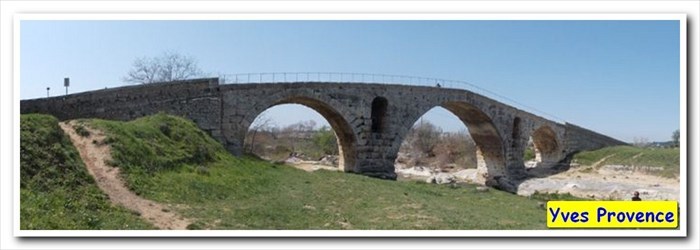
Length of bridge: 46 m

Height of bridge: 11,50
What type of traffic does this bridge support?: pedestrians, bike, hikers
What kind of gap does this bridge cross?:
The Calavon River
Date constructed: -3 av JC
Is the bridge still in service for its original purpose?: No
Name of road or trail the bridge services: Old D108
Location:
Bonnieux, Paca, France
|
Visit Instructions:
Please submit a photo(s) taken by you of your visit to the location (non-copyrighted photos only). GPS photos are also accepted with the location in the background, and old vacation photos are accepted. If you are not able to provide a photo, then please describe your visit or give a story about the visit. If the bridge location prevents you from taking a safe photograph, then please do not stop to take the photo. Safety is more important.
|