Fort Steele Bridge - 1966 - Fort Steele, BC
Posted by:  T0SHEA
N 49° 36.725 W 115° 38.122
11U E 598582 N 5496396
Along Highway 95, just south across the Kootenay River from Fort Steele and 12 kilometres north of Cranbrook is the Fort Steele Bridge.
Waymark Code: WMVKHN
Location: British Columbia, Canada
Date Posted: 04/29/2017
Views: 2
Fort Steele is the biggest and baddest tourist attraction in the area, well worth spending an afternoon, or even a full day, exploring. It is a museum and heritage village with over 60 restored and reconstructed heritage buildings, as well as machinery, vehicles, tractors, a steam locomotive and railway cars, and artefacts galore.
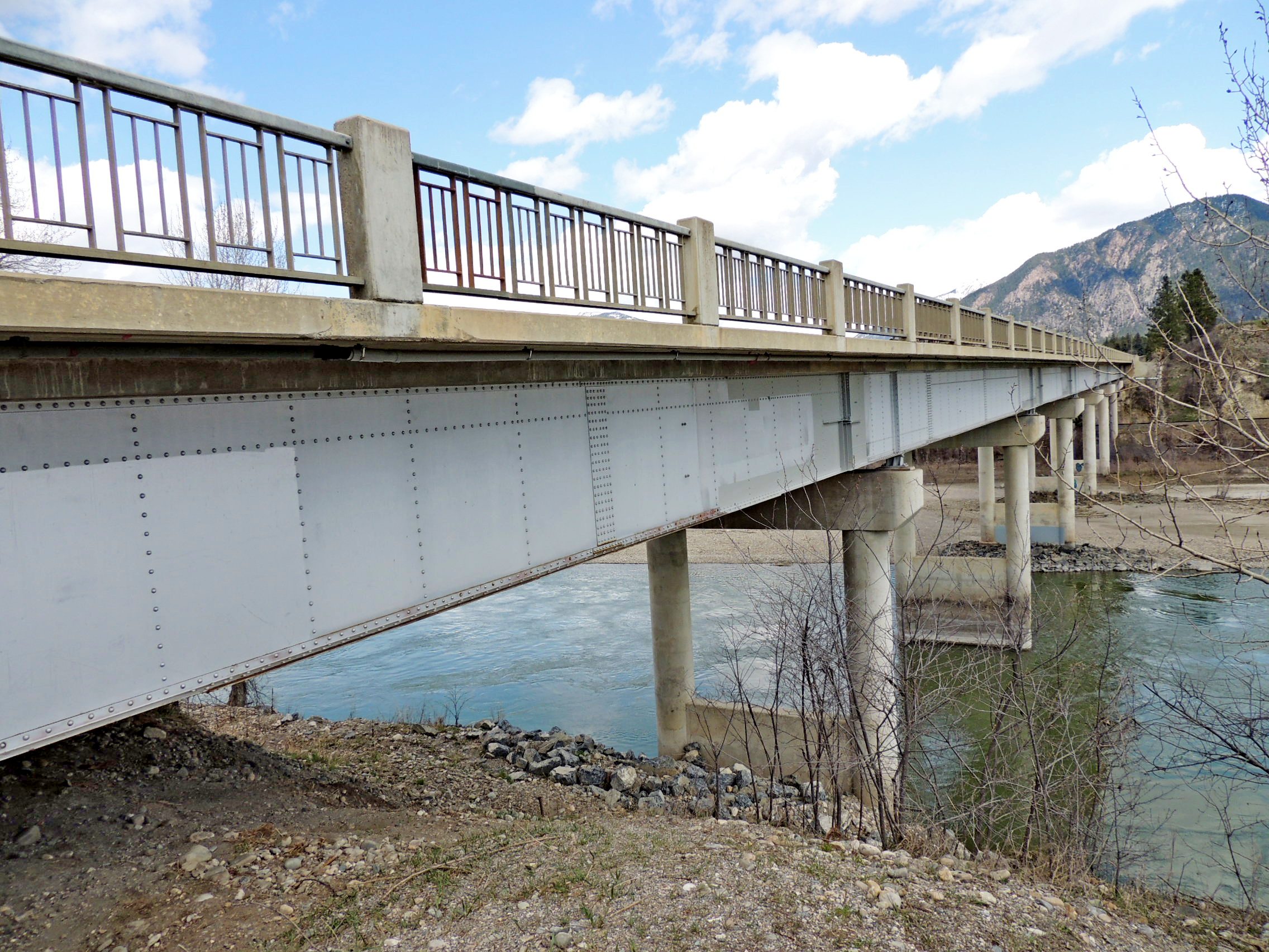
Crossing the Kootenay River just south of Fort Steele is this concrete and steel bridge, complete with benchmark at the southeast corner of the bridge. Supported by steel girders, the 750 foot long bridge stands on six pairs of round concrete pillars in the river and concrete abutments each end.
On the southwest end of the bridge is a well oxidized bronze plaque carrying the date of construction of the bridge, 1966.
| British Columbia
|
| Department of Highways
|
| Fort Steele Bridge
|
| 1966
|
| Hon P. A. Gaglardi | H.T. Maird
|
| Minister of Highways |
Deputy Minister of Highways |
| D.D. Godfrey | J. Alton
|
| Chief Engineer |
Bridge Engineer |
| Contractors |
| Bakgaard Construction Co. Ltd. |
| Dominion Bridge Company Limited |