Canal Flats Overhead - 1965 - Canal Flats, BC
Posted by:  T0SHEA
N 50° 09.923 W 115° 50.861
11U E 582298 N 5557654
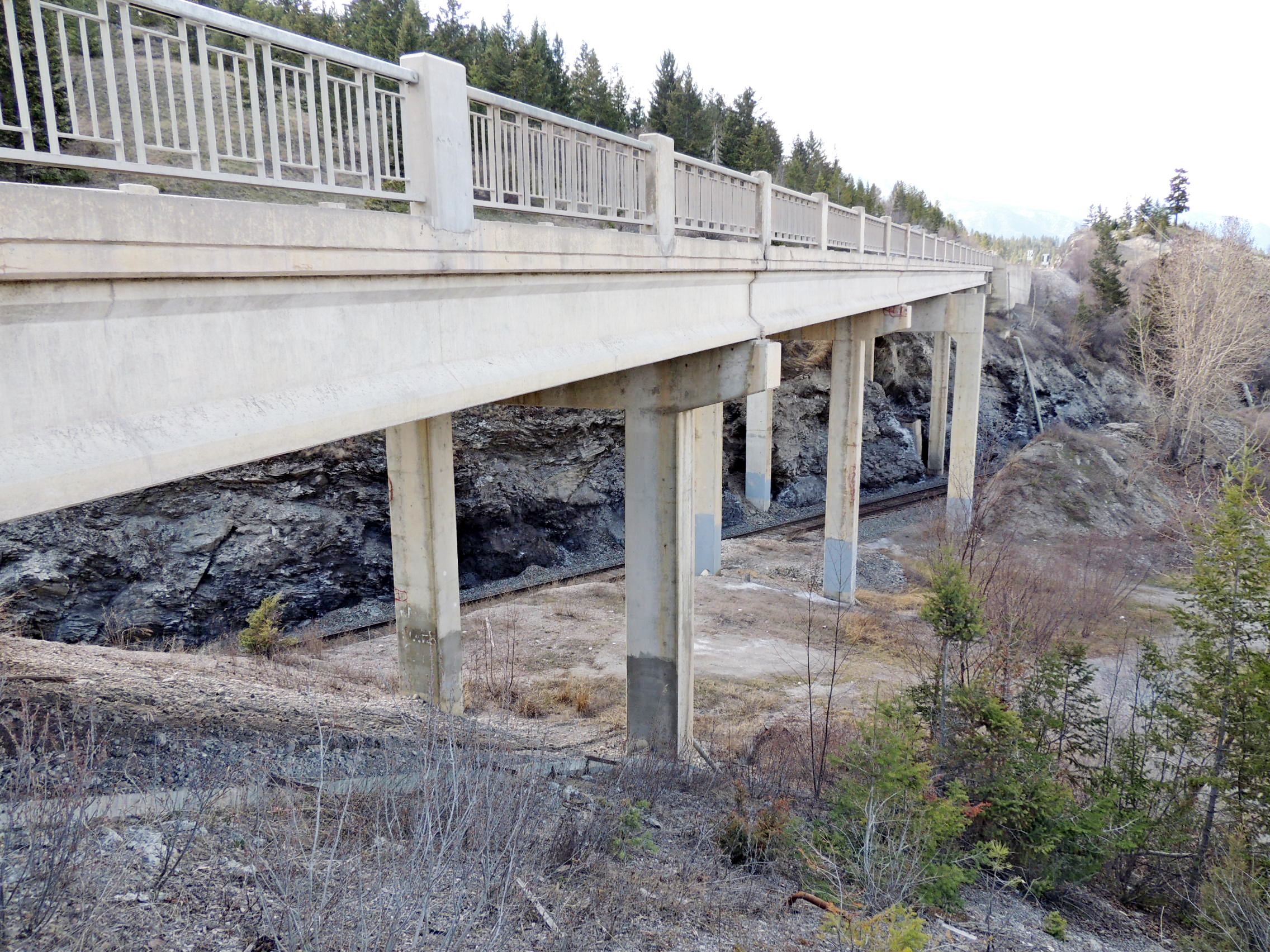
Just a bit north of the town of Canal Flats, on Highway 93/95, is the Canal Flats Overhead, which passes over a small gulch and the CPR line at the same time.
Waymark Code: WMVKDP
Location: British Columbia, Canada
Date Posted: 04/28/2017
Views: 0
At the southern end of Columbia Lake, this is almost precisely at the beginning point of the Columbia River, the largest river in the North American northwest. From here the Columbia flows north while any water which falls a few feet south of here flows south in the Kootenay River. The two ultimately meet at Castlegar, BC.
Standing on this bridge affords one a good view of Columbia Lake. About 350 feet in length, this overhead stands on four sets of concrete piers and is supported by prestressed concrete I-Beams.
The date, 1965, is impressed in the right hand concrete end post/abutment at each end of the bridge.