
Revelstoke Bridge - Revelstoke, BC
Posted by:  T0SHEA
N 51° 00.298 W 118° 13.298
11U E 414289 N 5651087
A magnificent suspension bridge, the Revelstoke Bridge has carried the motoring public over the Columbia River for fifty six years as of 2017.
Waymark Code: WMVJN2
Location: British Columbia, Canada
Date Posted: 04/25/2017
Views: 1
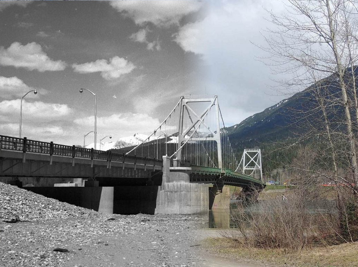
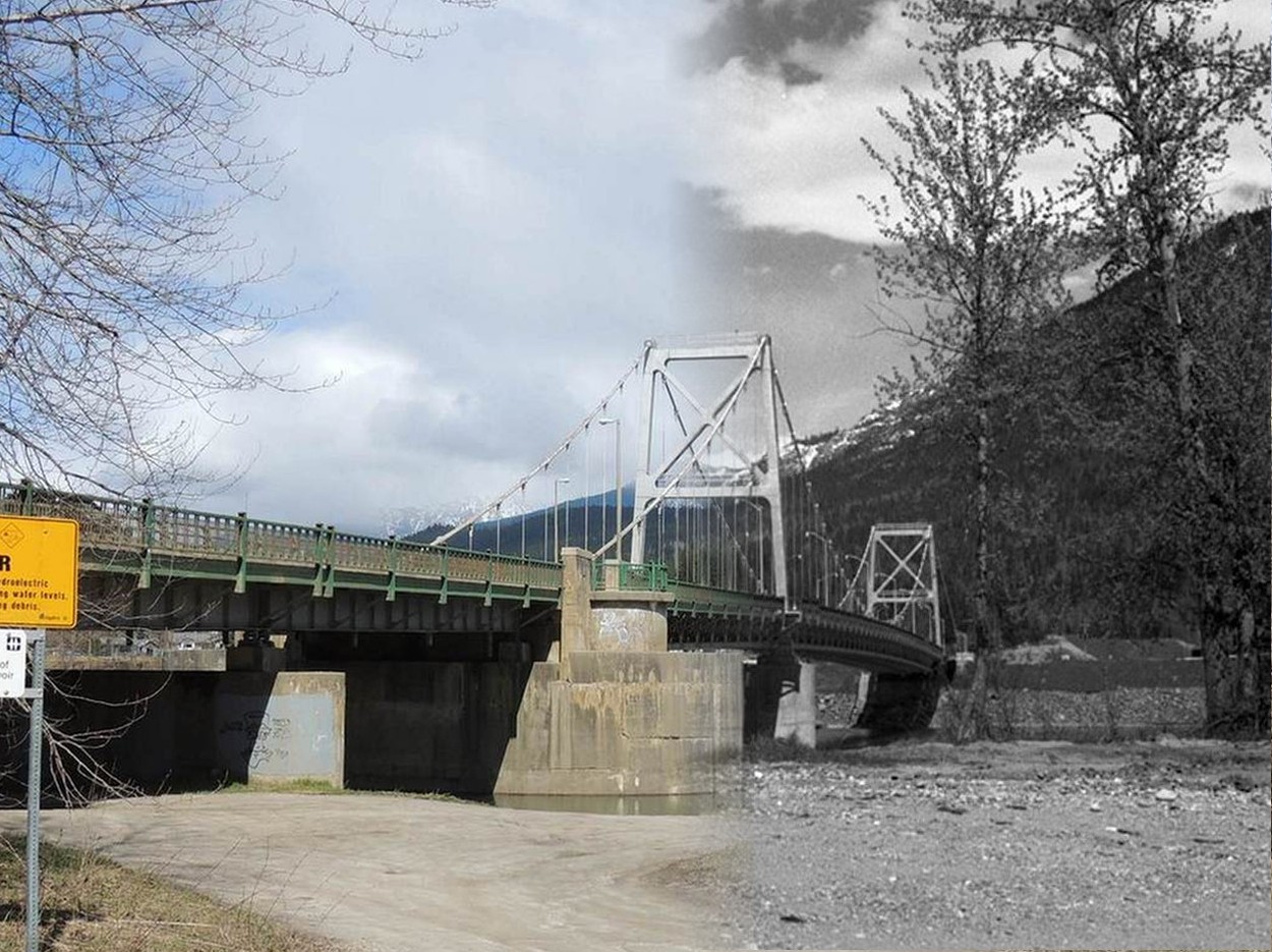
The Revelstoke Bridge is one of several crossings of the Columbia River by the TransCanada Highway on its way through the British Columbia interior. Completed in 1961 and officially opened on July 28 of that year, the bridge is 310-meters (1,016 feet) in length. It is accompanied by a Canadian Pacific Railroad bridge, immediately to the southeast, and the old six span single lane truss bridge, opened in 1924, to the southeast of the railway bridge.
Like much of the TransCanada Highway in the vicinity, the bridge has only two lanes. This (the two lane highway) was one of the major reasons for the construction of the Coquihalla Highway, officially opened on May 16, 1986. It serves as a bypass for much of the BC section of the TransCanada, though not this section.
"Now" and "Then" photos here were taken from the south end of the bridge off the east side, looking generally north. The "Then" photo was taken in 1961 or 1962, shortly after the bridge was opened.
|
|
Revelstoke Bridge - 1961-2017 |
|
|
Revelstoke Bridge - 2017-1961 |