
Centre of Missouri Valley History & Historic Highway
N 44° 26.531 W 100° 25.263
14T E 386917 N 4921969
Half way between the mouth to the source of the Missouri River, was the center of the fur trade for half a century.
Waymark Code: WMTJG
Location: South Dakota, United States
Date Posted: 10/08/2006
Views: 29
The center of the Missoui was a Native American capitol, with many villiages and fortresses, which can still be seen today.
These Native American developments were here in 1743 when Verendrye planted a lead plate for France.
Here, in 1804, Lewis and Clark counciled with the Teton Sioux on this very site.
Here, in 1811, the famous brawl, immortalized by Washington Irving, between Manuel Lisa and Hunt, leader of the Astorians, occurred.
Here, in 1817, there were many permanent fur posts.
Here, in 1831, the first steamboat Yellowstone came to carry away the buffalo and decimate the fabulous herds.
Here, in 1856, Harney counciled with the Sioux, the largest aggregation of Native Americans ever assembled.
Here, in 1863, Sully's expeditions of 1863 and 1864 against the Sioux jumped off.
Here, in 1876, was the steamboat head for the great Black Hills Gold Rush, and the railhead for its continuance from 1880 to 1886.
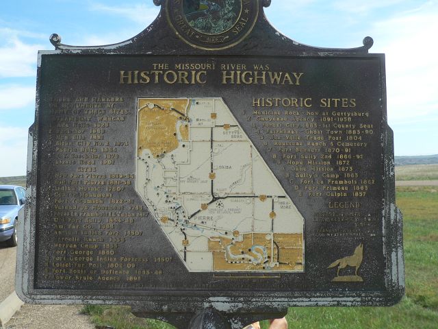
On the obverse side of the historic marker (photo to the right), is a Historic Highway map of the many markers, monuements, and historic sites from Ft. Thompson to Mobridge.