
27-16 Grahamville
Posted by:  mikemtn
N 32° 28.243 W 080° 57.902
17S E 503285 N 3592613
Located in Grahamville at the intersection of Roads 13 & 29. Erected by The Jasper County Historical Society in 2000.
Waymark Code: WMQ3A
Location: South Carolina, United States
Date Posted: 09/10/2006
Views: 23
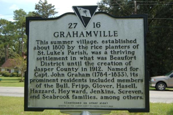
Text front: This summer village, established by the rice planters of St. Luke's Parish, was a thriving settlement in what was the Beaufort District until the creation of Jasper County in 1912. Named for Capt. John Graham (1784-1833), its prominent residents included members of the Bull, Fripp, Glover, Hassell, Hazzard, Heyward, Jenkins, Screven, and Seabrook families, among others.
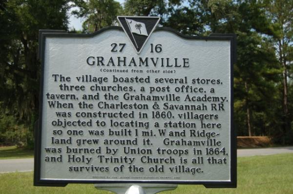
Text reverse: The village boasted several stores, three churches, a post office, a tavern, and the Grahamville Academy. When the Charleston & Savannah RR was constructed in 1860, villagers objected to locating a station here so one was built 1 mi. W and Ridgeland grew around it. Grahamville was burned by Union troops in 1864, and Holy Trinity Church is all that survives of the old village.
