
Thayer Game Refuge
Posted by:  flyingmoose
N 39° 31.844 W 079° 20.744
17S E 642173 N 4376981
This marker describes the land you see before you and that it was sold for the sole purpose of hunting game.
Waymark Code: WMN0V
Location: Maryland, United States
Date Posted: 08/21/2006
Views: 18
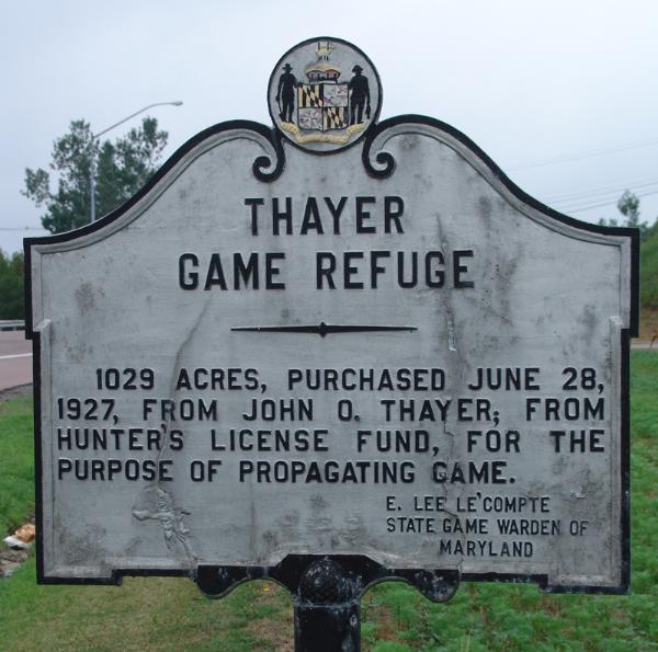
1029 Acres, Purchased June 28,
1927 from John O. Thayer, from
Hunter's License Fund, for the
purpose of propagating game.
Marker Type (optional): ----

County (required): Garrett County
Location (required): East of Deep Creek Lake along route 219
More info about the site/marker (optional): Not listed
Website for more info (optional): Not listed
|
Visit Instructions:
A photo of yourself and/or your GPS with the marker should be uploaded with each visit. The marker must be visible. If the marker is in a location that may be unsafe to pull over and stop, the best image you can provide (assuming you obtain the rest of the relevant information) should be sufficient.
If you submit a new waymark that gets accepted into the category, feel free to log a visit on it!