
McKee Bridge - Jackson County, Oregon
Posted by:  ddtfamily
N 42° 07.557 W 123° 04.363
10T E 493989 N 4663763
Marker providing historic information about the McKee Covered Bridge
Waymark Code: WMMZ3H
Location: Oregon, United States
Date Posted: 11/27/2014
Views: 3
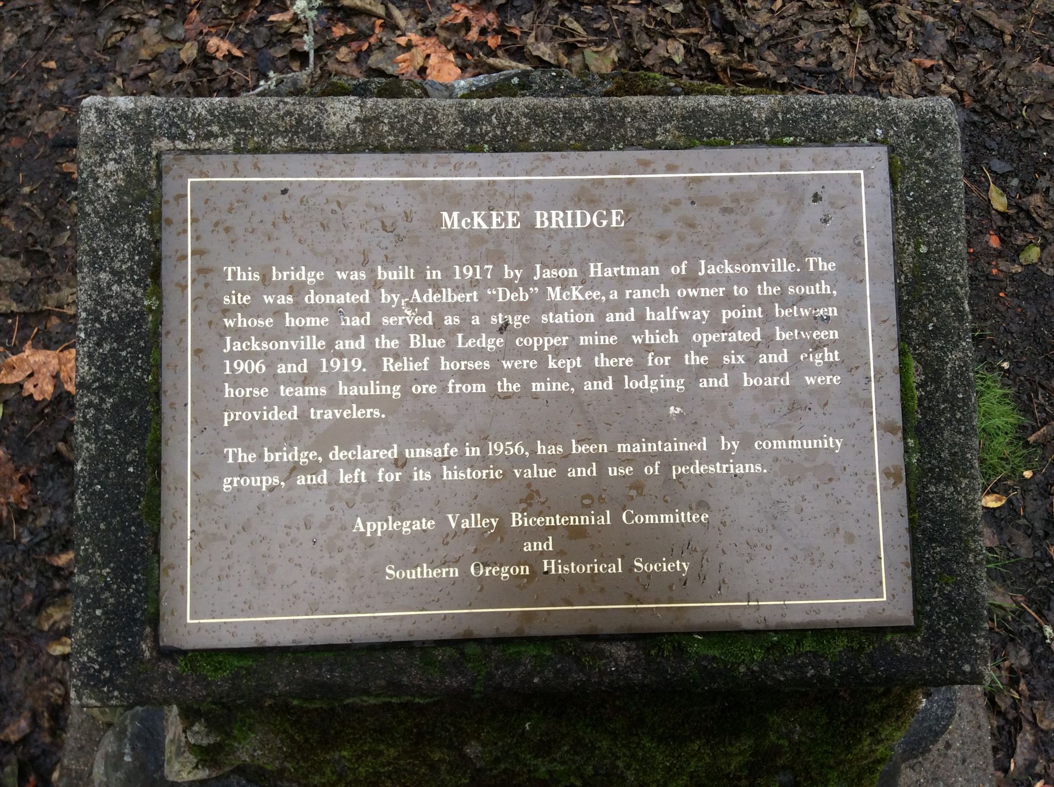
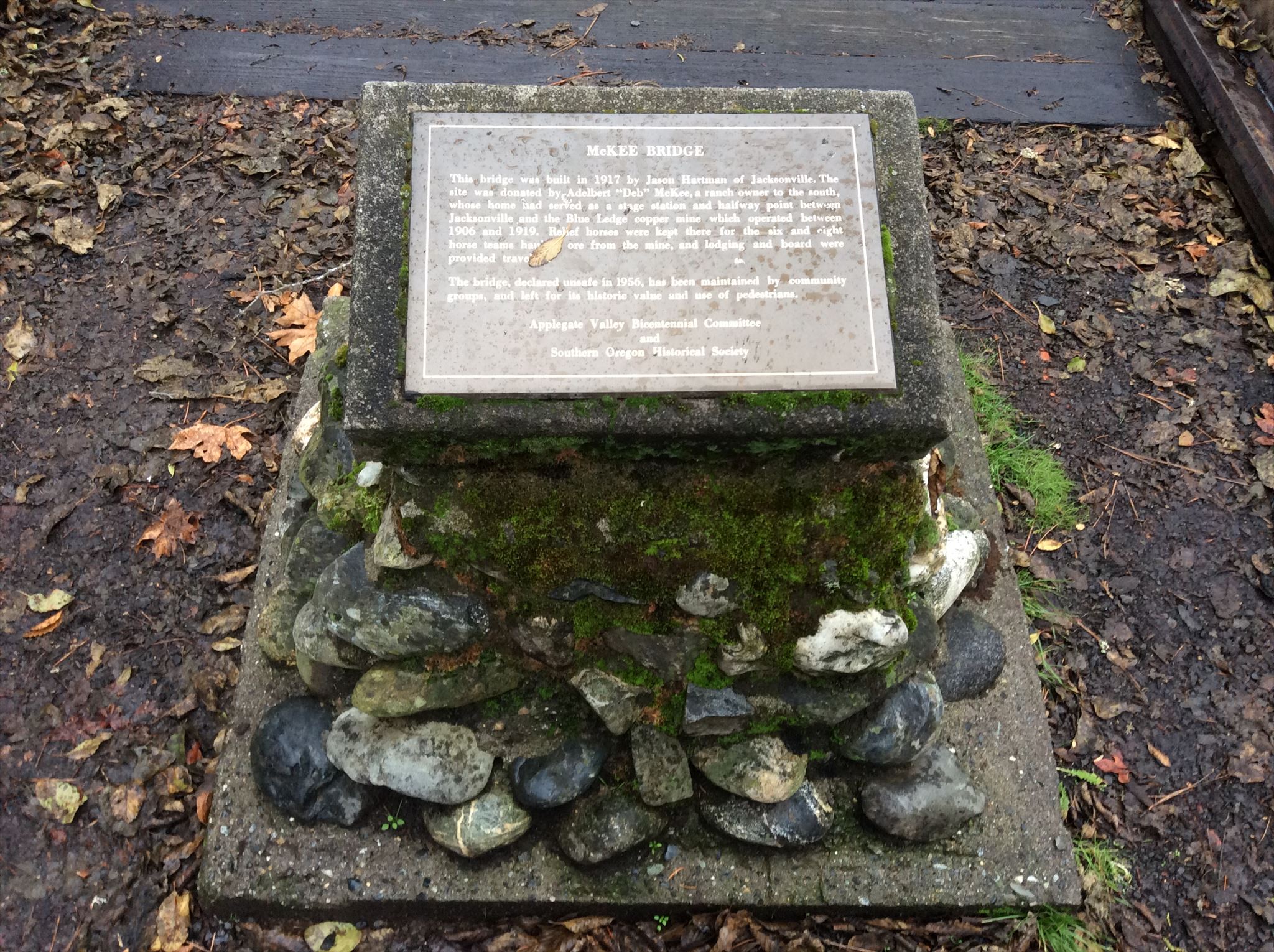
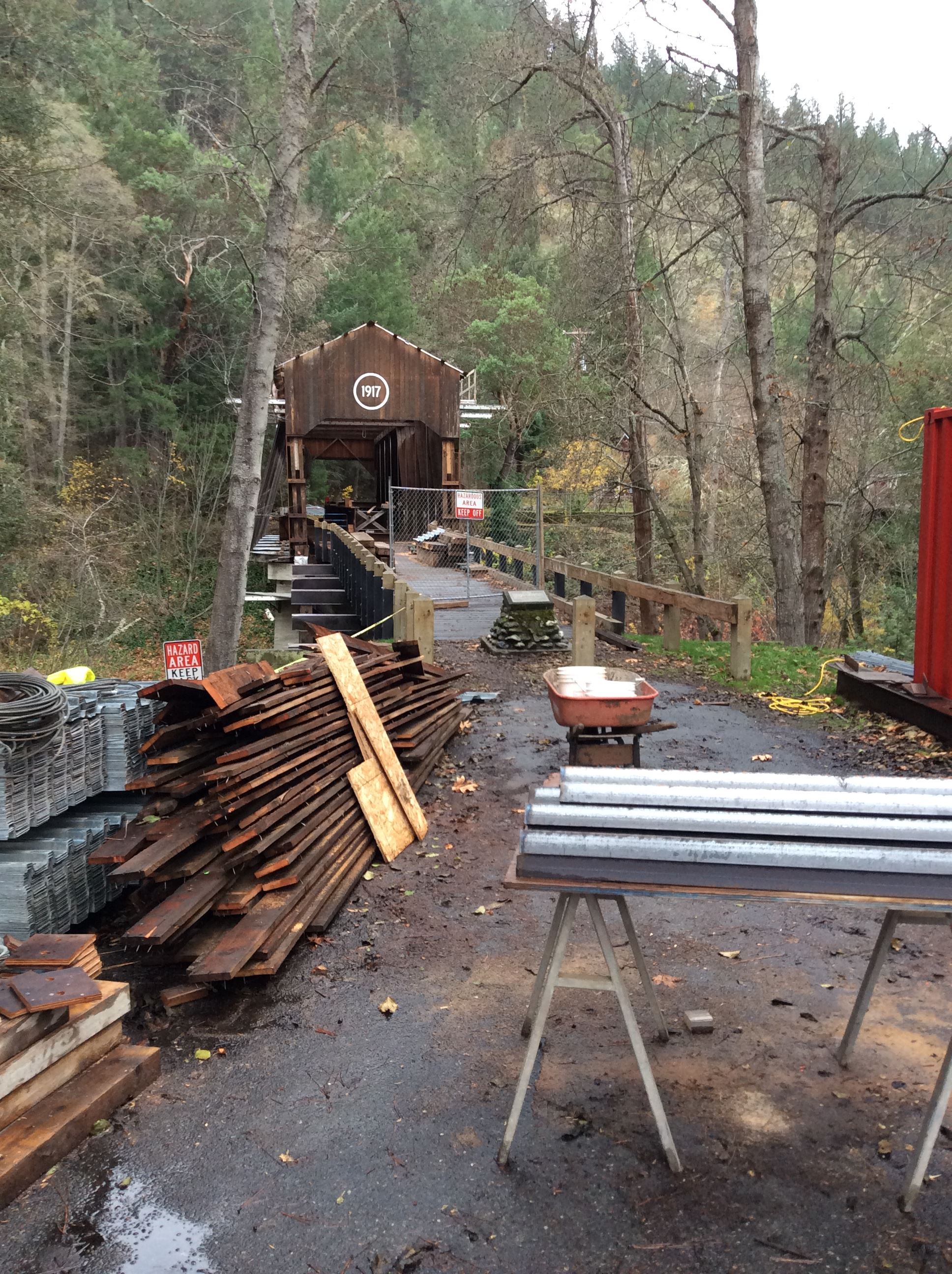
This historic marker is located at the north end of historic McKee bridge, a covered bridge dating to 1917 that crosses the Applegate River. The marker was placed by the Applegate Valley Bicentennial Committee and the Southern Oregon Historical Society. The text of the marker reads:
| McKEE BRIDGE
This bridge was built in 1917 by Jason Hartman of Jacksonville. The site was donated by Adelbert "Deb" McKee, a ranch owner to the south, whose home had served as a stage station and halfway point between Jacksonville and the Blue Ledge copper mine which operated between 1906 and 1919. Relief horses were kept there for the six and eight horse teams hauling ore from the mine, and lodging and board were provided travelers.
Applegate Valley Bicentennial Committee
and
Southern Oregon Historical Society |
Click a photo to enlarge
Visit Instructions:
Include your thoughts and observations pertaining to this location and your visit. Provide any additional history that you are aware of that pertains to this location. If the marker commemorates a historic building tell us what it is used for now or share with us the circumstances of an earlier visit to bring this locations history to life.
Please upload a favorite photograph you took of the waymark. Although visiting this waymark in person is the only thing required of you to receive credit for your visit, taking the time to add this information is greatly appreciated.
Be creative.