Geierhaupt - Seckauer Tauern, Austria
Posted by: Groundspeak Premium Member Rikitan
N 47° 22.472 E 014° 38.150
33T E 472507 N 5246849
Geierhaupt (2417m / 7930ft ASL) is the highest peak of Seckauer Tauern, part of Niederen (Lower) Tauern. It rises on the border between disctricts Mur and Leoben.
Waymark Code: WMMM8G
Location: Steiermark, Austria
Date Posted: 10/07/2014
Published By:Groundspeak Premium Member RakeInTheCache
Views: 6


Geierhaupt (2417m / 7930ft ASL) is the highest mountain in the Seckauer Tauern, which are part of the Niedere Tauern. It rises on the border of the municipalities Gaal and Wald am Schoberpaß which also forms the border between the districts of Mur and Leoben.
Access:
Marked trail leads from Wald am Schoberpaß or Unterwald in the Liesing ditch, the former farmstead Postl in the Ripplewood ditch, 
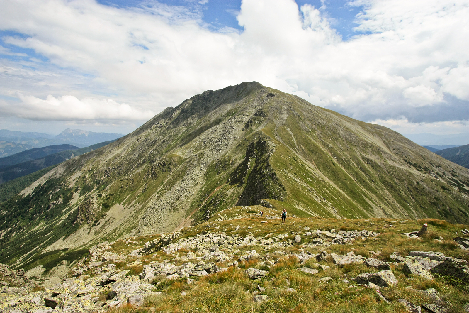
steep to the Hocheggriedel and finally the Grieskogel. It is long route, sure-footedness is required. Walking time from the forest about 5 hours, with car access in the Liesing trench 4 hours.

Another marked path leads from Gasthof Beisteiner to Bärensulsattel, continue to Lattenberg, Goldkogel and Kerschkern(Kogel), and finally through Schrimpfkogel from the west to the Geierhaupt summit. The route is exhausting because of its length and two major ascents, slip resistance is required. Walking time about 5 hours.

And finally, there are some not marked trails, that lead from Ingeringsee lake on the Saurücken or from Hintertriebental over the Schaunitztörl and require good sense for orientation and good knowledge of the terrain.


My Flickr album with more pictures: Seckauer Tauern by Rikitan
Sources: de.wikipedia.org, own visits and pictures at the site
Altitude in Feet: 7930

Visit Instructions:
To post a visit log for waymarks in this category, you must have personally visited the waymark location. When logging your visit, please provide a note describing your visit experience, along with any additional information about the waymark or the surrounding area that you think others may find interesting.

We especially encourage you to include any pictures that you took during your visit to the waymark.

Search for...
Geocaching.com Google Map
Google Maps
MapQuest
Bing Maps
Nearest Waymarks
Nearest Mountain Summits
Nearest Geocaches
Create a scavenger hunt using this waymark as the center point
Recent Visits/Logs:
There are no logs for this waymark yet.