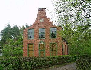
Hunter's Castle / Jagdschloß
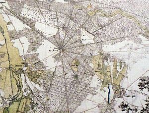
Historical map of the Trail Star |
In 1870, the Prussian Royal Geodetic Institute was founded. The Institute was an early leader in the observation and study of earthquakes. The world's first long distant measurement of seismic activities was carried out here in 1889, registering a quake taking place in Japan.
To precisely measure tectonic movements, the institude was looking for a long and absolutely straight line and found it at the Great Trail Star.
This was a hunting resort, founded by Prussian King Frederick William I, consisting of sixteen up to three-mile-long trails, leaving in all directions from the Hunter's Castle, which is locate in the center of the area.
Benchmarks were installed in the center and at the end of all trails around the end of the 19th century and measurements were taken after each registered earthquake.
The benchmarks at the trail ends are lost, but the two marks at the western wall of Hunter's Castle are still existing.
|