
The Carolina Road
Posted by:  pixieslayer
N 38° 51.651 W 077° 38.234
18S E 271173 N 4304640
This describes the origins of the Carolina road, which is roughly about where US 15 is at this point.
Waymark Code: WMK33
Location: Virginia, United States
Date Posted: 08/03/2006
Views: 23
 The Carolina Road
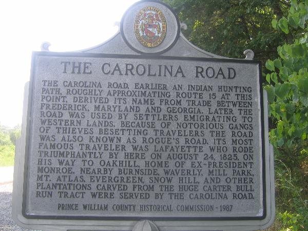
The Carolina Road, earlier an Indian hunting path, roughly approximating Route 15 at this point, derived it's name from trade between Frederick, Maryland and Georgia. Later the road was used by settlers emigrating to the western lands. Because of the notorious gangs of thieves besetting travelers the road was also known as a rogue's road. Its most famous traveler was
Lafayette who rode triumphantly by here on August 24, 1825, on his way to
Oakhill, home of ex-president
Monroe. Nearby Burnside, Waverly, Mill Park, Mt. Atlas,Evergreen, Snow Hill, and other plantations carved from the huge Carter Bull Run tract were served by the Carolina Road.