Craters of the Moon National Monument and Preserve is characterized as a landscape of weird beauty. The coordinates above take you the visitors Center. Three young and well preserved lava fields are covering about 2,000km². The landscape is obviously resembling the surface of the moon, or at least what we think the moon looks like. Robert Limbert, who explored and promoted the area at the beginning of the 20th century, used the name Craters of the Moon first, in an article for a national magazine. It was so concise, it was soon used by everyone.
A scenic drive of 11km offers vies of the lava fields and cinder cones on Snake River Plain. Volcanic activity occurred here for many millions of years, but the area of the park was formed by eruptions, which started 15,000 years ago and ended 2,100 years ago. But it is called a dormant volcanic area, and will most likely become active within the next 1,000 years.
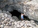
The park is visited, like most parks of the U.S.A., by driving along the scenic loop road. At various parking areas trails start into the lava fields. One of those trails is called The Cave Trail, and leads to several volcanic caves, lava tubes, which are not developed but may be visited. The whole trip to the caves and back, including the cave visits is about 3km long and you should plan two hours, if you want to explore the caves.
Click the links or the thumbnailed pictures to get to the individual waymarks for each cave.
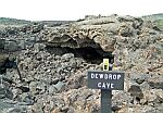 |
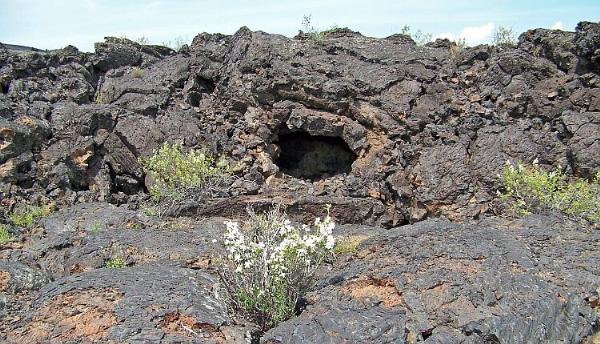
Dew Drop Cave is the first cave along the trail. The cave is very small, a collapse of the roof allows access to a single chamber with a heap of debris in the center, from the collapsed roof. It is almost completely visible from the path and should not be entered because of the steep walls. |
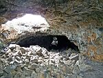 |
Indian Tunnel is a large lava tube. In is entered on a staircase through one of numerous roof collapses. Because of the high amount of openings, most of the cave is bright enough to visit even without a lamp. Nevertheless we recommend enough light sources for the cave visits, two per person at least, if you are a party, three if you are alone. The tunnel is of impressive size and very easy. The exit on the other end requires a little climbing across a rock pile and through a narrow opening, but it is also possible to turn around. |
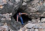 |
Boy Scout Cave contains ice all year round, the floor is covered by ice and often water too. The entrance through a collapse doline is right in the middle of the tube. The western branch contains the ice and is a little bigger in size. The eastern branch is often low and narrow, and requires some easy climbing and stooping until you reach the Back Door, formed by a huge roof collapse. This cave requires warm clothes (which may get dirty), sturdy and warm shoes, and enough light. A hard hat is a good idea. |
|
Boy Scout Cave continues after the huge collapse, but it is now called Beauty Cave. The very first part is difficult and only for cavers, but the next collapse is an entrance to the cave. However, the official entrance is at the far end and much more comfortable. It uses a bigger collapse forming a spacious entrance to the lava tube. The cave is 100m long and has two spacious sections of about 35m, which are connected by a tight crawl. There are several narrow off-branches, one of them leading to the deepest point of all caves. For exploring narrow parts and the crawl, we again recommend, old and warm clothes, sturdy shoes and a hard hat. The entrance chamber with its smooth pahoehoe lava floor may be visited without special clothes.
|
One more cave, called Buffalo Cave, is reached on another trail, the Broken Top Loop Trail (3km, 45min). The cave entrance is located south of the Broken Top, only a few hundred meters from the southernmost parking area. It is allowed to visit the cave, but it requires climbing over loose rock and crouching under low ceilings. Again we strongly recommend appropriate equipment.
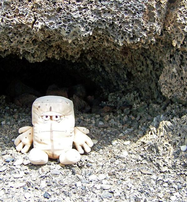
There is a lot more to discover and Bernd das Brot found his own little cave - unfortunately too small for humans.