BOB - Nelson, BC
Posted by:  T0SHEA
N 49° 30.487 W 117° 16.896
11U E 479613 N 5483981
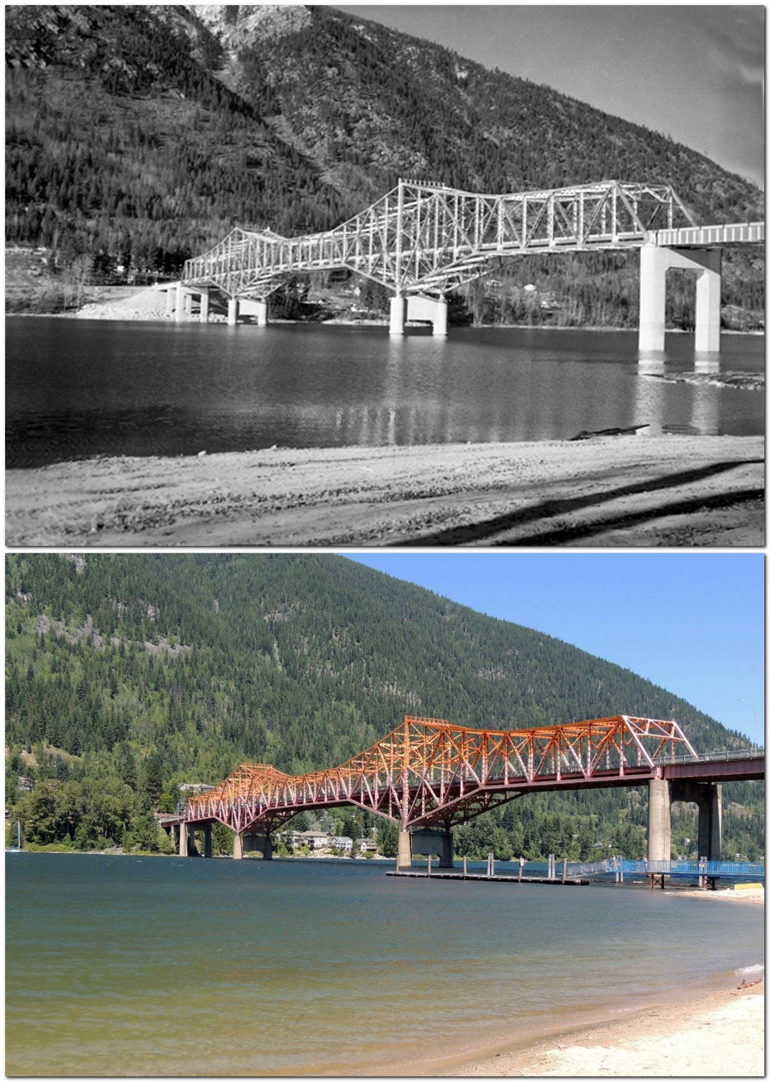
Meet "BOB", the Big Orange Bridge across the west arm of Kootenay Lake at Nelson.
Waymark Code: WMHK7E
Location: British Columbia, Canada
Date Posted: 07/18/2013
Views: 3
The photos were taken from the beach in Rotary Lakeside Park, the largest park in Nelson. The original was taken circa 1960, the now photo, July 16th, 2013.
The bridge was built in 1957, to the great relief of the locals, as it replaced a ferry which by that time was seriously overtaxed. The ferry had been put in the river in 1911 - the locals had been petitioning Victoria(BC's capital) for a bridge since 1910.
For the first several years of its life, this $4,000,000 structure was a toll bridge. Originally painted grey and green, the bridge attained its lasting moniker when repainted the bright orange that it sports today.