
Medicine Lake Volcano - Siskiyou County, CA
N 41° 44.285 W 121° 31.745
10T E 622317 N 4621741
This orientation table is located within the Lava Beds National Monument (seasonal fees may apply) and at the Schonchin Butte Fire Lookout in Siskyou County, CA.
Waymark Code: WMGWAJ
Location: California, United States
Date Posted: 04/15/2013
Views: 4
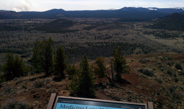

This orientation table is located at the Schonchin Butte Fire Lookout and focuses on the Medicine Lake Volcano and reads:
Medicine Lake Volcano
The broad, gently sloping profile of the Medicine Lake shield volcano spans the southern horizon before you like a warrior's curved shield. As with other volcanoes of the Cascades Range, volcanic activity here is caused by a dense tectonic plate under the Pacific Ocean sliding beneath the continental plate. Several hundred miles inland and deep underground, the edge of the subducted plate melts. The resulting magma erupts and builds a chain of volcanoes from northern California to British Columbia. Over the last half-million years, eruptions from numerous magma chambers beneath the surface have built the vast Medicine Lake volcano layer upon layer. Today, it is the largest volcano by volume and surface area in the Cascades Range.
The Medicine Lake shield volcano is also mentioned on Wikipedia as the largest volcano by volume in the Cascade Range here, the USGS website here, and a great link to a PDF document from the National Park Service that highlights the wonderful attributes of the Medicine Lake shield volcano within the Lava Beds here.
Visitors who are able to make the trek up here are welcomed with some spectacular views of the surrounding landscape.