
Jacob Conser Bridge - Jefferson, Oregon
Posted by:  ddtfamily
N 44° 42.898 W 123° 00.827
10T E 498907 N 4951288
The Jacob Conser Bridge, a classic Conde B. McCollough reinforced-concrete through arch design spanning the Santiam River
Waymark Code: WMF5RC
Location: Oregon, United States
Date Posted: 08/27/2012
Views: 1
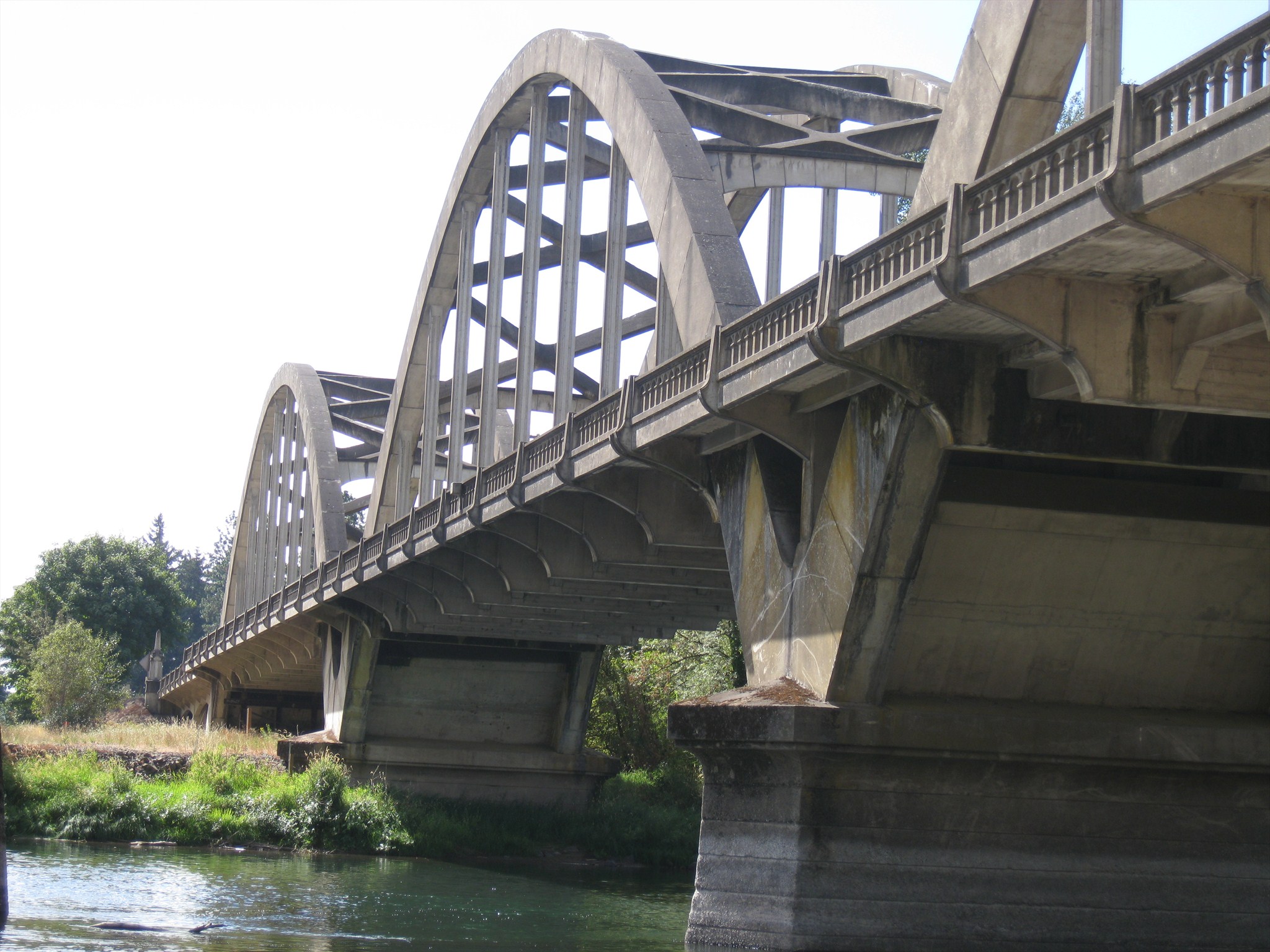
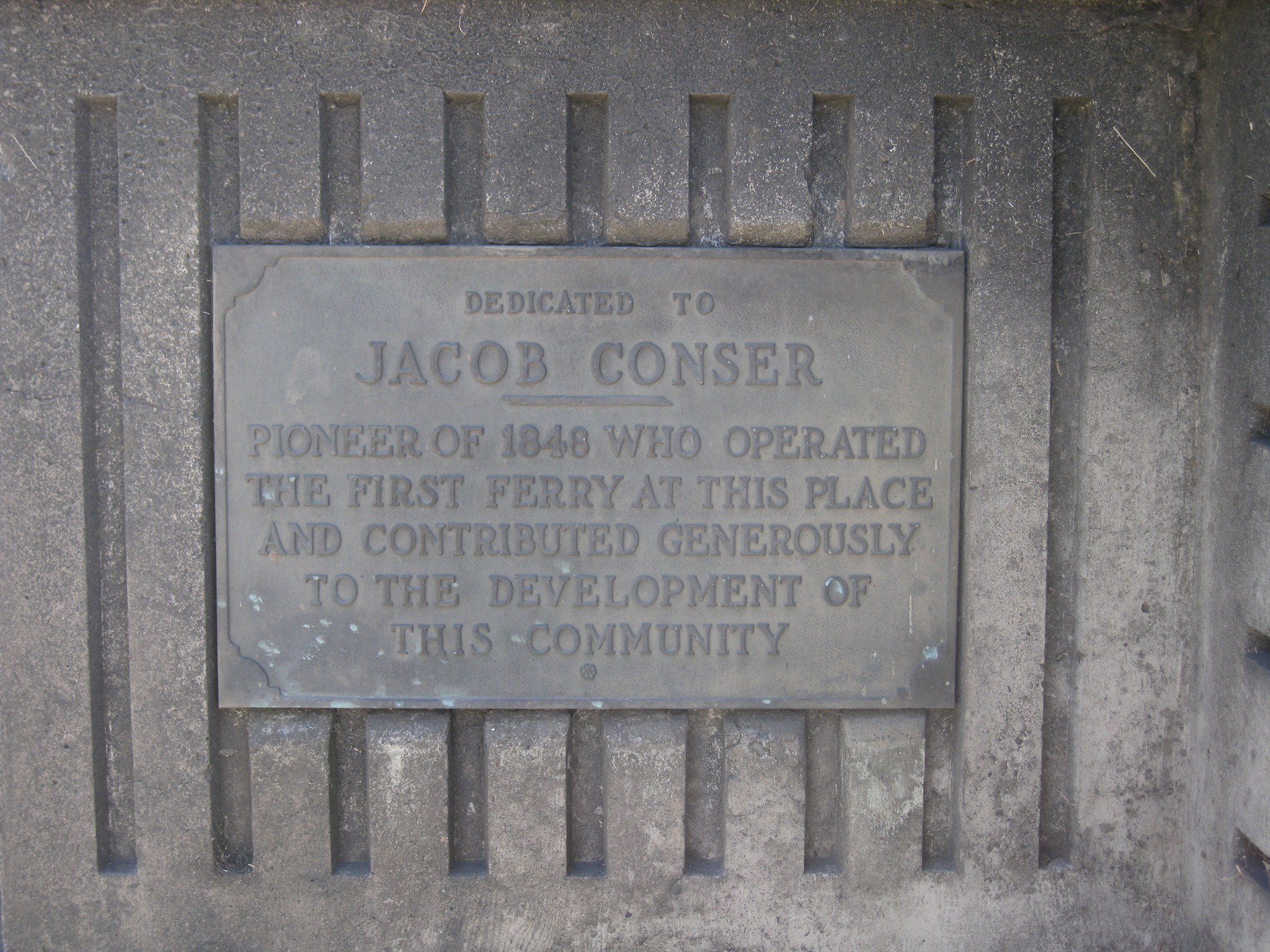
When most people think of the work of Conde B. McCullough, Oregon's Master bridge builder, they probably envision the many bridges along the Oregon Coast Highway. However, there are many McCullough designs across the state and this reinforced-concrete through arch, spanning the Santiam River at Jefferson, is a beauty. The bridge is dedicated to Jacob Conser, an early pioneer to the Oregon Territory and founder of the city of Jefferson.
Like several other McCullough designs, the bridge features obelisk-shaped entrance pylons. The bridge has three rainbow arches, spanning roughly 200 feet each. A Union Pacific Railroad bridge stands immediately adacent, just south of the Conser span.
The bridge was one of the last of McCullough's career and was financed by the Public Works Administration, a program created by the National Industrial Recovery Act of 1933. In the near future, decisions will need to be made about it's fate as it is now functionally obsolete and truck traffic is limited to vehicles under 80,000 pounds. The bridge currently supports average daily traffic of about 7,200 vehicles.