
Cumberland Gap NHP - Middlesboro, KY
Posted by:  Lat34North
N 36° 36.173 W 083° 41.715
17S E 258919 N 4054202
For centuries the Cumberland Gap has been a passageway through the Allegheny Mountains in 1775, Daniel Boone blaze the Wilderness Road through the Cumberland Gap into central Kentucky. Over 200,000 pioneers came over the Wilderness Road.
Waymark Code: WMF4MP
Location: Kentucky, United States
Date Posted: 08/22/2012
Views: 9
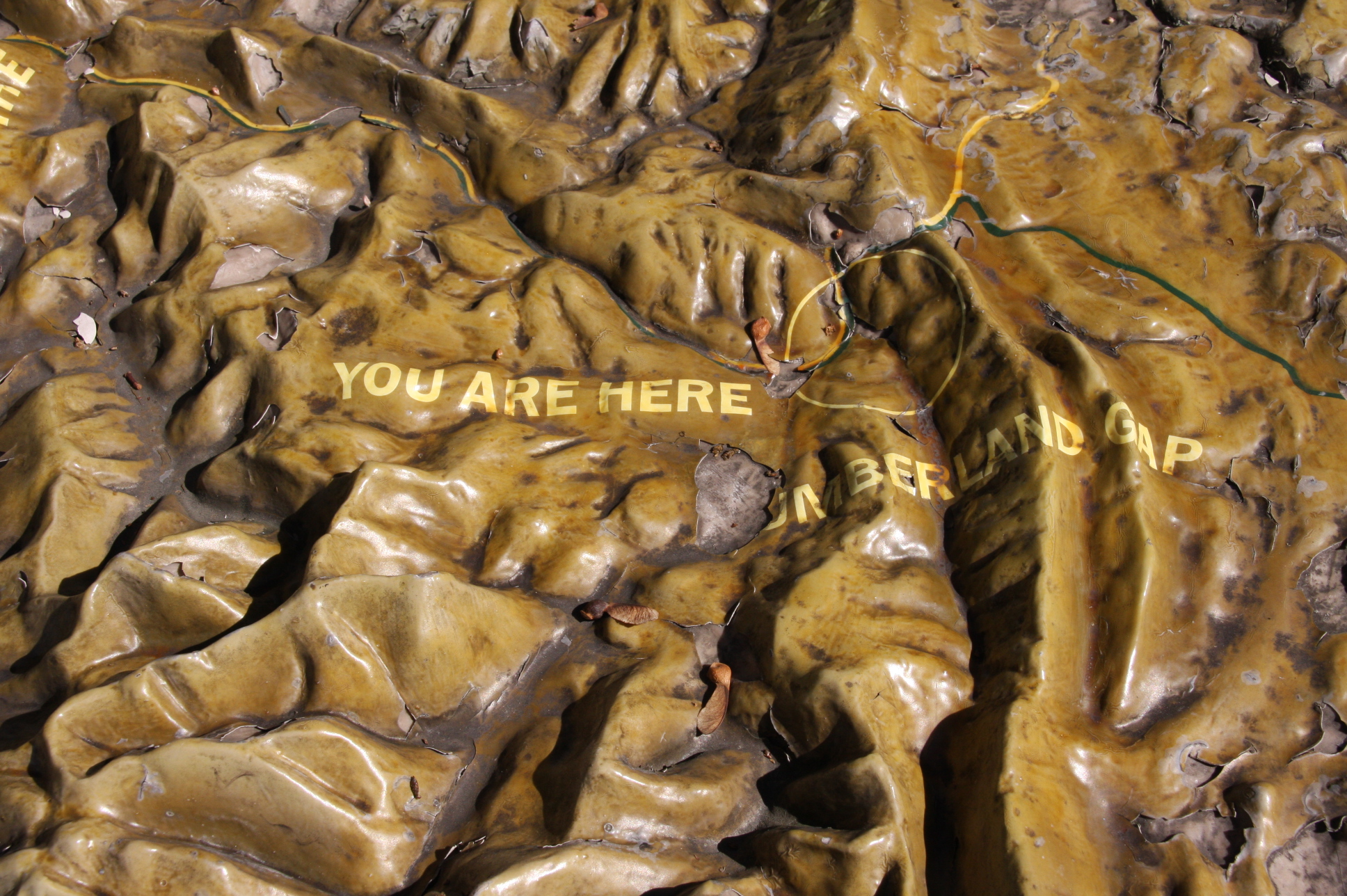
This 3-D map is located near the main entrance to the Cumberland Gap NHP Visitor Center. The area Shown is the pass through the Cumberland Mountains region of the Appalachian Mountains. The gap is located near the point where the states of Kentucky, Tennessee and Virginia meet. The Elevation of the pass is 1,600 ft (490 m).
From the National Park Service web site:
Cumberland Gap National Historical Park
"At Cumberland Gap, the first great gateway to the west, follow the buffalo, the Native American, the longhunter, the pioneer... all traveled this route through the mountains into the wilderness of Kentucky. Modern day explorers and travelers stand in awe at this great gateway and the many miles of trails and scenic features found in the park.
Wild Mountain Scenery
Scenic vistas, cascading waterfalls, and lush forests excite the senses and provide the opportunity to experience the Southern Appalachians up close. The forests and streams of the mountains provide habitat for numerous species of plants and animals.
85 miles of trails and numerous scenic areas provide the opportunity to explore the great outdoors!"
More Information:
Wikipedia -
Cumberland Gap