
Zook's Mill Covered Bridge - West Earl Twp., PA
N 40° 07.820 W 076° 13.885
18T E 395085 N 4442949
Yet another fantastic, red covered bridge in Lancaster County. The bridges are virtually identical. This one was almost washed away in '72 by Agnes as indicated by historical records and the high water marker present.
Waymark Code: WM9RAA
Location: Pennsylvania, United States
Date Posted: 09/23/2010
Views: 18
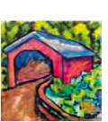
Zook's Mill Bridge, one of the older bridges in Lancaster County. Built by Henry Zook in 1849 for $700, this bridge is also known as Wenger’s Mill Bridge. Flood waters from Hurricane Agnus rose 6 1/2 ft. above the bridge floor, but did not destroy the bridge. The bridge is located 1/2 mile north of Highway 272 and Rose Hill Road on Log Cabin Road.
The bridge has a single span, wooden, double Burr arch trusses design with the addition of steel hanger rods. The deck is made from oak planks. It is painted red, the traditional color of Lancaster County covered bridges, on both the inside and outside. Both approaches to the bridge are painted red with white trim.
From Wikipedia: The bridge is 74 feet long and 13 feet three inches wide. It has a wooden burr type truss and was built in 1849 by Henry Zook. Unlike many other bridges in the county the bridge withstood Hurricane Agnes, despite being filled with 6-and-a-half feet of water. It is also known as the Wenger Covered Bridge, the Rose Hill Covered Bridge, and the Cocalico #7 Bridge.
Dimensions
- Length: 74 feet (22.6 m) span and 89 feet (27.1 m) total length
- Width: 13 feet 3 inches (4.0 m) clear deck and 15 feet (4.6 m) total width
- Overhead Clearance: 11 feet 6 inches (3.5 m)
- Underclearance: 9 feet 6 inches (2.9 m)