
Mount Bierstadt Summit Trail
Posted by:  Team Laxson
N 39° 34.958 W 105° 40.130
13S E 442562 N 4381648
Mount Bierstadt is the 39th tallest peak in Colorado, towering 14,060 feet
Waymark Code: WM96R2
Location: Colorado, United States
Date Posted: 07/06/2010
Views: 8
Mount Bierstadt: 14,060
Mount Bierstadt is the 39th tallest peak in Colorado, towering 14,060 feet
above sea level. Biestadt is often refered as 'the easy 14er, but don't let
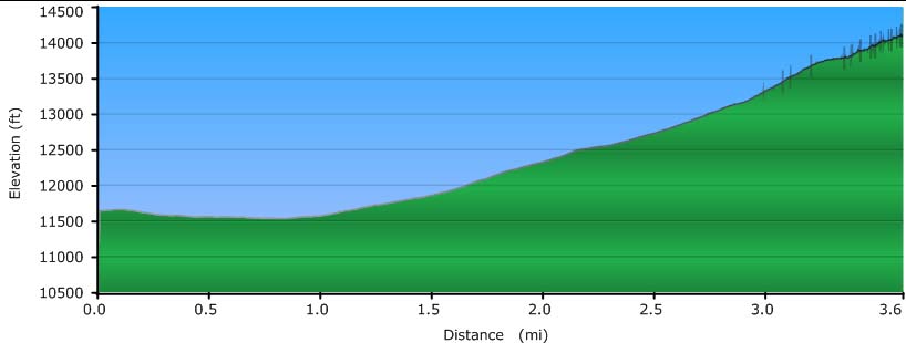
that influence your decision to hike this trail. The trail (standard route)
gains 2,850 ft over 3.6 miles leading up to the summit, with the entire distance of
your hike being above tree line.
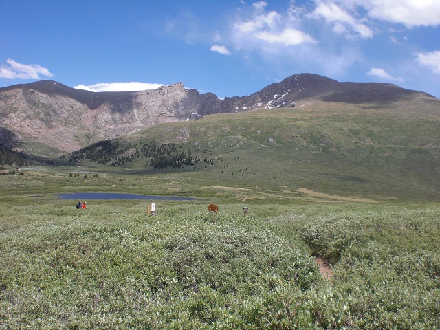
The hike begins downhill, bringing you through a forest of xxx bushes. The ground is frequently sloppy, so footbridges were built to prevent excessive wear to the area.

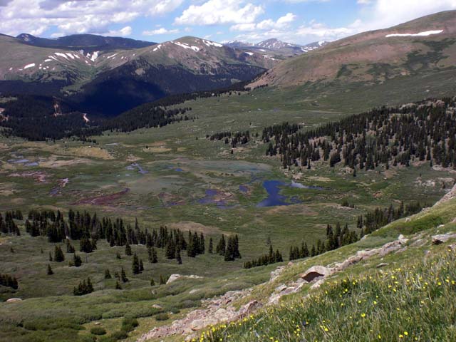
Beyond that, the trail gradually gains altitude over the next few miles, roughly about 1,000ft per mile. Switchbacks are scarce along the trail and the elevation gain seems relentless. Along the way, you'll see plenty of wildflowers, bushes, and even a stream crossing. When you look back toward the trailhead, you'll be rewarded with a wonderful view, including pockets of water, streams, and other nearby mountains.


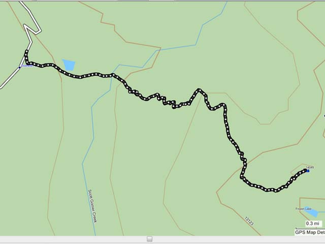
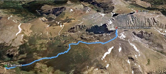
The hike visualized:
Driving Directions:
From Denver/North:
Get on I-70 heading West to Georgetown. From there, take CR381 South to the trailhead. The road is dirt and bumpy in places, but should be passable in all types of vehicles. As always, proceed with your comfort level.
From South:
Get on Hwy 285 near Lakewood and head West to Grant. From there, take CR62 North to the trailhead (it turns into CR 381 once you cross the county border). The road is dirt and bumpy in places, but should be passable in all types of vehicles. As always, proceed with your comfort level.