
Mapleton Hill Pioneer Trail
Posted by:  TheBeanTeam
N 44° 04.468 W 123° 55.267
10T E 426242 N 4880556
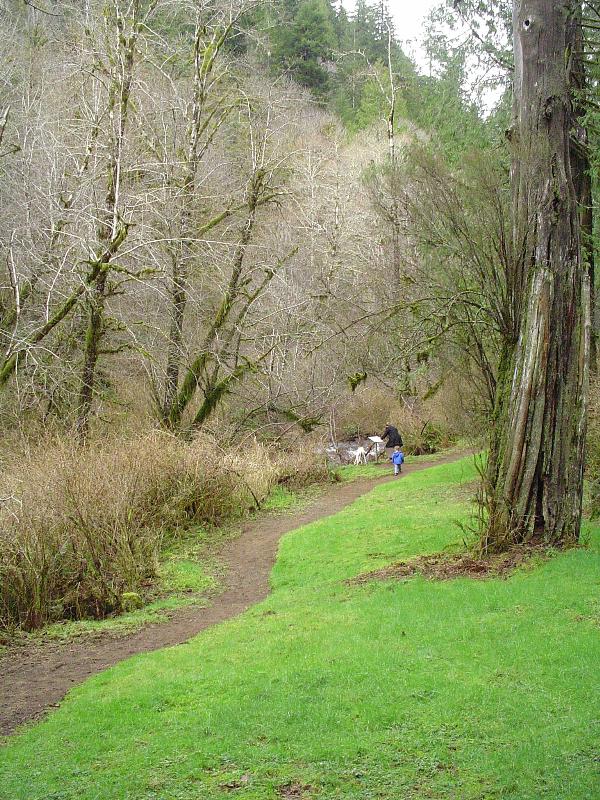
This marker can be found at the beginning of a lovely forest stroll filled with historic details of the area.
Waymark Code: WM8K2
Location: Oregon, United States
Date Posted: 03/08/2006
Views: 10
This is the first of several markers along this trail.
Marker Text:
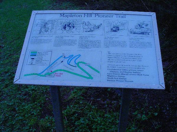
Mapleton Hill Pioneer Trail
Animal and Aboriginal Trail
Pre-1875
Deer and other traveling animals cut the first paths through thick forest vegetation. Early Native Americans then followed and improved these paths on their hunting expeditions, creating the first trails.
North Fork Pioneer Trail
1875-1908
This area officially opened for settlement in 1875 when the Coast Indian Reservation closed. White settlers used existing trails as they sought new areas to hunt, trap and stake homesteads. Families and cattle herds soon followed and settlers realized that the trail had become too small to handle the increasing traffic.
On The Road Again
1916-1927
A new problem appeared when people started trading in their wagons for the new “horseless carriage,” the car. The road’s narrow width and 13 tight switchbacks gave vehicles a rough time. Around 1916, Locals widened this dirt road and enlarged the switchbacks to accommodate the automobile.
Latest Construction
1927-Present
Even with the latest construction, traveling this road proved miserable and scary. The need for major reconstruction quickly became a necessity. In 1927, Lane County eliminated seven of 13 switchbacks, widened and rocked the road, and added turnouts for passing vehicles.
The rich history of Mapleton Hill Road makes it eligible for the National Register of Historic Places. To enjoy that history yourself, take a short walk along a piece of the original road and trail.
This trail was made possible through the efforts of the USDA Forest Service
in cooperation with:
Confederated Tribes of Coos, Lower Umpqua, and Siuslaw Indians
Lane County Sheriff’s Forest Work Camp
Mapleton Grange
North Fork Grange
Visit Instructions:
Include your thoughts and observations pertaining to this location and your visit. Provide any additional history that you are aware of that pertains to this location. If the marker commemorates a historic building tell us what it is used for now or share with us the circumstances of an earlier visit to bring this locations history to life.
Please upload a favorite photograph you took of the waymark. Although visiting this waymark in person is the only thing required of you to receive credit for your visit, taking the time to add this information is greatly appreciated.
Be creative.