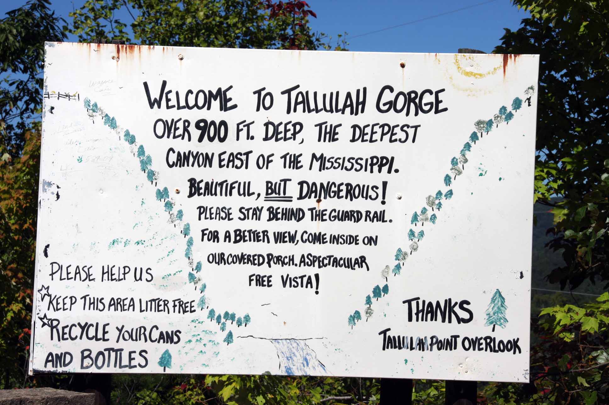
Sign at the historic overlook point.
Coordinates are from the visitors center - Tallulah Gorge State Park
Coordinates for overlook point are: N 34 43.765 W 83 23.001
Source Wikipedia http://en.wikipedia.org/wiki/Tallulah_Gorge
The Tallulah Gorge is a gorge that is formed by the Tallulah River cutting through the Tallulah Dome rock formation. The gorge is approximately two miles long and features rocky cliffs up to 1,000 feet (304 m) high. Through it, a series of falls known as Tallulah Falls, drop a total of 150 meters or 500 feet in one mile (1.6 km). Tallulah Falls is actually composed of six separate falls: l'Eau d'Or (46 ft), Tempesta (76 ft), Hurricane (the tallest at 96 feet), Oceana (50 ft), the smooth "sliding rock" at Bridal Veil (17 ft) and Lovers Leap (16 ft). The Tallulah Gorge is located next to the town of Tallulah Falls, Georgia. Tallulah Gorge State Park protects much of the gorge and its waterfalls. The gorge is considered to be one of the Seven Natural Wonders of Georgia.
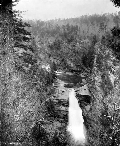
Tallulah Falls. Rabun County, Georgia. ca. 1894.
Hillers, J.K.
Source: U.S. Geological Survey Photographic Library
Just above the falls is Lake Tallulah Falls, created in 1913 by a hydroelectric dam built by Georgia Railway and Power (now Georgia Power) in order to run Atlanta's streetcars. The dam still collects and redirects most of the water via a 6,666 foot tunnel sluice or penstock (pipe) around the falls to an electricity generation station downstream that is 608 feet lower than the lake, except for a few days each year. The days when water is released are very popular for recreation, such as kayaking and whitewater rafting.
Since the early 1800s, Tallulah Gorge and its waterfalls have been a tourist attraction. In 1882, Tallulah Falls Railway was built, increasing the accessibility of the area to tourists from Atlanta and south Georgia, and the gorge became North Georgia's first tourist attraction. Resort hotels and bars sprung up to serve the tourist trade, which, after the addition of the railway, swelled to as many as 2,000 people on Sunday alone. In 1883, tightrope walker Professor Leon crossed the gorge as part of publicity stunt for one hotel. On July 18, 1970, Karl Wallenda became the second man to walk across the gorge on a tightrope.
In the 1910s, Georgia Railway and Power began building dams on the river. The town of Burton, Georgia was purchased and flooded as Lake Burton in 1919. Many area residents opposed the dams, including the widow of Confederate general James Longstreet, Helen Dortch Longstreet, who led a campaign in 1911 to have Tallulah Gorge protected by the state. The Georgia Assembly was unable to raise the $1 million required to purchase the gorge. Although her campaign was not successful, it was one of the first conservation movements in Georgia. When the dam was completed in 1913, the roar of the Tallulah Falls (the roar could be heard for miles from the gorge) was quieted, and tourism dwindled. It was not until 1993 that the Tallulah Gorge State Park was created by Georgia governor Zell Miller in cooperation with Georgia Power.
Although tourism promoters in the late 1800s described the word Tallulah as meaning "loud waters" in Cherokee, it actually has no meaning in that language. The most likely source of the word is the Okonee (a branch of the Creek Indians) word talula, which means "town." The Okonee People occupied northeastern Georgia and northwestern South Carolina for hundreds of years prior to the arrival of the Cherokees in the early 1700s.
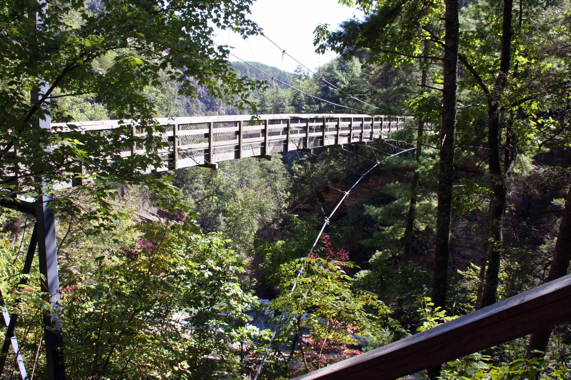
Suspension bridge over the
Tallulah River and
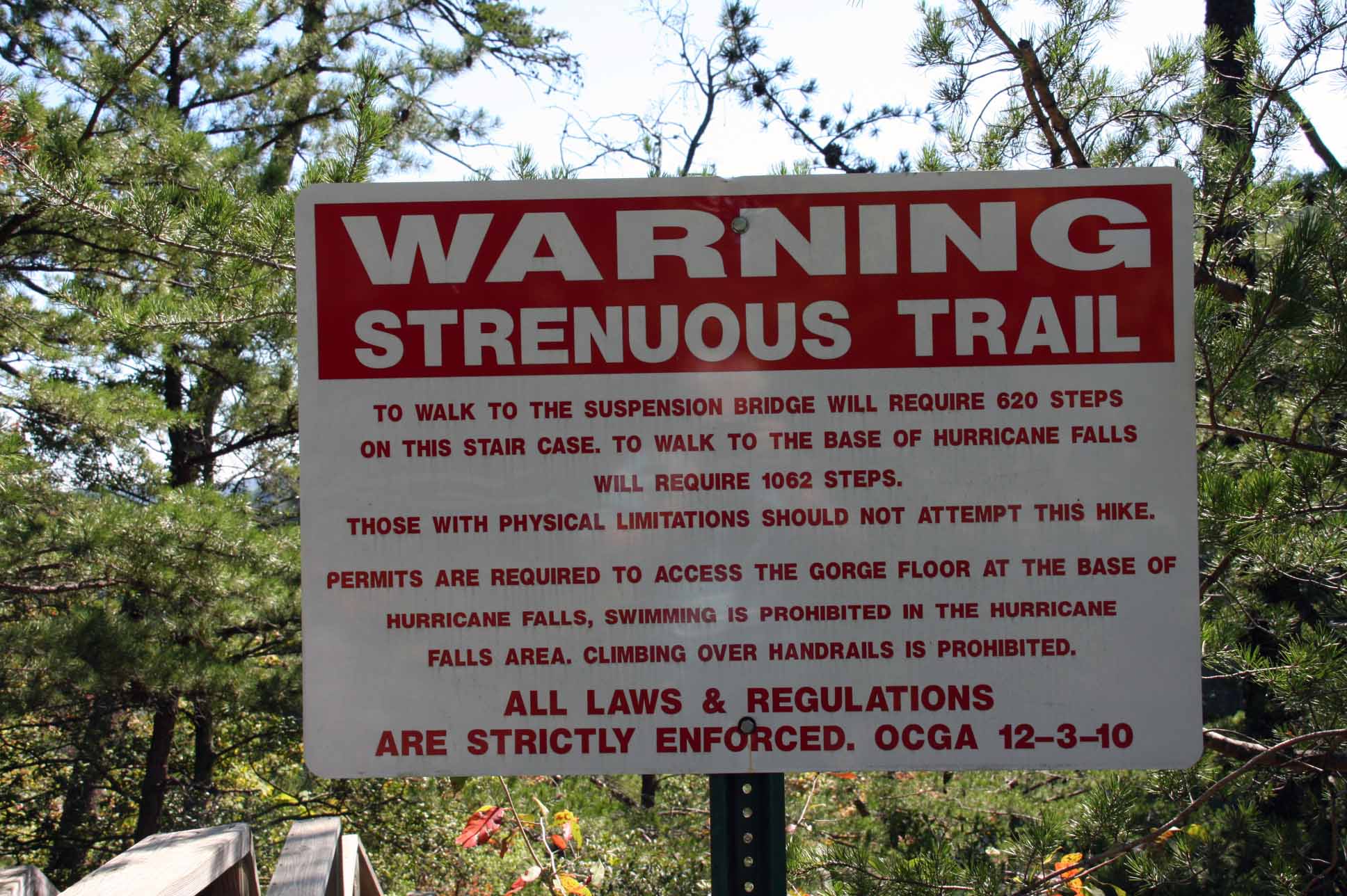
Warning sign – the 310 steps down are easy
It’s the 310 on the way back up that will get you.