Unicoi Turnpike - GA
N 34° 41.209 W 083° 42.616
17S E 251712 N 3841656
This valley has long been a connector for those traveling through the area--from a Cherokee traiding path to the first vehicle route from Augusta to Chattanooga to North Carolina through the Georgia mountains.
Waymark Code: WM7648
Location: Georgia, United States
Date Posted: 09/07/2009
Views: 7
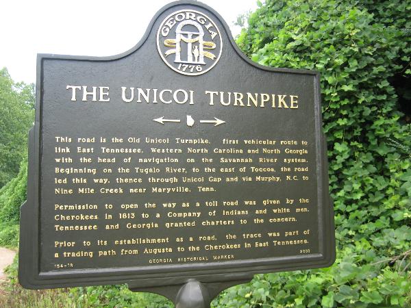
This road is the Old Unicoi Turnpike, first vehicular route to link East Tennessee, Western North Carolina and North Georgia with the head of navigation on the Savannah River System. Beginning on the Tugalo River, to the east of Toccoa, the road led this way, thence through Unicoi Gap and via Murphy, N.C. to Nine Mile Creek near Maryville, Tenn.
Permission to open the way as a toll road was given by the Cherokees in 1813 to a Company of Indians and white men. Tennessee and Georgia granted charters to the concern.
Prior to its establishment as a road, the trace was part of a trading path from Augusta to the Cherokees in East Tennessee.