
Mount Cutler Trail - Colorado Springs, CO
Posted by:  condor1
N 38° 47.510 W 104° 53.161
13S E 509898 N 4293682
The Mount Cutler trail is locate along the edge of the Stratton Open Space on the extreme western edge of Colorado Springs. It is literally up against the eastern mountains of the Colorado Rockies.
Waymark Code: WM6HY7
Location: Colorado, United States
Date Posted: 06/07/2009
Views: 8
This beautiful trail is considered "Moderate to Low" in the difficulty scale. Clocked with my GPS the actual trail all the way to the peak of Mount Cutler is 1.38 miles. The scenic views along the majority of the trail are magnificent. The trail has an elevation gain of 415 feet as it snakes around the mountain and ends up at the peak.
Approximatley 1000 feet from the end of the trail is the required photo.......a spectacular view of 7-Falls. The (1) required photo is for the view of 7-Falls.
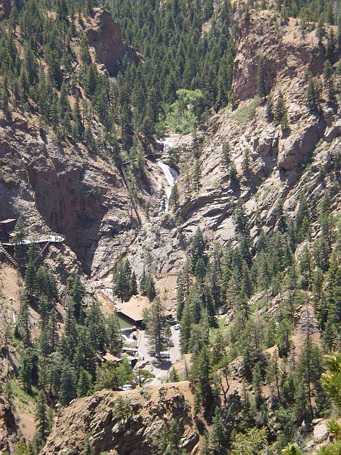
View for the Required Photo