
Blue Canyon Wind Farm
Posted by:  Oklee
Oklee
N 34° 51.499 W 098° 32.849
14S E 541364 N 3857424
This farm is sure to survive another Oklahoma Dust Bowl.
Waymark Code: WM6DZ
Location: Oklahoma, United States
Date Posted: 01/22/2006
Views: 127
Rising high above their rocky limestone perches, 45 wind turbines turn gracefully against the Southwest Oklahoma sky. It’s technology at its latest capturing a natural resource to be used for energy by Western Farmers Electric Cooperative, the power supplier for 19 of Oklahoma’s rural electric cooperatives.
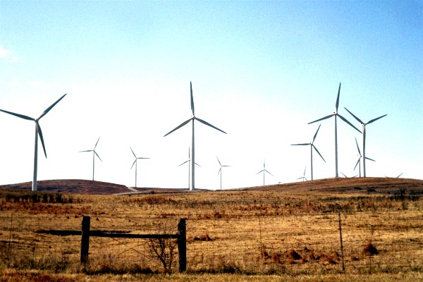
At a height of almost 330 feet, from the base, up the 220-foot tower, to the tip of an upright 115-foot blade, the majestic wind turbines of the Blue Canyon Wind Farm catch the attention of everyone passing through the Slick Hills vicinity. This geographic formation is just north of the Wichita Mountains and northwest of Lawton. A close-up view, just south of the intersection of State Highways 58 and 19 (11 miles west of Apache), helps bring the towers and blades into a more comprehensible perspective.