Sturtevant Falls
Posted by:  showbizkid
N 34° 12.708 W 118° 01.134
11S E 406139 N 3786109
Sturtevant Falls in Santa Anita Canyon above Arcadia.
Waymark Code: WM679
Location: California, United States
Date Posted: 01/18/2006
Views: 187
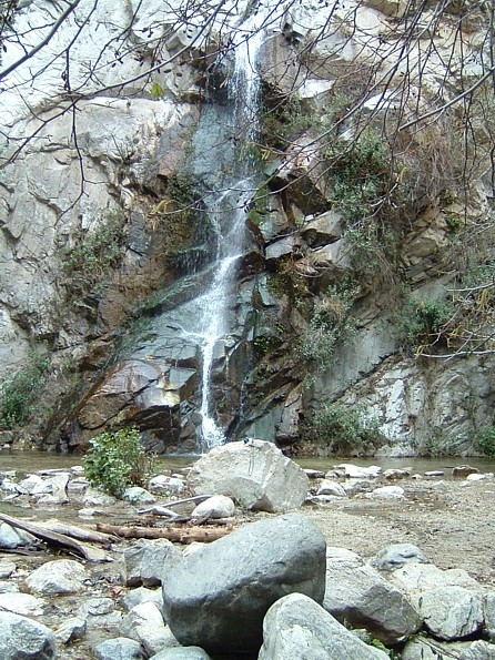
Sturtevant Falls in Santa Anita Canyon above Arcadia, California is a 50 foot waterfall. This is big by Southern California standards.
The falls are named for William M. Sturtevant, a pioneer in the San Gabriel Mountains. He operated a popular camp in the canyon beginning in the 1890's.
The falls are reached from Chantry Flats via the Gabrielino Trail. A good webpage with directions is HERE. This is a popular area, especially on warm summer weekends, but people come up to enjoy the falls year round.
Trees are growing in the wash in front of the falls, so I hade to split the photos below.
To log your visit to this waymark, post your own photo of the waymark and leave some brief comments. Logs without photos will be archived. Thanks.
Top of the Falls: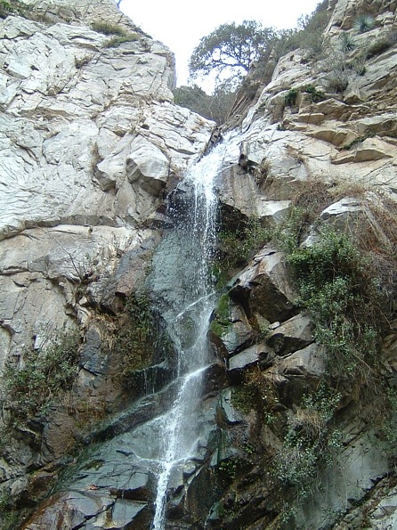
Bottom of the Falls: