
Bonneville Dam - Columbia River - Oregon
Posted by:  BruceS
N 45° 38.502 W 121° 56.608
10T E 582336 N 5054781
Massive concrete dam spanning the Columbia River between Oregon and Washington.
Waymark Code: WM6248
Location: Oregon, United States
Date Posted: 03/19/2009
Views: 18
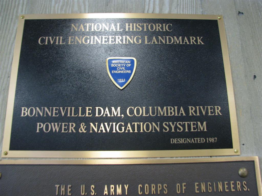
"The Bonneville Dam, Columbia River Power and Navigation System consists of 55 major projects on Oregon's Columbia River and is said to be the largest hydroelectric system in the world.
The Columbia River forms part of the border between Washington and Oregon and flows inland through the only waterway that crosses the Cascade Mountains. To harness the energy of the ninth longest river in North America, engineers developed unique design and construction approaches to overcome problems caused by depth of water, current velocity, and an irregularly-shaped river bottom.
Among the special techniques was the development of horseshoe-shaped timber cribs used as cofferdams which were fit into the irregular river bottom. This eliminated the costly and time-consuming task of leveling the river bottom. The cribs diverted the river during construction.
Facts
The Bonneville Dam is a gravity-type, concrete spillway dam spanning 1,230 feet across the center channel of the Columbia River. It measures 180 feet wide at its base.
Two 350-ton gantry cranes, operated from a service roadway 99 feet above the water, regulate its 18 movable-crest steel gates.
With reinforced concrete cut-off walls set into the banks of adjoining islands, the dam's overflow is fixed at a crest of 24 feet.
The project required 750,000 cubic yards of concrete." - ASCE website