
Pipeline Falls, Oregon
Posted by:  Volcanoguy
N 43° 42.929 W 121° 19.435
10T E 635019 N 4841637
Small falls on Paulina Creek upstream from Footbridge Falls.
Waymark Code: WM4QF
Location: Oregon, United States
Date Posted: 12/08/2005
Views: 22
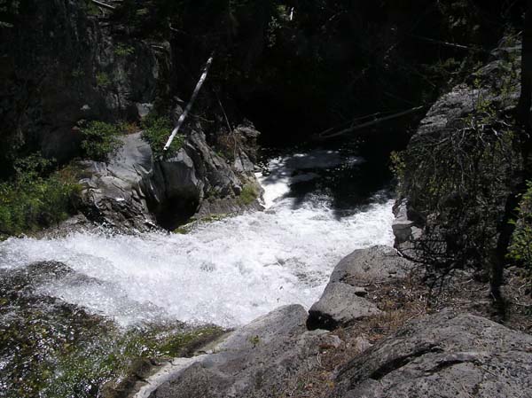
This 12-foot falls (estimate) is located on Paulina Creek about a half mile above Footbridge Falls or about 2 miles below Paulina Creek Falls. The best place to park is at the 10-Mile Sno-Park, but it is possible to drive closer if you find the right road from the north. No official viewpoint but user trails lead to various views. The name Pipeline Falls comes from an old nearby wood-stave pipeline which supplied water to the old logging railroad camp of Shevlin.
Paulina Creek is undersized for the features found along the channel, it’s average annual discharge is 18 cubic feet per second. Between 2000 and 4000 years ago a small waterfall reached Paulina Lake and dropped the lake’s level by about 8 feet. This resulted in a flood with an estimated discharge rate of about 7000 cubic feet per second (almost 400 times the annual rate). The flood lasted no more than two days. This flood formed the many large scale features found along Paulina Creek. Here at Pipeline Falls there was a single falls over 150 feet wide with water about 10 feet deep across the entire falls.
Please post a photo at Pipeline Falls when you log this waymark.