
Amicalola Falls - Amicalola Falls State Park, GA
Posted by:  Lat34North
N 34° 34.000 W 083° 14.681
17S E 294076 N 3827279
Amicalola Falls is located in Amicalola Falls State Park on GA 52, north of Dawsonville, GA.
Waymark Code: WM4GMH
Location: Georgia, United States
Date Posted: 08/22/2008
Views: 108
Amicalola Falls is located in
Amicalola Falls State Park on GA 52, north of Dawsonville, GA. There are roads leading to the base of the falls as well as the top. Also there is a paved trail leading from the base of the falls to the top. The ascendant becomes steeper near the top and there are steps as well as several viewing platforms. The coordinates of the base of the falls are N34 33.963 W84 14.717. The coordinates given are approximately 0.27 miles from the base of the falls along the path.
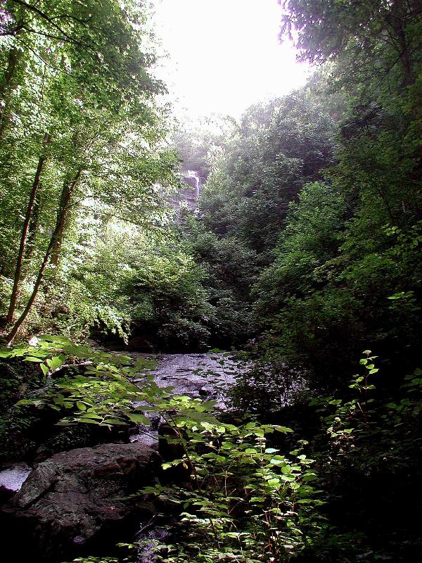
High in the watershed of a ridge known as Amicalola Mountain a body of water forms, enthusiastically called a river. Along the western slope the river runs, until it tumbles, swirls and drops off a ledge at the southern end of the Blue Ridge Mountains.
Wikipedia -
Amicalola Falls State Park
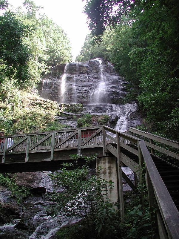 View showing steps and upper viewing platform/bridge. It gets steep near the top.
The name Amicalola is derived from a Cherokee language word meaning "tumbling waters".
View showing steps and upper viewing platform/bridge. It gets steep near the top.
The name Amicalola is derived from a Cherokee language word meaning "tumbling waters".
Part way up. There is a viewing platform here.
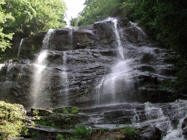
From this point there are steps leading up to the best spot to view the falls (or what I consider the best spot).
View from the base of the falls. There is a pool here where you can fish. Best views from this point are during the winter month when there are not leaves on the trees.
Park Hours: 7 a.m. to 10 p.m.
Office Hours: 8 a.m. to 5 p.m.
Lodge open 24 hours
$3.00 entrance fee.