
Ball Ground, Georgia for the Bi-Centennail 2083
Posted by:  GA Cacher
N 34° 20.263 W 084° 22.560
16S E 741388 N 3802721
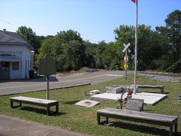
Time Capsule in small city park downtown Ball Ground, Georgia.
Waymark Code: WM48MA
Location: Georgia, United States
Date Posted: 07/22/2008
Views: 30
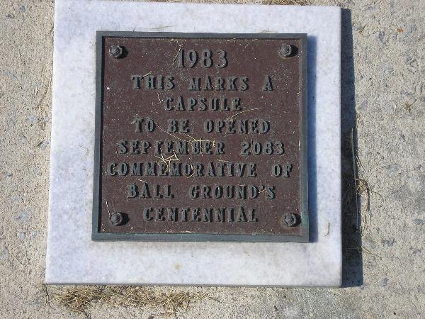
Placed by the city on the Centennial of the city in Sept 1983 , to be opened on the Bi-Centennial Sept 2063.
History:
The name of Ball Ground is a survival of Indian days, when the site of the present town was used by the Cherokees for their national pastime, the ball-play. The several hills on which the town is built sweep up from a broad level space to the south, probably the identical tract on which the Cherokees won a game of ball from their southern neighbors, the Creeks, for the prize of a thousand square miles of land.
Although its name has always been applied to the immediate locality, Ball Ground did not come into existence as a town until the railroad passed through it in 1882. Its development up to that year consisted mainly of two country stores and half a dozen dwellings. The community was almost purely agricultural.
When the survey of the Marietta & North Georgia line was run through Ball Ground in 1882, the officials of the road decided to put up a depot there and start a town to go along with it. Land for a town site was contributed to the railroad by landowners of the vicinity, whose deed of transfer stated that "The consideration moving each of us in the establishing of this town is the enhanced value to our lands within and adjacent to the said town, and the general benefit to the country, by which we shall be benefited."
City of Ball Ground.