|
 CONFLUENCE - Kings River South and Middle Fork
N 36° 50.276 W 118° 52.513
11S E 332788 N 4078534
Junction of the two main forks of California's Kings River
Waymark Code: WM3NZ5
Location: California, United States
Date Posted: 04/27/2008
Views: 55

|
Click on any picture for larger images and click the blue links for other nearby waymarks.
Wherever one travels on Kings Canyon Road, one cannot escape the magnificent view of the junction of the two main forks of the Kings River. However, only few people actually make it all the way down to the place where the South and Middle Fork, coming from the top of the Sierra Nevada meet in roaring thunder.
|
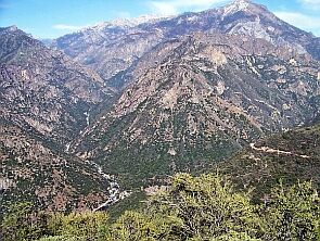
Junction View
A first look at the river
The easiest view to see (and hear) the junction is at a highway vista point called Junction View, 2,300 feet above the river.
The junction seen from 2,300 ft above |
 |
 |
|
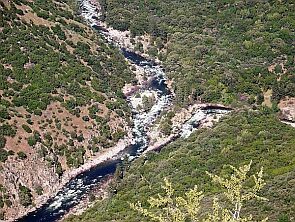
Zoomed in on the junction
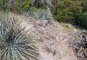
Yucca Point Trail
Hiking down to the river
For those who want more, there is Yucca Point Trail, winding down the slopes of Kings Canyon and leading right to the river.
 Yucca Point Trail Yucca Point Trail |
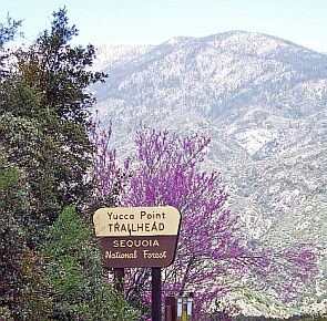 Trailhead Trailhead |
 |
|
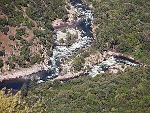
The trail is steep and the hike is somewhat strenuous, but those who do it are rewarded with an amazing experience: The merging of two wild, untamed rivers, coming from the snowy top of the Sierra Nevada and merging in a steep canyon, carved by the forces of water and time. |
|
 |

We usually avoid polluting a perfectly pristine landscape with our own images but here we just had to produce some proof that we really made it there.
|
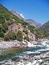
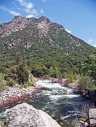
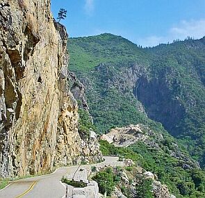
Kings Canyon Road
The Story continues...
After Yucca Point, Kings Canyon Road continues for another 20 miles along the South Fork of the Kings River.
We know, these pictures have nothing to
do with the confluence-topic, but we find
this wild river so amazing that we just want
to share these pictures with everybody else
who loves rivers. |
|
Parking Coordinates: N 36° 49.821 W 118° 52.623

Trailhead Coordinates: N 36° 49.821 W 118° 52.623
Relevant Web Site: Not listed
|
Visit Instructions:
1. Describe your journey and visit.
2. Date of your visit.
3. At least one original photo (DO NOT include either you or your GPSr).
Recent Visits/Logs:
| There are no logs for this waymark yet. |
|
|
|
|