
Cape Horn, Columbia River Gorge, Washington
Posted by:  Rose Red
N 45° 34.588 W 122° 11.689
10T E 562820 N 5047307
Less than 30 minutes east from Portland/Vancouver, the Cape Horn Overlook along Washington's State Highway 14 (Milepost 25) provides one of the most scenic viewpoints in the Columbia River Gorge.
Waymark Code: WM1K8M
Location: Washington, United States
Date Posted: 05/25/2007
Views: 160
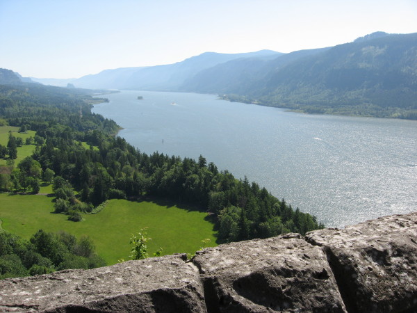
Less than 30 minutes east from Portland/Vancouver, the Cape Horn Overlook along Washington's State Highway 14 (Milepost 25) provides one of the most scenic viewpoints in the Columbia River Gorge. However the view is only accessible along a dangerous highway pull out. It is safer to be traveling eastbound than westbound.Cape Horn (River Mile (RM) 132) is a formation of Grande Ronde basalt flows (Columbia River Basalt)--a massive basalt cliff outcrop--covered by Troutdale gravels, which in turn are covered by the lavas of the small Biddle Butte (aka Mount Zion; known as Cape Horn Mountain in 1860s), an olivine basalt shield volcano cone which rises above Cape Horn.
Standing at the rock wall, on a clear day you can look upstream towards Beacon Rock and Skamania Island, and down on Phoca Rock, located in the middle of the Columbia River. Also looking down you can see the location of Cape Horn Landing, once steamboat stop on the river. Absolutely breathtaking!