While Curlew, Washington, was once considered a ghost town, it is now a thriving small community. It's located in Ferry County, between Malo and Danville, and along State Route 21. The community's history dates back to 1896, with a general store serving miners and others. Today, Curlew has a population of around 106 and features a library, historic Ansorge Hotel, grocery store, post office, restaurant, and bar & grill.
Curlew Bridge, a national historic bridge, is only one lane in width. It is one of only eight road bridges built in Washington prior to 1910.
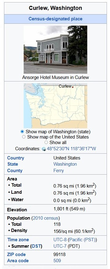
Built about 1903, the Ansorge Hotel has become a major landmark in the little village of Curlew. It was, for a small town, an elegant and well equipped hotel. The hotel remains clad in the mock stone stamped steel siding which it wore when built. It was likely the site of the first telephone in Curlew and contained the only long distance phone in town until well into the 1950s.
Curlew, Washington
Curlew is an unincorporated community and census-designated place (CDP) located in northwestern Ferry County, Washington, United States, between Malo and Danville on State Route 21. The BNSF Railway ran through the town. The historic Ansorge Hotel is located in Curlew. As of the 2010 census, the population of the community was 118. The settlement is named for the curlew birds once prevalent in the area.
Geography
Curlew is located at the confluence of Long Alec Creek and the Kettle River. Its elevation is 1,800 feet (550 m) above sea level. Via State Route 21, it is 21 miles (34 km) north of Republic, the Ferry County seat, and 10 miles (16 km) south of the Canadian border.
One of the most popular sites on the Kettle River in summer is "the Old Swimming Hole" near the center of town. Curlew was a pick-up point for moonshine that was dropped in the Kettle River. The tradition is still celebrated on the first Sunday in June each year during the Curlew Barrel Derby Days. A barrel is set adrift in the Kettle River at the Job Corps Bridge, and local citizens bet on when it will reach town.
History
Early community
In 1896, two traders, Guy S. Helphry and J. Walters, set up a general store at an old ferry crossing near the junction of Curlew Creek and the Kettle River. The site around the store grew into a collection of log buildings and other stores. In 1898, a post office was established and the town was named "Curlew". Miners, railroad workers, natives, and others passed through the region and by 1901, a bridge was built across the Kettle River and the community had grown to a population of 200. Nearby mines such as Drummer, Lancaster and Panama grew. Curlew's population and expansion peaked at this time, and the town contained two general stores, two saloons, a hotel, two livery stables, a dry goods store and several other businesses,
The Curlew Air Force Station, part of the network of Air Defense Command radar stations, was near the area and was operational in the 1950s. As of 2023, the radar site no longer exists, and the base, 10 miles (16 km) northwest of Curlew up the Kettle River valley, is in use by Job Corps.
Railroad expansion
In fall 1901, the Republic and Kettle Valley Railway (operating as the Kettle Valley Lines) (KVL), and Washington and Great Northern Railway (W&GN) (operating as the Spokane Falls and Northern Railway subsidiary of the Great Northern Railway) (GN) were building competing Grand Forks (BC)–Curlew–Republic (WA) lines. About a mile north of Curlew, the KVL grade passed over the GN one. In January 1902, GN construction crews were unsuccessful in pulling down the KVL trestlework that crossed the GN track. Law enforcement officers diffused a series of subsequent confrontations.
KVL, which began the Grand Forks–Curlew–St. Peter's Creek passenger service in March 1902, extended the line to five or six miles north of Republic in April, and held a symbolic last spike ceremony. That July, the GN Marcus (WA)–Grand Forks–Curlew–Republic passenger service began. GN began Curlew–Midway (BC) passenger service in December 1905.
Railroad demise
In 1919, the KVL became insolvent, and all services are believed to have ceased that year, and the track was subsequently abandoned. In 1935, GN abandoned Curlew–Molson. In 2006, the Kettle Falls International Railway, the GN successor, abandoned the 28.5-mile San Poil–Danville section, ending all railroad service to Curlew.
From Wikipedia, the free encyclopedia